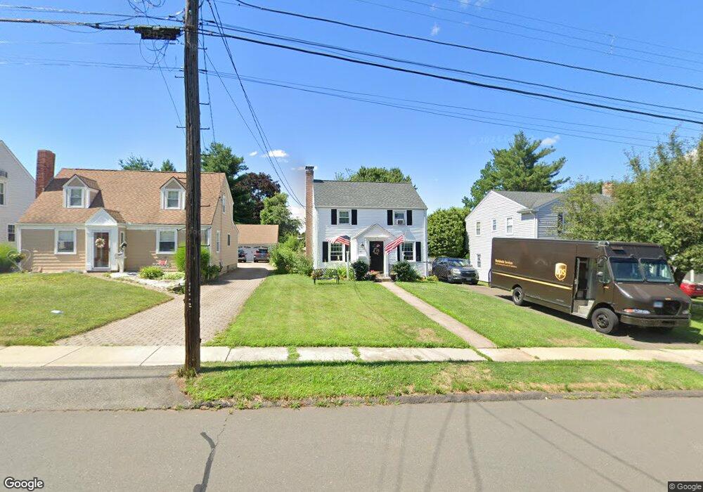
69 Chamberlain Rd Wethersfield, CT 06109
Estimated Value: $368,000 - $383,000
2
Beds
2
Baths
1,224
Sq Ft
$306/Sq Ft
Est. Value
About This Home
This home is located at 69 Chamberlain Rd, Wethersfield, CT 06109 and is currently estimated at $374,145, approximately $305 per square foot. 69 Chamberlain Rd is a home located in Hartford County with nearby schools including Alfred W. Hanmer School, Silas Deane Middle School, and Wethersfield High School.
Ownership History
Date
Name
Owned For
Owner Type
Purchase Details
Closed on
Dec 16, 2016
Sold by
Gangloff Maryanne C and Gangloff Joseph R
Bought by
Gangloff Ryan
Current Estimated Value
Home Financials for this Owner
Home Financials are based on the most recent Mortgage that was taken out on this home.
Original Mortgage
$157,600
Outstanding Balance
$127,338
Interest Rate
3.54%
Mortgage Type
Purchase Money Mortgage
Estimated Equity
$246,807
Purchase Details
Closed on
Sep 30, 2005
Sold by
Cardany Christopher P and Cardany Kristin M
Bought by
Gangloff Maryanne C and Gangloff Joseph R
Home Financials for this Owner
Home Financials are based on the most recent Mortgage that was taken out on this home.
Original Mortgage
$188,000
Interest Rate
5.84%
Purchase Details
Closed on
Jan 29, 1999
Sold by
Oreilly Agnes D
Bought by
Cardany Christopher P and Cardany Kristin M
Create a Home Valuation Report for This Property
The Home Valuation Report is an in-depth analysis detailing your home's value as well as a comparison with similar homes in the area
Home Values in the Area
Average Home Value in this Area
Purchase History
| Date | Buyer | Sale Price | Title Company |
|---|---|---|---|
| Gangloff Ryan | $197,000 | -- | |
| Gangloff Maryanne C | $235,000 | -- | |
| Cardany Christopher P | $128,000 | -- |
Source: Public Records
Mortgage History
| Date | Status | Borrower | Loan Amount |
|---|---|---|---|
| Open | Cardany Christopher P | $157,600 | |
| Previous Owner | Cardany Christopher P | $180,000 | |
| Previous Owner | Cardany Christopher P | $188,000 | |
| Previous Owner | Cardany Christopher P | $135,000 |
Source: Public Records
Tax History
| Year | Tax Paid | Tax Assessment Tax Assessment Total Assessment is a certain percentage of the fair market value that is determined by local assessors to be the total taxable value of land and additions on the property. | Land | Improvement |
|---|---|---|---|---|
| 2025 | $9,397 | $227,980 | $91,920 | $136,060 |
| 2024 | $6,399 | $148,050 | $76,990 | $71,060 |
| 2023 | $6,186 | $148,050 | $76,990 | $71,060 |
| 2022 | $6,082 | $148,050 | $76,990 | $71,060 |
| 2021 | $6,021 | $148,050 | $76,990 | $71,060 |
| 2020 | $6,024 | $148,050 | $76,990 | $71,060 |
| 2019 | $6,032 | $148,050 | $76,990 | $71,060 |
| 2018 | $6,044 | $148,200 | $73,400 | $74,800 |
| 2017 | $5,894 | $148,200 | $73,400 | $74,800 |
| 2016 | $5,712 | $148,200 | $73,400 | $74,800 |
| 2015 | $5,660 | $148,200 | $73,400 | $74,800 |
| 2014 | $5,445 | $148,200 | $73,400 | $74,800 |
Source: Public Records
Map
Nearby Homes
- 108 Chamberlain Rd
- 35 Stillwold Dr
- 119 Coleman Rd
- 91 Somerset St
- 87 Somerset St
- 137 Dale Rd
- 38 Wheeler Rd
- 195 Middletown Ave
- 89 Merriman Rd
- 116 Wells Farm Dr
- 455 Brimfield Rd
- 1 Fernwood St
- 317 Garden St Unit 319
- 18 Avalon Place
- 104 Willow St
- 493 Main St
- 219 Jordan Ln Unit 221
- 20 Forest Dr
- 0 Collier Rd
- 48 Ridge Crest Cir
- 73 Chamberlain Rd
- 65 Chamberlain Rd
- 77 Chamberlain Rd
- 61 Chamberlain Rd
- 81 Chamberlain Rd
- 57 Chamberlain Rd
- 68 Stillwold Dr
- 72 Stillwold Dr
- 62 Stillwold Dr
- 76 Stillwold Dr
- 53 Chamberlain Rd
- 58 Stillwold Dr
- 85 Chamberlain Rd
- 80 Stillwold Dr
- 68 Chamberlain Rd
- 72 Chamberlain Rd
- 54 Stillwold Dr
- 49 Chamberlain Rd
- 64 Chamberlain Rd
- 76 Chamberlain Rd
Your Personal Tour Guide
Ask me questions while you tour the home.