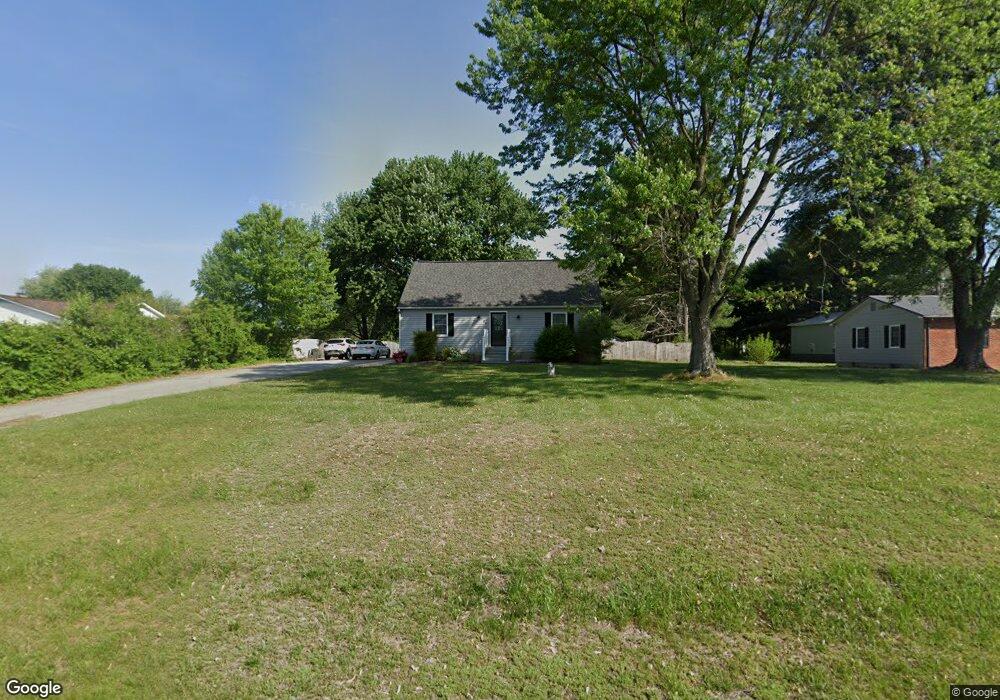
69 Cole Rd Townsend, DE 19734
Estimated Value: $345,000 - $453,000
About This Home
This home is located at 69 Cole Rd, Townsend, DE 19734 and is currently estimated at $393,340, approximately $217 per square foot. 69 Cole Rd is a home located in New Castle County with nearby schools including Bunker Hill Elementary School, Cantwell's Bridge Middle School, and Odessa High School.
Ownership History
We collect this data history from publicly available records. To have your information removed, we recommend requesting removal directly through your county’s website.
Purchase Details
Home Financials for this Owner
Home Financials are based on the most recent Mortgage that was taken out on this home.Home Values in the Area
Average Home Value in this Area
Purchase History
We collect this data history from publicly available records. To have your information removed, we recommend requesting removal directly through your county’s website.
| Date | Buyer | Sale Price | Title Company |
|---|---|---|---|
| $146,000 | -- |
Mortgage History
We collect this data history from publicly available records. To have your information removed, we recommend requesting removal directly through your county’s website.
| Date | Status | Borrower | Loan Amount |
|---|---|---|---|
| Open | $146,000 |
Tax History
We collect this data history from publicly available records. To have your information removed, we recommend requesting removal directly through your county’s website.
| Year | Tax Paid | Tax Assessment Tax Assessment Total Assessment is a certain percentage of the fair market value that is determined by local assessors to be the total taxable value of land and additions on the property. | Land | Improvement |
|---|---|---|---|---|
| 2025 | $2,778 | $357,900 | $132,200 | $225,700 |
| 2024 | $2,436 | $58,200 | $12,200 | $46,000 |
| 2023 | $2,070 | $58,200 | $12,200 | $46,000 |
| 2022 | $2,085 | $58,200 | $12,200 | $46,000 |
| 2021 | $2,059 | $58,200 | $12,200 | $46,000 |
| 2020 | $2,035 | $58,200 | $12,200 | $46,000 |
| 2019 | $1,885 | $58,200 | $12,200 | $46,000 |
| 2018 | $1,814 | $58,200 | $12,200 | $46,000 |
| 2017 | $1,737 | $58,200 | $12,200 | $46,000 |
| 2016 | $1,587 | $58,200 | $12,200 | $46,000 |
| 2015 | $1,544 | $58,200 | $12,200 | $46,000 |
| 2014 | $1,540 | $58,200 | $12,200 | $46,000 |
Map
- 335 Helen Dr
- 1504 Caldwell Corner Rd
- 1500 Caldwell Corner Rd
- 735 Tracy Cir
- 301 Helen Dr
- 102 Edgar Rd
- 444 Dogtown Rd
- 131 Log Yard Ln
- 306 Lattomus St
- 0 Dexter Corner Rd Unit DENC2075584
- 345 Sunnyside Ln
- 1142 E Founds St
- 2 Barcus Ct
- 342 Coralroot Dr
- 529 Ginn St
- 341 Coralroot Dr
- 1115 E Founds St
- 0 Blackbird Station Rd Unit DENC2096526
- 404 Wiggins Mill Rd
- 422 Bellflower Way Unit CHALFONT PLAN
Ask me questions while you tour the home.