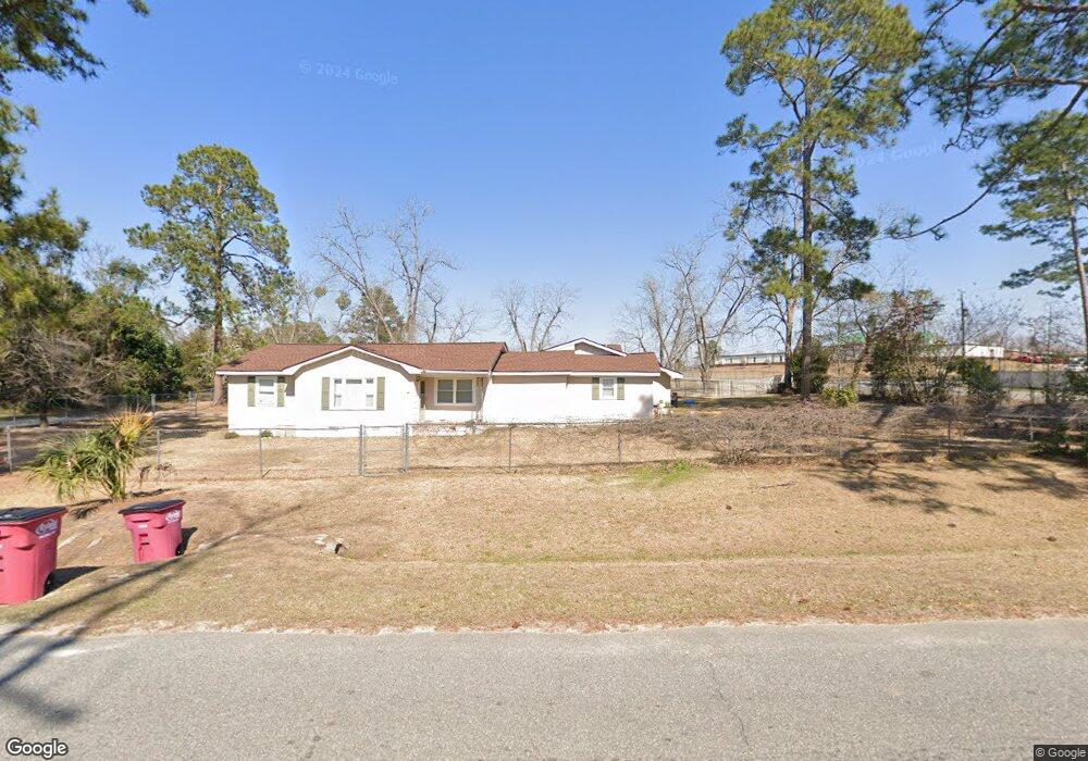
69 E Fifth St Mc Rae Helena, GA 31037
Estimated Value: $104,471 - $227,000
--
Bed
--
Bath
1,462
Sq Ft
$106/Sq Ft
Est. Value
About This Home
This home is located at 69 E Fifth St, Mc Rae Helena, GA 31037 and is currently estimated at $155,368, approximately $106 per square foot. 69 E Fifth St is a home with nearby schools including Telfair County Elementary School, Telfair County Middle School, and Telfair County High School.
Ownership History
Date
Name
Owned For
Owner Type
Purchase Details
Closed on
May 30, 2014
Sold by
Wilcox Diane Clay
Bought by
Haynes Derell Demetrius
Current Estimated Value
Home Financials for this Owner
Home Financials are based on the most recent Mortgage that was taken out on this home.
Original Mortgage
$78,551
Outstanding Balance
$60,105
Interest Rate
4.36%
Mortgage Type
FHA
Estimated Equity
$95,263
Purchase Details
Closed on
Feb 27, 2004
Sold by
Stevenson Thomas Rudolph
Bought by
Brack Stephen Ashley
Create a Home Valuation Report for This Property
The Home Valuation Report is an in-depth analysis detailing your home's value as well as a comparison with similar homes in the area
Home Values in the Area
Average Home Value in this Area
Purchase History
| Date | Buyer | Sale Price | Title Company |
|---|---|---|---|
| Haynes Derell Demetrius | $80,000 | -- | |
| Brack Stephen Ashley | -- | -- |
Source: Public Records
Mortgage History
| Date | Status | Borrower | Loan Amount |
|---|---|---|---|
| Open | Haynes Derell Demetrius | $78,551 |
Source: Public Records
Tax History Compared to Growth
Tax History
| Year | Tax Paid | Tax Assessment Tax Assessment Total Assessment is a certain percentage of the fair market value that is determined by local assessors to be the total taxable value of land and additions on the property. | Land | Improvement |
|---|---|---|---|---|
| 2024 | $1,911 | $47,352 | $1,020 | $46,332 |
| 2023 | $1,756 | $43,403 | $1,020 | $42,383 |
| 2022 | $1,292 | $43,403 | $1,020 | $42,383 |
| 2021 | $960 | $30,706 | $1,020 | $29,686 |
| 2020 | $768 | $24,142 | $1,020 | $23,122 |
| 2019 | $772 | $24,142 | $1,020 | $23,122 |
| 2018 | $1,040 | $24,142 | $1,020 | $23,122 |
| 2017 | $944 | $29,635 | $1,020 | $28,615 |
| 2016 | $944 | $29,635 | $1,020 | $28,615 |
| 2015 | -- | $29,635 | $1,020 | $28,615 |
| 2014 | -- | $27,825 | $1,020 | $26,805 |
| 2013 | -- | $27,825 | $1,020 | $26,805 |
Source: Public Records
Map
Nearby Homes
- 210 W Graham St
- 15 Ben Ave
- 17 2nd St
- 0 Ll350 & 398 7th District Unit 30490
- Lot 126 Pansy Ln
- 0 Jackson Ave Unit 10548102
- 78 S Second Ave
- 47 S First Ave
- 125 Fifth Ave
- 427 3rd Ave
- 141 S First Ave
- 0 Center Ave
- 27 E Bruce St
- 36 Strozier St
- 76 E Grant St
- 160 E Willow Creek Ln
- 0 Bonaire St Unit 10647239
- 22 Spring Ave
- 0 U S 23
- 0 Concord Dr Unit 10542376