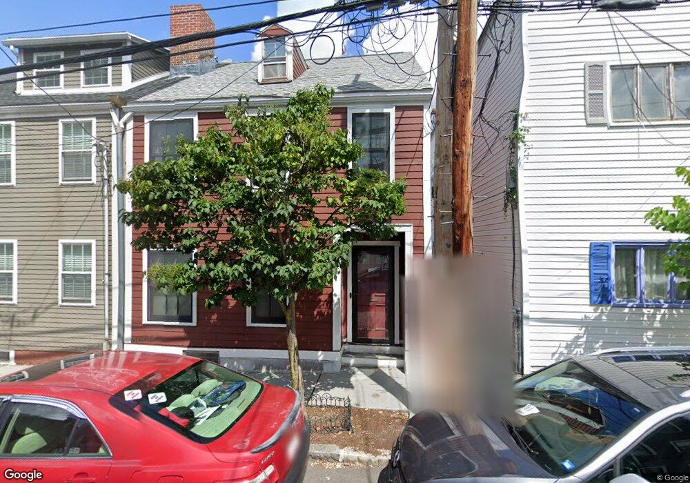
69 Gore St Unit R Cambridge, MA 02141
East Cambridge NeighborhoodEstimated Value: $812,000 - $1,290,000
2
Beds
2
Baths
954
Sq Ft
$1,005/Sq Ft
Est. Value
About This Home
This home is located at 69 Gore St Unit R, Cambridge, MA 02141 and is currently estimated at $959,133, approximately $1,005 per square foot. 69 Gore St Unit R is a home located in Middlesex County with nearby schools including Community Charter School of Cambridge, Torit Montessori School, and Boston Children's School.
Ownership History
Date
Name
Owned For
Owner Type
Purchase Details
Closed on
May 2, 1996
Sold by
Singer Susan F and Bresler Joseph
Bought by
Przybek Judith D and Kohane Helen M
Current Estimated Value
Home Financials for this Owner
Home Financials are based on the most recent Mortgage that was taken out on this home.
Original Mortgage
$69,000
Outstanding Balance
$3,867
Interest Rate
7.82%
Mortgage Type
Purchase Money Mortgage
Estimated Equity
$955,266
Create a Home Valuation Report for This Property
The Home Valuation Report is an in-depth analysis detailing your home's value as well as a comparison with similar homes in the area
Home Values in the Area
Average Home Value in this Area
Purchase History
| Date | Buyer | Sale Price | Title Company |
|---|---|---|---|
| Przybek Judith D | $92,000 | -- | |
| Przybek Judith D | $92,000 | -- |
Source: Public Records
Mortgage History
| Date | Status | Borrower | Loan Amount |
|---|---|---|---|
| Open | Przybek Judith D | $69,000 | |
| Closed | Przybek Judith D | $69,000 |
Source: Public Records
Tax History Compared to Growth
Tax History
| Year | Tax Paid | Tax Assessment Tax Assessment Total Assessment is a certain percentage of the fair market value that is determined by local assessors to be the total taxable value of land and additions on the property. | Land | Improvement |
|---|---|---|---|---|
| 2025 | $4,314 | $679,300 | $502,300 | $177,000 |
| 2024 | $4,232 | $714,900 | $545,400 | $169,500 |
| 2023 | $3,911 | $667,400 | $520,800 | $146,600 |
| 2022 | $3,933 | $664,300 | $534,500 | $129,800 |
| 2021 | $3,807 | $650,800 | $524,500 | $126,300 |
| 2020 | $3,733 | $649,200 | $529,500 | $119,700 |
| 2019 | $3,938 | $663,000 | $519,300 | $143,700 |
| 2018 | $3,543 | $563,200 | $430,700 | $132,500 |
| 2017 | $3,317 | $511,100 | $385,100 | $126,000 |
| 2016 | $2,953 | $422,400 | $301,500 | $120,900 |
| 2015 | $2,866 | $366,500 | $258,400 | $108,100 |
| 2014 | $2,570 | $306,700 | $200,100 | $106,600 |
Source: Public Records
Map
Nearby Homes
- 36 Sciarappa St
- 68 Gore St
- 76-78 Thorndike St
- 30 2nd St Unit 2
- 30 2nd St Unit 1
- 30 2nd St Unit 1 & 2
- 25 6th St
- 170 Gore St Unit 502
- 170 Gore St Unit 113
- 17 Otis St Unit 602
- 59 7th St Unit 2
- 59 7th St Unit 1
- 59 7th St Unit 3
- 95 2nd St Unit 3
- 133 Charles St Unit 133
- 9 Medford St Unit 3
- 71 Fulkerson St Unit 206
- 1 Earhart St Unit 725
- 1 Earhart St Unit 705
- 2 Earhart St Unit T406
- 69 Gore St
- 69 Gore St
- 69 Gore St Unit 2
- 71 Gore St
- 71 Gore St Unit 2
- 71 Gore St Unit 1
- 67 Gore St Unit 2R
- 67 Gore St Unit 2F
- 67 Gore St Unit 1R
- 67 Gore St Unit 1F
- 67 Gore St Unit 3F
- 67 Gore St
- 67 Gore St Unit 2
- 73 Gore St
- 73 Gore St Unit 1
- 73 Gore St Unit 74-1
- 75 Gore St
- 75 Gore St Unit 2
- 75 Gore St Unit 1
- 65 Gore St