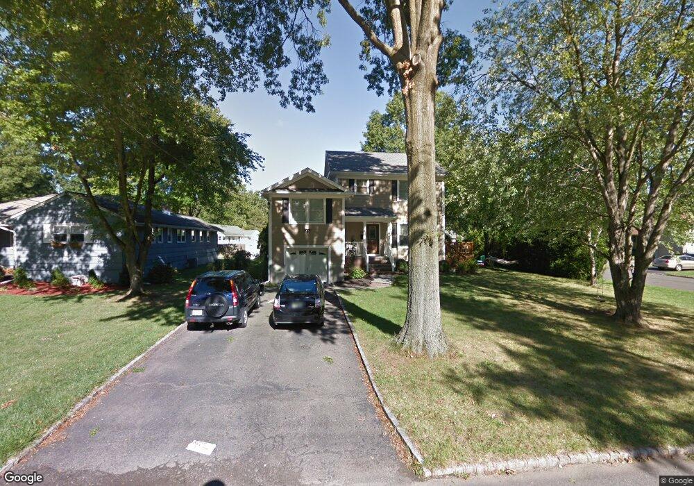
69 Hawthorne Dr New Providence, NJ 07974
Estimated Value: $842,716 - $936,000
--
Bed
--
Bath
2,650
Sq Ft
$335/Sq Ft
Est. Value
About This Home
This home is located at 69 Hawthorne Dr, New Providence, NJ 07974 and is currently estimated at $888,679, approximately $335 per square foot. 69 Hawthorne Dr is a home located in Union County with nearby schools including New Providence High School and The Academy of Our Lady of Peace.
Ownership History
Date
Name
Owned For
Owner Type
Purchase Details
Closed on
May 4, 2004
Sold by
Mcdonald Kenneth
Bought by
Ohlstein Deborah
Current Estimated Value
Home Financials for this Owner
Home Financials are based on the most recent Mortgage that was taken out on this home.
Original Mortgage
$320,000
Interest Rate
5.39%
Purchase Details
Closed on
Apr 16, 1996
Sold by
Orr Doris M
Bought by
Mcdonald Kenneth M and Mcdonald Megan M
Create a Home Valuation Report for This Property
The Home Valuation Report is an in-depth analysis detailing your home's value as well as a comparison with similar homes in the area
Home Values in the Area
Average Home Value in this Area
Purchase History
| Date | Buyer | Sale Price | Title Company |
|---|---|---|---|
| Ohlstein Deborah | $400,000 | -- | |
| Mcdonald Kenneth M | $215,000 | -- |
Source: Public Records
Mortgage History
| Date | Status | Borrower | Loan Amount |
|---|---|---|---|
| Previous Owner | Ohlstein Deborah | $320,000 |
Source: Public Records
Tax History Compared to Growth
Tax History
| Year | Tax Paid | Tax Assessment Tax Assessment Total Assessment is a certain percentage of the fair market value that is determined by local assessors to be the total taxable value of land and additions on the property. | Land | Improvement |
|---|---|---|---|---|
| 2025 | $14,768 | $286,100 | $102,800 | $183,300 |
| 2024 | $14,325 | $286,100 | $102,800 | $183,300 |
| 2023 | $14,325 | $286,100 | $102,800 | $183,300 |
| 2022 | $14,128 | $286,100 | $102,800 | $183,300 |
| 2021 | $14,025 | $286,100 | $102,800 | $183,300 |
| 2020 | $14,019 | $286,100 | $102,800 | $183,300 |
| 2019 | $13,933 | $286,100 | $102,800 | $183,300 |
| 2018 | $13,862 | $286,100 | $102,800 | $183,300 |
| 2017 | $13,636 | $286,100 | $102,800 | $183,300 |
| 2016 | $13,444 | $286,100 | $102,800 | $183,300 |
| 2015 | $13,258 | $286,100 | $102,800 | $183,300 |
| 2014 | $13,058 | $286,100 | $102,800 | $183,300 |
Source: Public Records
Map
Nearby Homes
- 132 Fairview Ave
- 11 Earl Place
- 19 Guenevere Way Ondo
- 41 Meadowview Ln
- 19 Slope Dr
- 16 Terrace Rd
- 36 Terrace Rd
- 20 High St
- 33 Bristol Ct
- 14 Holmes Oval
- 30 Robbins Ave
- 282 South St
- 16 Riverbend Ct
- 567 River Rd
- 32 Marion Ave
- 93 Park Edge Unit 3H
- 12 Park Edge
- 340 Livingston Ave
- 32 Charnwood Rd
- 52 Greenwood Rd