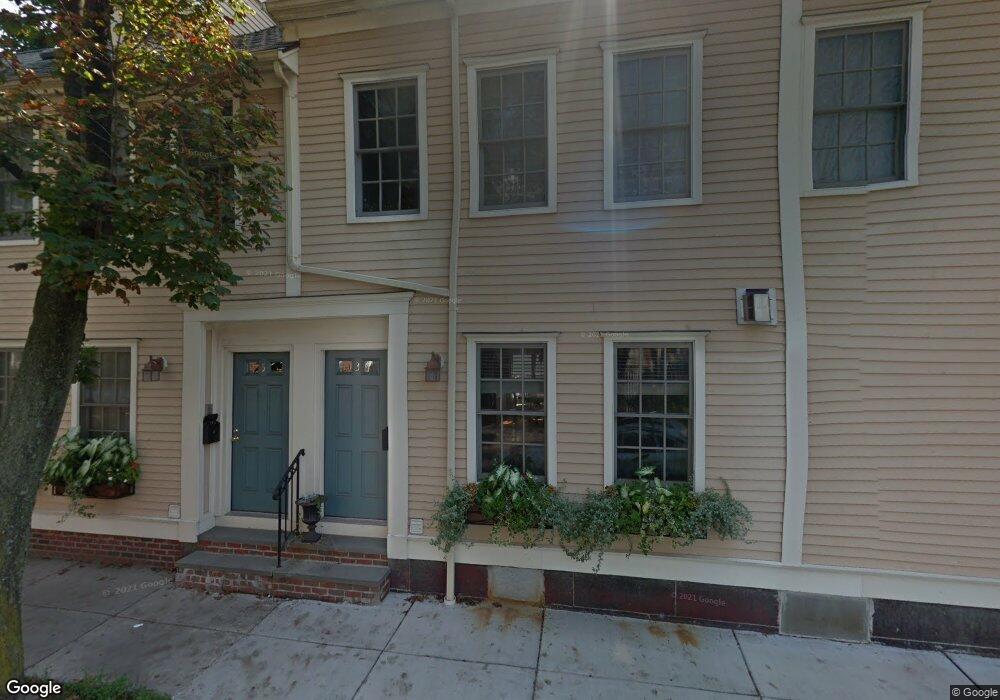
69 High St Unit 2 Charlestown, MA 02129
Thompson Square-Bunker Hill NeighborhoodEstimated Value: $1,644,000 - $1,869,000
3
Beds
3
Baths
1,994
Sq Ft
$882/Sq Ft
Est. Value
About This Home
This home is located at 69 High St Unit 2, Charlestown, MA 02129 and is currently estimated at $1,758,303, approximately $881 per square foot. 69 High St Unit 2 is a home located in Suffolk County with nearby schools including Community Charter School of Cambridge and Torit Montessori School.
Ownership History
Date
Name
Owned For
Owner Type
Purchase Details
Closed on
Oct 13, 2022
Sold by
Chisholm John J and Chisholm Jayne E
Bought by
Cutler Cody E and Morse Suzanne M
Current Estimated Value
Home Financials for this Owner
Home Financials are based on the most recent Mortgage that was taken out on this home.
Original Mortgage
$1,280,000
Outstanding Balance
$1,228,401
Interest Rate
5.66%
Mortgage Type
Purchase Money Mortgage
Estimated Equity
$529,902
Create a Home Valuation Report for This Property
The Home Valuation Report is an in-depth analysis detailing your home's value as well as a comparison with similar homes in the area
Home Values in the Area
Average Home Value in this Area
Purchase History
| Date | Buyer | Sale Price | Title Company |
|---|---|---|---|
| Cutler Cody E | $1,600,000 | None Available |
Source: Public Records
Mortgage History
| Date | Status | Borrower | Loan Amount |
|---|---|---|---|
| Open | Cutler Cody E | $1,280,000 |
Source: Public Records
Tax History Compared to Growth
Tax History
| Year | Tax Paid | Tax Assessment Tax Assessment Total Assessment is a certain percentage of the fair market value that is determined by local assessors to be the total taxable value of land and additions on the property. | Land | Improvement |
|---|---|---|---|---|
| 2025 | $17,355 | $1,498,700 | $0 | $1,498,700 |
| 2024 | $17,553 | $1,610,400 | $0 | $1,610,400 |
| 2023 | $16,458 | $1,532,400 | $0 | $1,532,400 |
| 2022 | $16,028 | $1,473,200 | $0 | $1,473,200 |
| 2021 | $15,411 | $1,444,300 | $0 | $1,444,300 |
| 2020 | $15,191 | $1,438,500 | $0 | $1,438,500 |
| 2019 | $14,165 | $1,343,900 | $0 | $1,343,900 |
| 2018 | $13,414 | $1,280,000 | $0 | $1,280,000 |
| 2017 | $13,154 | $1,242,100 | $0 | $1,242,100 |
| 2016 | $13,013 | $1,183,000 | $0 | $1,183,000 |
| 2015 | $11,084 | $915,300 | $0 | $915,300 |
| 2014 | $10,253 | $815,000 | $0 | $815,000 |
Source: Public Records
Map
Nearby Homes
- 56 High St Unit 3
- 46 High St
- 17 Trenton St
- 98 Warren St Unit 98
- 22 Pleasant St
- 54 Monument Ave Unit 3
- 12 Salem Street Ave Unit 2
- 121 High St Unit 3
- 50 Sullivan St Unit 3
- 207 Bunker Hill St Unit 2
- 52 Sullivan St Unit 1
- 236 Bunker Hill St Unit 3
- 5 Monument St
- 94A Bartlett St Unit 3
- 94A Bartlett St Unit 2
- 9 Russell St Unit 1
- 9 Russell St Unit 2
- 100 Main St Unit 5
- 246 Bunker Hill St Unit 3
- 14 Mystic St Unit 2
- 69 High St Unit 3
- 69 High St Unit 1
- 69 High St
- 5 Elm St
- 7 Elm St
- 65 High St
- 9 Elm St Unit 3
- 9 Elm St Unit 2
- 9 Elm St Unit 1
- 61 High St
- 5 Payson Place Unit 1
- 5 Payson Place
- 59 High St Unit 3
- 59 High St Unit 2
- 59 High St Unit 1
- 59 High St
- 3 Payson Place Unit 2
- 3 Payson Place Unit 1
- 57 High St Unit 3
- 57 High St Unit 2