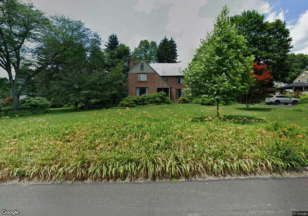
69 Homestead Dr Doylestown, PA 18901
Estimated Value: $923,768 - $1,177,000
5
Beds
1
Bath
2,984
Sq Ft
$349/Sq Ft
Est. Value
About This Home
This home is located at 69 Homestead Dr, Doylestown, PA 18901 and is currently estimated at $1,041,692, approximately $349 per square foot. 69 Homestead Dr is a home located in Bucks County with nearby schools including Linden El School, Lenape Middle School, and Central Bucks High School-West.
Ownership History
Date
Name
Owned For
Owner Type
Purchase Details
Closed on
Jul 27, 1995
Sold by
Meier Ruth E
Bought by
Klaessig Frederick and Klaessig Janet
Current Estimated Value
Home Financials for this Owner
Home Financials are based on the most recent Mortgage that was taken out on this home.
Original Mortgage
$100,000
Interest Rate
7.56%
Purchase Details
Closed on
Jun 16, 1970
Bought by
Meier William U and Meier Ruth E
Create a Home Valuation Report for This Property
The Home Valuation Report is an in-depth analysis detailing your home's value as well as a comparison with similar homes in the area
Home Values in the Area
Average Home Value in this Area
Purchase History
| Date | Buyer | Sale Price | Title Company |
|---|---|---|---|
| Klaessig Frederick | $350,000 | -- | |
| Meier William U | -- | -- |
Source: Public Records
Mortgage History
| Date | Status | Borrower | Loan Amount |
|---|---|---|---|
| Closed | Klaessig Frederick | $100,000 |
Source: Public Records
Tax History Compared to Growth
Tax History
| Year | Tax Paid | Tax Assessment Tax Assessment Total Assessment is a certain percentage of the fair market value that is determined by local assessors to be the total taxable value of land and additions on the property. | Land | Improvement |
|---|---|---|---|---|
| 2025 | $10,088 | $56,000 | $9,240 | $46,760 |
| 2024 | $10,088 | $56,000 | $9,240 | $46,760 |
| 2023 | $9,611 | $56,000 | $9,240 | $46,760 |
| 2022 | $9,478 | $56,000 | $9,240 | $46,760 |
| 2021 | $9,374 | $56,000 | $9,240 | $46,760 |
| 2020 | $9,271 | $56,000 | $9,240 | $46,760 |
| 2019 | $9,169 | $56,000 | $9,240 | $46,760 |
| 2018 | $9,057 | $56,000 | $9,240 | $46,760 |
| 2017 | $8,961 | $56,000 | $9,240 | $46,760 |
| 2016 | $8,961 | $56,000 | $9,240 | $46,760 |
| 2015 | -- | $56,000 | $9,240 | $46,760 |
| 2014 | -- | $56,000 | $9,240 | $46,760 |
Source: Public Records
Map
Nearby Homes
- 89 Homestead Dr
- 236 Green St
- 403 S Main St Unit S201
- 110 E Ashland St
- 3 Steeplechase Dr
- 69 E Oakland Ave
- 155 E Oakland Ave
- 195 Lafayette St
- 1 Barnes Ct
- 78 Tower Hill Rd
- 20 E Court St
- 339 E Ashland St
- 37 N Clinton St
- 2320 Turk Rd
- 146 E Court St
- 272 Fox Chase Ln
- 146 N Church St
- 130 N Clinton St
- 505 E State St
- 121 Cottage St