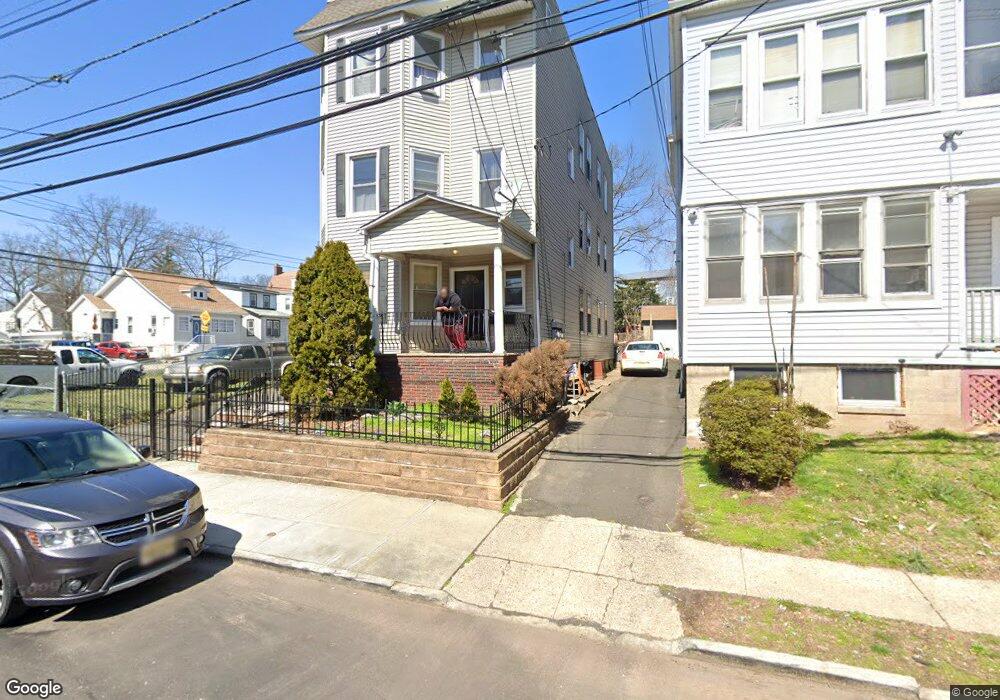
69 Lindsley Ave Newark, NJ 07106
Lower Vailsburg NeighborhoodEstimated Value: $617,000 - $724,000
3
Beds
1
Bath
5,166
Sq Ft
$131/Sq Ft
Est. Value
About This Home
This home is located at 69 Lindsley Ave, Newark, NJ 07106 and is currently estimated at $675,926, approximately $130 per square foot. 69 Lindsley Ave is a home located in Essex County with nearby schools including Lincoln Elementary School, Mt. Vernon School, and Hawthorne Avenue Elementary School.
Ownership History
Date
Name
Owned For
Owner Type
Purchase Details
Closed on
May 7, 2009
Sold by
Tmj Development Llc
Bought by
Harris William B
Current Estimated Value
Home Financials for this Owner
Home Financials are based on the most recent Mortgage that was taken out on this home.
Original Mortgage
$222,600
Outstanding Balance
$141,248
Interest Rate
4.93%
Mortgage Type
Purchase Money Mortgage
Estimated Equity
$534,678
Purchase Details
Closed on
Dec 27, 2005
Sold by
Langlois Judith
Bought by
Immesberger Thomas and Donato John
Create a Home Valuation Report for This Property
The Home Valuation Report is an in-depth analysis detailing your home's value as well as a comparison with similar homes in the area
Home Values in the Area
Average Home Value in this Area
Purchase History
| Date | Buyer | Sale Price | Title Company |
|---|---|---|---|
| Harris William B | $318,000 | Old Republic National Title | |
| Immesberger Thomas | $190,000 | -- |
Source: Public Records
Mortgage History
| Date | Status | Borrower | Loan Amount |
|---|---|---|---|
| Open | Harris William B | $222,600 |
Source: Public Records
Tax History Compared to Growth
Tax History
| Year | Tax Paid | Tax Assessment Tax Assessment Total Assessment is a certain percentage of the fair market value that is determined by local assessors to be the total taxable value of land and additions on the property. | Land | Improvement |
|---|---|---|---|---|
| 2025 | $7,340 | $196,900 | $17,500 | $179,400 |
| 2024 | $7,340 | $196,900 | $17,500 | $179,400 |
| 2022 | $7,356 | $196,900 | $17,500 | $179,400 |
| 2021 | $7,352 | $196,900 | $17,500 | $179,400 |
| 2020 | $7,482 | $196,900 | $17,500 | $179,400 |
| 2019 | $7,405 | $196,900 | $17,500 | $179,400 |
| 2018 | $7,272 | $196,900 | $17,500 | $179,400 |
| 2017 | $7,010 | $196,900 | $17,500 | $179,400 |
| 2016 | $6,773 | $196,900 | $17,500 | $179,400 |
| 2015 | $6,515 | $196,900 | $17,500 | $179,400 |
| 2014 | $6,106 | $196,900 | $17,500 | $179,400 |
Source: Public Records
Map
Nearby Homes
- 67 Lindsley Ave
- 144 Alexander St
- 190 Alexander St
- 18 Spencer St
- 189 Alexander St
- 184 Sunset Ave
- 16 Spencer St Unit 18
- 191 - 193 Sunset Ave
- 123 Alexander St
- 180 Brookdale Ave
- 197-199 Sunset Ave
- 199 Sunset Ave
- 223 W End Ave Unit 225
- 109 Alexander St
- 99 Alexander St
- 206-212 Brookdale Ave
- 232-236 W End Ave
- 124-126 Norwood St
- 240 W End Ave
- 160 Alexander St
- 63 Lindsley Ave Unit 65
- 158 Alexander St Unit 3rd Floor
- 158 Alexander St
- 9-11 Crown St
- 9 Crown St
- 156 Alexander St
- 59 Lindsley Ave
- 75 Lindsley Ave Unit 77
- 13 Crown St
- 70 Lindsley Ave
- 68 Lindsley Ave
- 72 Lindsley Ave Unit 74
- 64 Lindsley Ave Unit 66
- 150 Alexander St Unit 154
- 161 Alexander St
- 62 Lindsley Ave
- 15-17 Crown St
- 60 Lindsley Ave
- 79 Lindsley Ave Unit 81