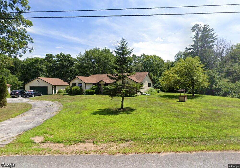
69 Lower Deerfield Rd Northwood, NH 03261
Estimated Value: $602,301 - $691,000
2
Beds
2
Baths
2,870
Sq Ft
$229/Sq Ft
Est. Value
About This Home
This home is located at 69 Lower Deerfield Rd, Northwood, NH 03261 and is currently estimated at $658,325, approximately $229 per square foot. 69 Lower Deerfield Rd is a home located in Rockingham County with nearby schools including Northwood Elementary School and Coe-Brown Northwood Academy.
Ownership History
Date
Name
Owned For
Owner Type
Purchase Details
Closed on
Sep 9, 2014
Sold by
Hannan Steven J and Bryant Suzanne R
Bought by
Camp Yavneh Inc
Current Estimated Value
Purchase Details
Closed on
May 29, 2003
Sold by
Donahue Ft
Bought by
Hannan Steven J
Home Financials for this Owner
Home Financials are based on the most recent Mortgage that was taken out on this home.
Original Mortgage
$252,000
Interest Rate
5.86%
Create a Home Valuation Report for This Property
The Home Valuation Report is an in-depth analysis detailing your home's value as well as a comparison with similar homes in the area
Home Values in the Area
Average Home Value in this Area
Purchase History
| Date | Buyer | Sale Price | Title Company |
|---|---|---|---|
| Camp Yavneh Inc | $300,000 | -- | |
| Hannan Steven J | $280,000 | -- |
Source: Public Records
Mortgage History
| Date | Status | Borrower | Loan Amount |
|---|---|---|---|
| Previous Owner | Hannan Steven J | $215,544 | |
| Previous Owner | Hannan Steven J | $252,000 |
Source: Public Records
Tax History Compared to Growth
Tax History
| Year | Tax Paid | Tax Assessment Tax Assessment Total Assessment is a certain percentage of the fair market value that is determined by local assessors to be the total taxable value of land and additions on the property. | Land | Improvement |
|---|---|---|---|---|
| 2024 | $7,514 | $482,600 | $158,800 | $323,800 |
| 2023 | $6,660 | $482,600 | $158,800 | $323,800 |
| 2022 | $6,071 | $482,600 | $158,800 | $323,800 |
| 2021 | $5,608 | $362,500 | $108,300 | $254,200 |
| 2020 | $4,567 | $362,500 | $108,300 | $254,200 |
| 2019 | $4,590 | $277,200 | $70,900 | $206,300 |
| 2018 | $4,781 | $277,200 | $70,900 | $206,300 |
| 2016 | $6,395 | $266,700 | $70,900 | $195,800 |
| 2015 | $6,662 | $266,700 | $70,900 | $195,800 |
| 2014 | $6,334 | $265,000 | $100,800 | $164,200 |
| 2012 | $6,051 | $260,800 | $100,800 | $160,000 |
Source: Public Records
Map
Nearby Homes
- 142 Mountain Ave
- 31 Green St
- 295 1st New Hampshire Turnpike
- 140 Mountain View Rd
- 16 Deer Run Ln
- 104 N River Lake Rd
- 2184 Franklin Pierce Hwy
- 150A 1st New Hampshire Turnpike
- 0 1st New Hampshire Turnpike Unit 5026030
- 0 1st New Hampshire Turnpike Unit 5013320
- 8 Bow Lake Rd
- 175 Old Turnpike Rd
- 278 Stage Rd
- Map 219 Lot 6-8 Ridge Rd
- 6 Pine St
- 62 Freeman Hall Rd
- 20 Hammond Rd
- 132 North Rd
- 54 Rita's Cir
- 51 Kelsey Mill Rd
- 73 Lower Deerfield Rd
- 58 Lower Deerfield Rd
- 86 Lower Deerfield Rd
- 83 Lower Deerfield Rd
- 20 Bigelow Rd
- 92 Lower Deerfield Rd
- 29 Bigelow Rd
- 15 Newman Dr
- 41 Bigelow Rd
- 41 Bigelow Rd Unit B
- 41 Bigelow Rd Unit A
- 23 Newman Dr
- 15 Big Buck Rd
- 11 Newman Dr
- 9 Newman Dr
- 0 Bigelow & Big Buck Rd Unit Lot 23 & 24
- 13 Big Buck Rd
- 18 Newman Dr
- 16 Big Buck Rd
- 27 Newman Dr