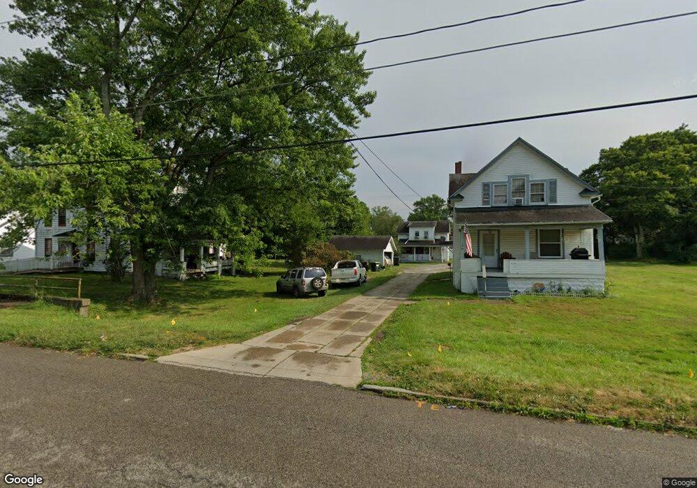
69 Meadowbrook Ave Youngstown, OH 44512
Estimated Value: $96,000 - $166,000
2
Beds
1
Bath
927
Sq Ft
$141/Sq Ft
Est. Value
About This Home
This home is located at 69 Meadowbrook Ave, Youngstown, OH 44512 and is currently estimated at $131,000, approximately $141 per square foot. 69 Meadowbrook Ave is a home located in Mahoning County with nearby schools including Boardman Glenwood Junior High School, Boardman High School, and Horizon Science Academy - Youngstown.
Ownership History
Date
Name
Owned For
Owner Type
Purchase Details
Closed on
Mar 4, 2021
Sold by
Federal Home Loan Mortgage Corporation
Bought by
Lopez Ross
Current Estimated Value
Purchase Details
Closed on
Jun 29, 2020
Sold by
Depp Bonnie S
Bought by
Federal Home Loan Mortgage Corporation
Purchase Details
Closed on
Mar 5, 2003
Sold by
Neuman Alice A and Arnal Alice A
Bought by
Depp Bonnie
Home Financials for this Owner
Home Financials are based on the most recent Mortgage that was taken out on this home.
Original Mortgage
$41,225
Interest Rate
6%
Mortgage Type
Purchase Money Mortgage
Purchase Details
Closed on
May 6, 1988
Bought by
Arnal Alice A
Create a Home Valuation Report for This Property
The Home Valuation Report is an in-depth analysis detailing your home's value as well as a comparison with similar homes in the area
Home Values in the Area
Average Home Value in this Area
Purchase History
| Date | Buyer | Sale Price | Title Company |
|---|---|---|---|
| Lopez Ross | $2,000 | None Available | |
| Federal Home Loan Mortgage Corporation | $24,000 | None Available | |
| Depp Bonnie | $42,500 | -- | |
| Arnal Alice A | -- | -- |
Source: Public Records
Mortgage History
| Date | Status | Borrower | Loan Amount |
|---|---|---|---|
| Previous Owner | Depp Bonnie | $41,225 |
Source: Public Records
Tax History Compared to Growth
Tax History
| Year | Tax Paid | Tax Assessment Tax Assessment Total Assessment is a certain percentage of the fair market value that is determined by local assessors to be the total taxable value of land and additions on the property. | Land | Improvement |
|---|---|---|---|---|
| 2024 | $554 | $2,980 | $2,980 | -- |
| 2023 | $1,477 | $2,980 | $2,980 | $0 |
| 2022 | $1,522 | $2,960 | $2,960 | $0 |
| 2021 | $1,127 | $2,960 | $2,960 | $0 |
| 2020 | $881 | $12,770 | $3,710 | $9,060 |
| 2019 | $889 | $11,200 | $3,250 | $7,950 |
| 2018 | $759 | $11,200 | $3,250 | $7,950 |
| 2017 | $743 | $11,200 | $3,250 | $7,950 |
| 2016 | $983 | $14,750 | $3,530 | $11,220 |
| 2015 | $964 | $14,750 | $3,530 | $11,220 |
| 2014 | $967 | $14,750 | $3,530 | $11,220 |
| 2013 | $956 | $14,750 | $3,530 | $11,220 |
Source: Public Records
Map
Nearby Homes
- 44 Gertrude Ave
- 149 Argyle Ave
- 81 Melrose Ave
- 167 Afton Ave
- 127 Melrose Ave
- 169 Wolcott Dr
- 197 Mathews Rd Unit B
- 0 Mathews Rd Unit 5038026
- 103 Wildwood Dr
- 235 Wolcott Dr
- 6001 Applecrest Dr
- 329 Afton Ave
- 26 Marlindale Ave
- 175 Homestead Dr
- 28 Terrace Dr
- 6511 Pembrooke Place
- 0 Indianola Rd
- 272 Shields Rd
- 642 Oakridge Dr
- 83 Beechwood Dr
- 69 Meadowbrook Ave
- 71 Meadowbrook Ave
- 67 Meadowbrook Ave
- 43 Meadowbrook Ave
- 64 Gertrude Ave
- 58 Gertrude Ave
- 68 Gertrude Ave
- 79 Meadowbrook Ave
- 60 Meadowbrook Ave
- 56 Meadowbrook Ave
- 41 Meadowbrook Ave
- 72 Gertrude Ave
- 68 Meadowbrook Ave
- 52 Meadowbrook Ave
- 46 Gertrude Ave
- 83 Meadowbrook Ave
- 72 Meadowbrook Ave
- 76 Gertrude Ave
- 46 Meadowbrook Ave
- 76 Meadowbrook Ave