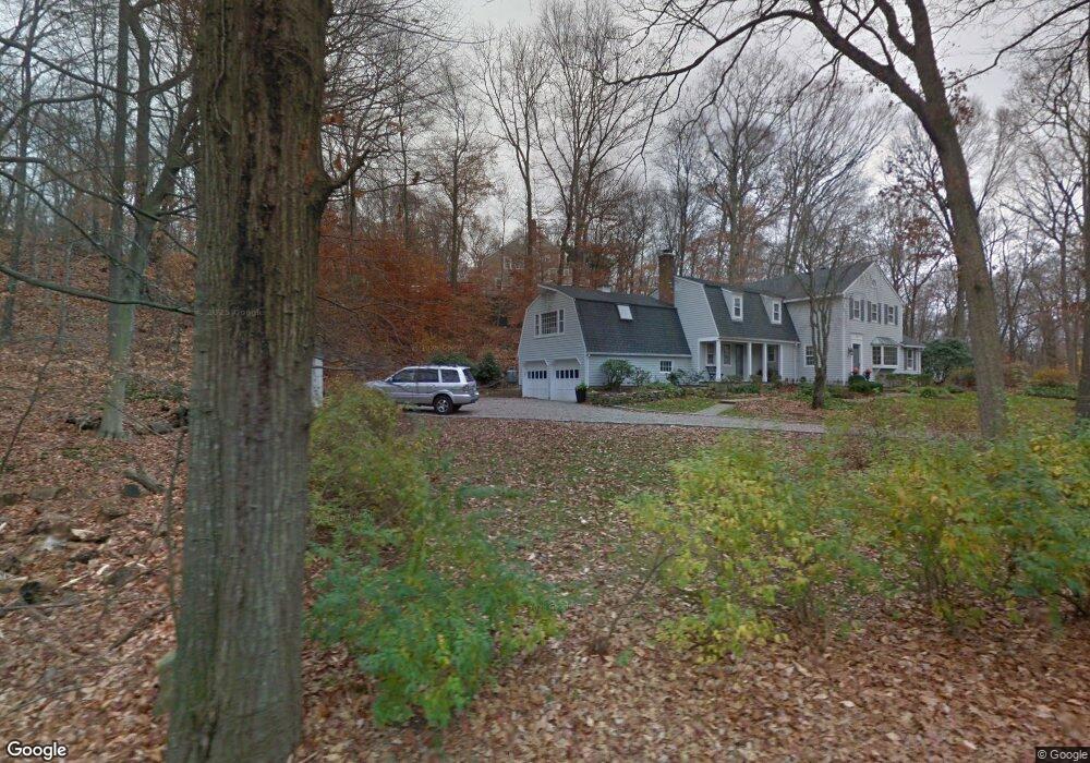
69 Old Kings Hwy Wilton, CT 06897
Estimated Value: $1,362,000 - $1,895,233
4
Beds
4
Baths
3,097
Sq Ft
$501/Sq Ft
Est. Value
About This Home
This home is located at 69 Old Kings Hwy, Wilton, CT 06897 and is currently estimated at $1,552,058, approximately $501 per square foot. 69 Old Kings Hwy is a home located in Fairfield County with nearby schools including Miller-Driscoll School, Cider Mill School, and Middlebrook School.
Ownership History
Date
Name
Owned For
Owner Type
Purchase Details
Closed on
Aug 16, 2005
Sold by
Bachmann John A and Bachmann Carol
Bought by
Turner Jeffrey W and Turner Nadine M
Current Estimated Value
Home Financials for this Owner
Home Financials are based on the most recent Mortgage that was taken out on this home.
Original Mortgage
$684,250
Interest Rate
5.37%
Create a Home Valuation Report for This Property
The Home Valuation Report is an in-depth analysis detailing your home's value as well as a comparison with similar homes in the area
Home Values in the Area
Average Home Value in this Area
Purchase History
| Date | Buyer | Sale Price | Title Company |
|---|---|---|---|
| Turner Jeffrey W | $977,500 | -- |
Source: Public Records
Mortgage History
| Date | Status | Borrower | Loan Amount |
|---|---|---|---|
| Open | Turner Jeffrey W | $630,000 | |
| Closed | Turner Jeffrey W | $684,250 |
Source: Public Records
Tax History Compared to Growth
Tax History
| Year | Tax Paid | Tax Assessment Tax Assessment Total Assessment is a certain percentage of the fair market value that is determined by local assessors to be the total taxable value of land and additions on the property. | Land | Improvement |
|---|---|---|---|---|
| 2025 | $26,953 | $1,104,180 | $292,670 | $811,510 |
| 2024 | $19,156 | $800,170 | $292,670 | $507,500 |
| 2023 | $15,032 | $513,730 | $279,860 | $233,870 |
| 2022 | $14,503 | $513,730 | $279,860 | $233,870 |
| 2021 | $14,318 | $513,730 | $279,860 | $233,870 |
| 2020 | $14,107 | $513,730 | $279,860 | $233,870 |
| 2019 | $14,662 | $513,730 | $279,860 | $233,870 |
| 2018 | $13,864 | $491,820 | $294,490 | $197,330 |
| 2017 | $13,658 | $491,820 | $294,490 | $197,330 |
| 2016 | $13,446 | $491,820 | $294,490 | $197,330 |
| 2015 | $13,196 | $491,820 | $294,490 | $197,330 |
| 2014 | $13,038 | $491,820 | $294,490 | $197,330 |
Source: Public Records
Map
Nearby Homes
- 181 Old Boston Rd
- 860 Silvermine Rd
- 256 Mill Rd
- 158L Carter St
- 152L Carter St
- 515 Belden Hill Rd
- 30L Huckleberry Hill Rd
- 332 Belden Hill Rd
- 136L Carter St
- 140L Carter St
- 67 Carter St
- 59 Snowberry Ln
- 106A Comstock Hill Ave
- 255 Silvermine Ave
- 250 Carter St
- 48 Silver Ridge Rd
- 18 Singing Woods Rd
- 515 Carter St
- 152 Long Lots Rd
- 123 Old Belden Hill Rd Unit 40
- 71 Old Kings Hwy
- 2 Forge Rd N
- 3 Forge Rd N
- 11 Forge Rd N
- 67 Old Kings Hwy
- 73 Old Kings Hwy
- 87 Old Kings Hwy
- 87 Old Kings Hwy
- 35 Forge Rd
- 85 Old Kings Hwy
- 12 Telva Rd
- 102 Old Kings Hwy
- 17 Forge Rd
- 34 Forge Rd
- 116 Old Kings Hwy
- 13 Lords Hill Way
- 4 Telva Rd
- 96 Old Kings Hwy
- 16 Lords Hill Way
- 20 Telva Rd