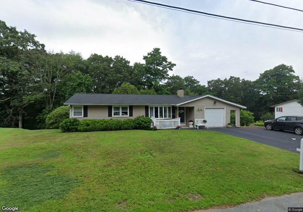
69 Peacedale Rd Cumberland, RI 02864
Cumberland Hill NeighborhoodEstimated Value: $397,000 - $429,391
3
Beds
3
Baths
1,128
Sq Ft
$372/Sq Ft
Est. Value
About This Home
This home is located at 69 Peacedale Rd, Cumberland, RI 02864 and is currently estimated at $419,098, approximately $371 per square foot. 69 Peacedale Rd is a home located in Providence County with nearby schools including Ashton Elementary School, North Cumberland Middle School, and Cumberland High School.
Ownership History
Date
Name
Owned For
Owner Type
Purchase Details
Closed on
Feb 2, 2018
Sold by
Robertson Family Lp
Bought by
Robertson Ellen M and Labree Lynn D
Current Estimated Value
Purchase Details
Closed on
Jul 21, 1988
Sold by
Mulligan Arthur
Bought by
Loynds Steven A
Create a Home Valuation Report for This Property
The Home Valuation Report is an in-depth analysis detailing your home's value as well as a comparison with similar homes in the area
Home Values in the Area
Average Home Value in this Area
Purchase History
| Date | Buyer | Sale Price | Title Company |
|---|---|---|---|
| Loynds Steven A | $115,000 | -- | |
| Robertson Ellen M | -- | -- |
Source: Public Records
Mortgage History
| Date | Status | Borrower | Loan Amount |
|---|---|---|---|
| Previous Owner | Loynds Steven A | $30,000 | |
| Previous Owner | Loynds Steven A | $60,500 | |
| Previous Owner | Loynds Steven A | $90,000 | |
| Previous Owner | Loynds Steven A | $20,000 |
Source: Public Records
Tax History Compared to Growth
Tax History
| Year | Tax Paid | Tax Assessment Tax Assessment Total Assessment is a certain percentage of the fair market value that is determined by local assessors to be the total taxable value of land and additions on the property. | Land | Improvement |
|---|---|---|---|---|
| 2025 | $4,200 | $342,300 | $143,900 | $198,400 |
| 2024 | $4,090 | $342,300 | $143,900 | $198,400 |
| 2023 | $3,978 | $342,300 | $143,900 | $198,400 |
| 2022 | $3,885 | $259,200 | $102,800 | $156,400 |
| 2021 | $3,821 | $259,200 | $102,800 | $156,400 |
| 2020 | $3,712 | $259,200 | $102,800 | $156,400 |
| 2019 | $3,621 | $228,000 | $86,500 | $141,500 |
| 2018 | $3,516 | $228,000 | $86,500 | $141,500 |
| 2017 | $3,468 | $228,000 | $86,500 | $141,500 |
| 2016 | $3,255 | $190,600 | $86,500 | $104,100 |
| 2015 | $3,255 | $190,600 | $86,500 | $104,100 |
| 2014 | $3,255 | $190,600 | $86,500 | $104,100 |
| 2013 | $3,623 | $229,600 | $86,500 | $143,100 |
Source: Public Records
Map
Nearby Homes
- 64 Peacedale Rd
- 35 Timberland Dr
- 1504 Hunting Hill Dr
- 1503 Hunting Hill Dr
- 1501 Hunting Hill Dr
- 1302 Hunting Hill Dr
- 86 Forestdale Dr
- 50 Circledale Dr
- 73 Scott Rd
- 2 School St Unit 241
- 2 School St Unit 311
- 2 School St Unit 130
- 2 School St Unit 108
- 2 School St Unit 403
- 164 Scott Rd
- 2 Main St Unit 15
- 128 Old River Rd
- 103 Old River Rd
- 96 Evergreen St
- 27 Oxford Rd
- 63 Peacedale Rd
- 75 Peacedale Rd
- 55 Peacedale Rd
- 10 Rosetti Dr
- 74 Peacedale Rd
- 77 Peacedale Rd
- 51 Peacedale Rd
- 9 Rosetti Dr
- 79 Peacedale Rd
- 1906 Mendon Rd
- 43 Peacedale Rd
- 44 Peacedale Rd
- 1930 Mendon Rd
- 39 Peacedale Rd
- 1909 Mendon Rd
- 0 Anthony Dr Unit 4361
- 0 Anthony Dr Unit 708808
- 0 Anthony Dr Unit 759066
- 0 Anthony Dr Unit 833264
- 0 Anthony Dr Unit 945431