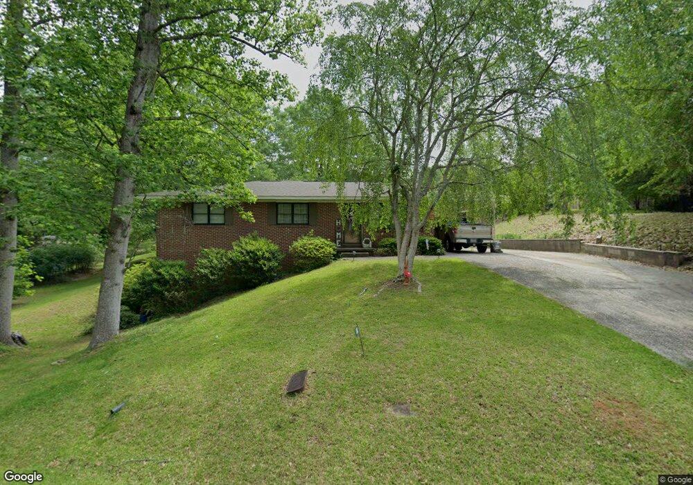
69 Poplar Trail Toccoa, GA 30577
Estimated Value: $177,786 - $204,000
3
Beds
2
Baths
1,363
Sq Ft
$141/Sq Ft
Est. Value
About This Home
This home is located at 69 Poplar Trail, Toccoa, GA 30577 and is currently estimated at $191,947, approximately $140 per square foot. 69 Poplar Trail is a home located in Stephens County with nearby schools including Stephens County High School.
Ownership History
Date
Name
Owned For
Owner Type
Purchase Details
Closed on
Aug 31, 2022
Sold by
Franklin Dorsey
Bought by
Polaris Properties Of Toccoa Llc
Current Estimated Value
Purchase Details
Closed on
Nov 7, 2017
Sold by
Carter Danny
Bought by
Franklin Dorsey
Purchase Details
Closed on
Apr 23, 2013
Sold by
Franklin Dorsey
Bought by
Carter Danny
Home Financials for this Owner
Home Financials are based on the most recent Mortgage that was taken out on this home.
Original Mortgage
$65,000
Interest Rate
3.59%
Mortgage Type
New Conventional
Purchase Details
Closed on
Jul 29, 2004
Bought by
Franklin Dorsey
Purchase Details
Closed on
Jun 1, 2004
Bought by
<Buyer Info Not Present>
Purchase Details
Closed on
Mar 1, 1992
Bought by
<Buyer Info Not Present>
Create a Home Valuation Report for This Property
The Home Valuation Report is an in-depth analysis detailing your home's value as well as a comparison with similar homes in the area
Purchase History
| Date | Buyer | Sale Price | Title Company |
|---|---|---|---|
| Polaris Properties Of Toccoa Llc | $500,000 | -- | |
| Franklin Dorsey | -- | -- | |
| Carter Danny | $65,000 | -- | |
| Franklin Dorsey | $30,000 | -- | |
| <Buyer Info Not Present> | -- | -- | |
| <Buyer Info Not Present> | $51,000 | -- |
Source: Public Records
Mortgage History
| Date | Status | Borrower | Loan Amount |
|---|---|---|---|
| Previous Owner | Carter Danny | $65,000 |
Source: Public Records
Tax History
| Year | Tax Paid | Tax Assessment Tax Assessment Total Assessment is a certain percentage of the fair market value that is determined by local assessors to be the total taxable value of land and additions on the property. | Land | Improvement |
|---|---|---|---|---|
| 2025 | $1,532 | $43,915 | $2,043 | $41,872 |
| 2024 | $1,025 | $28,762 | $2,043 | $26,719 |
| 2023 | $811 | $26,633 | $2,043 | $24,590 |
| 2022 | $721 | $24,217 | $2,043 | $22,174 |
| 2021 | $698 | $22,330 | $2,043 | $20,287 |
| 2020 | $695 | $22,005 | $2,043 | $19,962 |
| 2019 | $698 | $22,005 | $2,043 | $19,962 |
| 2018 | $709 | $22,347 | $2,043 | $20,304 |
| 2017 | $720 | $22,347 | $2,043 | $20,304 |
| 2016 | $709 | $22,346 | $2,042 | $20,303 |
| 2015 | $759 | $22,867 | $2,042 | $20,824 |
| 2014 | $772 | $22,867 | $2,043 | $20,824 |
| 2013 | -- | $20,882 | $2,042 | $18,840 |
Source: Public Records
Map
Nearby Homes
- 526 Poplar St
- 0 Valley Dr Unit 10701357
- 704 Skyline Dr
- 372 Hilltop Way
- 820 Collier Rd
- 926 Skyline Dr
- 208 Cherry St
- 253 Stancil Dr
- 475 Hilltop Way
- 0 Stephen Dr Unit 10710969
- 0 Stephen Dr Unit 10710891
- 93 Hickory Cir
- 122 King St
- 158 Pebble Creek Dr
- 9 Poplar St
- 1037 S Pond St
- 27 Hilltop Ln
- 943 S Pond St
- 481 Collins Rd
- 103 Old Liberty Hill Rd
- 69 Poplar Trail
- 109 Poplar Trail
- 852 Poplar St
- 76 Poplar Trail
- 76 Poplar Trail
- 488 Poplar St
- 88 Poplar Trail
- 836 Poplar St
- 29 Poplar Trail
- 76 Poplar Trail
- 32 Poplar Trail
- 782 Poplar St
- 98 Poplar Trail
- 900 Poplar St
- 11 Poplar Trail
- 12 Poplar Trail
- 12 Poplar Trail
- 720 Poplar St
- 859 Poplar St
- 833 Poplar St
Your Personal Tour Guide
Ask me questions while you tour the home.