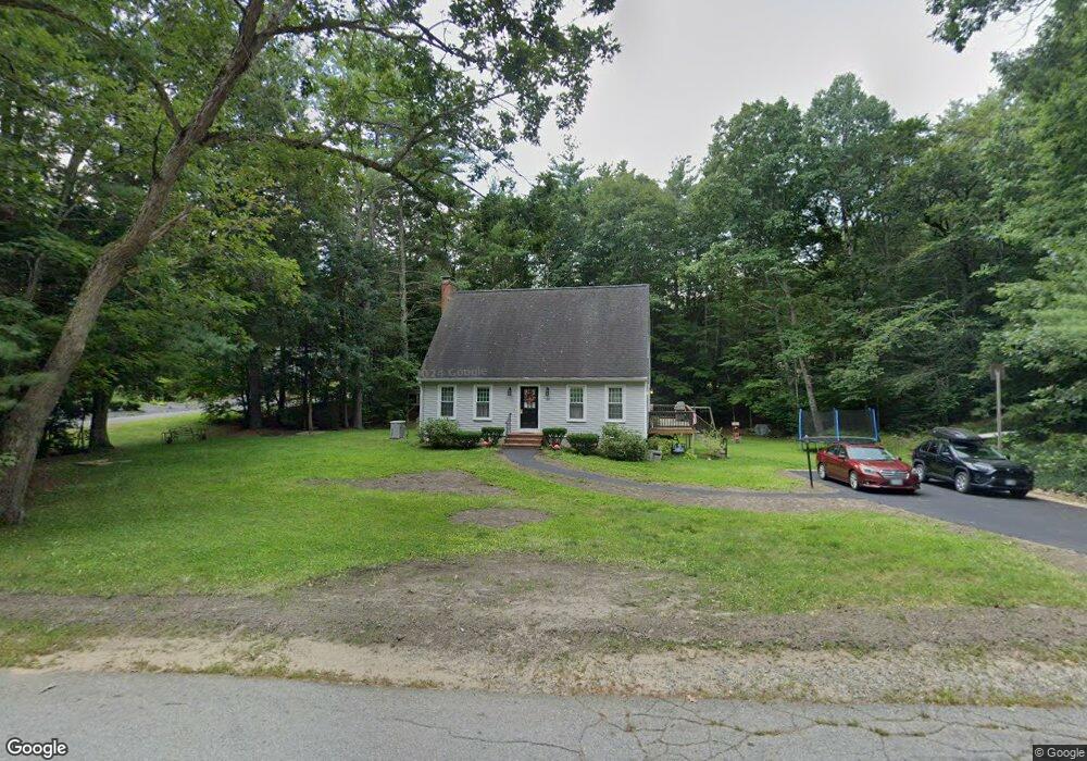
69 Poplin Dr Fremont, NH 03044
Estimated Value: $536,839 - $613,000
3
Beds
2
Baths
1,764
Sq Ft
$328/Sq Ft
Est. Value
About This Home
This home is located at 69 Poplin Dr, Fremont, NH 03044 and is currently estimated at $577,710, approximately $327 per square foot. 69 Poplin Dr is a home located in Rockingham County with nearby schools including Ellis School.
Ownership History
Date
Name
Owned For
Owner Type
Purchase Details
Closed on
May 5, 2003
Sold by
Fegan Jamie T and Fegan Cherise L
Bought by
Straw Chris A
Current Estimated Value
Home Financials for this Owner
Home Financials are based on the most recent Mortgage that was taken out on this home.
Original Mortgage
$245,063
Interest Rate
5.82%
Purchase Details
Closed on
Sep 24, 1997
Sold by
Labbe Lieselotte L and Labbe Patrick E
Bought by
Fegan Jamie T and Fegan Cherise L
Home Financials for this Owner
Home Financials are based on the most recent Mortgage that was taken out on this home.
Original Mortgage
$115,000
Interest Rate
7.47%
Create a Home Valuation Report for This Property
The Home Valuation Report is an in-depth analysis detailing your home's value as well as a comparison with similar homes in the area
Home Values in the Area
Average Home Value in this Area
Purchase History
| Date | Buyer | Sale Price | Title Company |
|---|---|---|---|
| Straw Chris A | $247,000 | -- | |
| Fegan Jamie T | $129,900 | -- |
Source: Public Records
Mortgage History
| Date | Status | Borrower | Loan Amount |
|---|---|---|---|
| Open | Fegan Jamie T | $195,025 | |
| Closed | Fegan Jamie T | $245,063 | |
| Previous Owner | Fegan Jamie T | $115,000 |
Source: Public Records
Tax History Compared to Growth
Tax History
| Year | Tax Paid | Tax Assessment Tax Assessment Total Assessment is a certain percentage of the fair market value that is determined by local assessors to be the total taxable value of land and additions on the property. | Land | Improvement |
|---|---|---|---|---|
| 2024 | $7,302 | $276,900 | $94,000 | $182,900 |
| 2023 | $6,532 | $276,900 | $94,000 | $182,900 |
| 2022 | $6,421 | $276,900 | $94,000 | $182,900 |
| 2021 | $6,180 | $276,900 | $94,000 | $182,900 |
| 2020 | $2,630 | $270,400 | $94,000 | $176,400 |
| 2019 | $6,766 | $217,900 | $73,900 | $144,000 |
| 2018 | $17,294 | $217,900 | $73,900 | $144,000 |
| 2017 | $2,430 | $217,900 | $73,900 | $144,000 |
| 2016 | $6,511 | $217,900 | $73,900 | $144,000 |
| 2015 | $6,319 | $217,900 | $73,900 | $144,000 |
| 2014 | $6,163 | $218,400 | $73,900 | $144,500 |
| 2013 | $6,227 | $218,400 | $73,900 | $144,500 |
Source: Public Records
Map
Nearby Homes
- 454 Main St
- 38 Bluefish Dr
- 564 Main St
- 94 Thunder Rd
- 308 Main St
- 54 Cavil Mill Rd
- 98 Copp Dr
- 60 Copp Dr
- 164 Hall Rd
- 240 Main St
- 45 Whittier Dr
- 188 Main St
- 8 Taylor Cir Unit 12
- Lot 7-0 Sanborn Meadow Unit 7-0
- Lot 7-3 Sanborn Meadow Unit 7-3
- Lot 7-2 Sanborn Meadow Unit 7-2
- 32 Country Ln
- 245 Danville Rd
- 118 Hall Rd Unit 3
- 9 Byrne Cir Unit 65