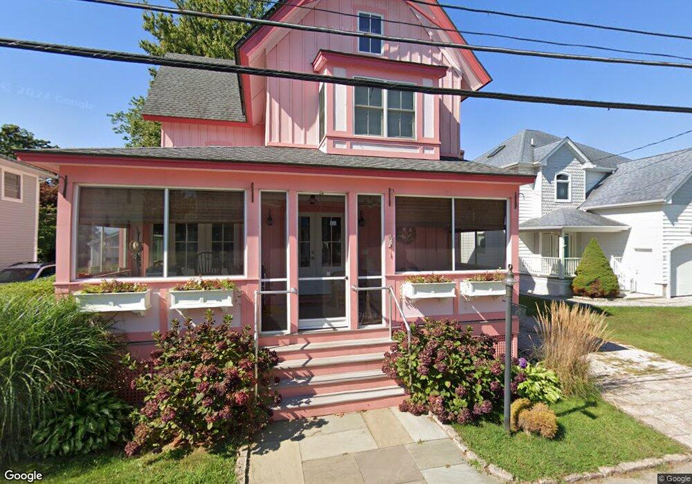
69 Post Ave Westbrook, CT 06498
Estimated Value: $1,066,000 - $1,343,000
3
Beds
3
Baths
1,872
Sq Ft
$653/Sq Ft
Est. Value
About This Home
This home is located at 69 Post Ave, Westbrook, CT 06498 and is currently estimated at $1,223,086, approximately $653 per square foot. 69 Post Ave is a home located in Middlesex County with nearby schools including Daisy Ingraham School, Westbrook Middle School, and Westbrook High School.
Create a Home Valuation Report for This Property
The Home Valuation Report is an in-depth analysis detailing your home's value as well as a comparison with similar homes in the area
Home Values in the Area
Average Home Value in this Area
Tax History
| Year | Tax Paid | Tax Assessment Tax Assessment Total Assessment is a certain percentage of the fair market value that is determined by local assessors to be the total taxable value of land and additions on the property. | Land | Improvement |
|---|---|---|---|---|
| 2025 | $10,385 | $461,540 | $171,250 | $290,290 |
| 2024 | $10,015 | $461,540 | $171,250 | $290,290 |
| 2023 | $9,840 | $461,540 | $171,250 | $290,290 |
| 2022 | $9,582 | $461,540 | $171,250 | $290,290 |
| 2021 | $8,923 | $356,930 | $103,790 | $253,140 |
| 2020 | $8,923 | $356,930 | $103,790 | $253,140 |
| 2019 | $8,805 | $356,930 | $103,790 | $253,140 |
| 2018 | $8,698 | $356,930 | $103,790 | $253,140 |
| 2017 | $8,698 | $356,930 | $103,790 | $253,140 |
| 2016 | $8,636 | $373,190 | $70,060 | $303,130 |
| 2015 | $2,575 | $114,400 | $70,060 | $44,340 |
| 2014 | $2,493 | $114,400 | $70,060 | $44,340 |
Source: Public Records
Map
Nearby Homes
- 0 Boston Post Rd Unit 24080344
- 40 Hammock Rd S
- 328 Hammock Rd N
- 951 Old Clinton Rd Unit 15
- 41 Trolley Rd
- 29 Salt Island Rd
- 11a/11b Pond Circle Rd
- 86 Grove Beach Rd N
- 85 McVeagh Rd
- 19 Old Forge Rd
- 44 Linden Ave N
- 5 Meadow Point Rd
- 8 Cook Terrace
- 407 Grove Beach Rd N
- 39 Sagamore Terrace Rd
- 5 Robin Ln
- 40 Beach Rd
- 37 Nolin Rd
- 10 Winterberry Cir
- 0 Causeway
Your Personal Tour Guide
Ask me questions while you tour the home.