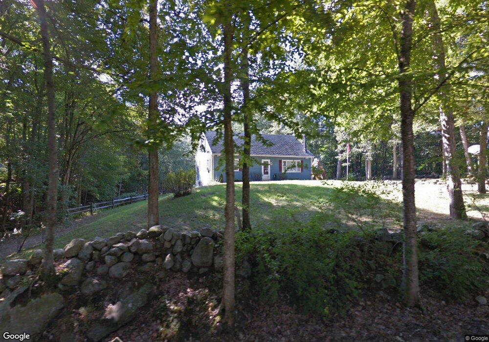
69 Rattlesnake Hill Rd Auburn, NH 03032
Estimated Value: $571,655 - $669,000
4
Beds
2
Baths
2,307
Sq Ft
$267/Sq Ft
Est. Value
About This Home
This home is located at 69 Rattlesnake Hill Rd, Auburn, NH 03032 and is currently estimated at $615,914, approximately $266 per square foot. 69 Rattlesnake Hill Rd is a home located in Rockingham County with nearby schools including Auburn Village School, Pinkerton Academy, and Busche Academy.
Ownership History
Date
Name
Owned For
Owner Type
Purchase Details
Closed on
Jul 1, 1998
Sold by
Grodt Thomas P and Grodt Bonnie R
Bought by
Dennis Richard K and Dennis Erin L
Current Estimated Value
Home Financials for this Owner
Home Financials are based on the most recent Mortgage that was taken out on this home.
Original Mortgage
$127,000
Interest Rate
7.04%
Create a Home Valuation Report for This Property
The Home Valuation Report is an in-depth analysis detailing your home's value as well as a comparison with similar homes in the area
Home Values in the Area
Average Home Value in this Area
Purchase History
| Date | Buyer | Sale Price | Title Company |
|---|---|---|---|
| Dennis Richard K | $135,000 | -- |
Source: Public Records
Mortgage History
| Date | Status | Borrower | Loan Amount |
|---|---|---|---|
| Open | Dennis Richard K | $201,235 | |
| Closed | Dennis Richard K | $50,299 | |
| Closed | Dennis Richard K | $127,000 |
Source: Public Records
Tax History Compared to Growth
Tax History
| Year | Tax Paid | Tax Assessment Tax Assessment Total Assessment is a certain percentage of the fair market value that is determined by local assessors to be the total taxable value of land and additions on the property. | Land | Improvement |
|---|---|---|---|---|
| 2024 | $6,592 | $489,400 | $189,500 | $299,900 |
| 2023 | $6,030 | $478,200 | $189,500 | $288,700 |
| 2022 | $5,792 | $324,500 | $162,400 | $162,100 |
| 2021 | $5,886 | $324,500 | $162,400 | $162,100 |
| 2020 | $5,997 | $324,500 | $162,400 | $162,100 |
| 2019 | $6,104 | $324,500 | $162,400 | $162,100 |
| 2018 | $5,536 | $324,500 | $162,400 | $162,100 |
| 2017 | $5,402 | $255,400 | $147,900 | $107,500 |
| 2016 | $5,271 | $260,300 | $151,200 | $109,100 |
| 2015 | $5,391 | $260,300 | $151,200 | $109,100 |
| 2014 | $5,547 | $260,300 | $151,200 | $109,100 |
| 2013 | $5,099 | $260,300 | $151,200 | $109,100 |
Source: Public Records
Map
Nearby Homes
- 45 Peach Tree Rd
- 59 Hawthorne Dr
- #1 the Cliffs at Evergreen Dr
- 74 Nolls Farm Rd
- 40 Pinyon Place
- 34 Conifer Place
- 55 Norwich Place
- 29 the Cliffs at Evergreen Cliffside Dr Unit 29
- 54 the Cliffs at Evergreen Dr
- 628 Megan Dr
- 612 Megan Dr
- 91 Raymond Rd
- 8 Ledgewood Dr
- 193 Morning Glory Dr
- 4 Ledgewood Dr
- 62 Hooksett Rd
- 54 Daniel Rd
- 50 Daniel Rd
- 52 Daniel Rd
- 22 Eastmeadow Way
- 5 Haven Dr
- 2 Haven Dr
- 4 Haven Dr
- 68 Rattlesnake Hill Rd
- 57 Rattlesnake Hill Rd
- 71 Rattlesnake Hill Rd
- 81 Rattlesnake Hill Rd
- 78 Rattlesnake Hill Rd
- 56 Rattlesnake Hill Rd
- 47 Rattlesnake Hill Rd
- 17 Haven Dr
- 72 Rattlesnake Hill Rd
- 44 Rattlesnake Hill Rd
- 18 Haven Dr
- 27 Haven Dr
- 29 Haven Dr
- 94 Rattlesnake Hill Rd
- 33 Rattlesnake Hill Rd
- 36 Rattlesnake Hill Rd
- 37 Haven Dr