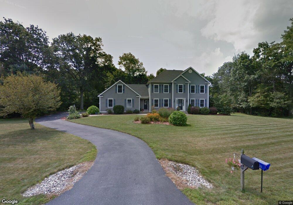
69 Stonecroft Ln Coventry, CT 06238
Estimated Value: $534,000 - $597,000
4
Beds
4
Baths
2,124
Sq Ft
$268/Sq Ft
Est. Value
About This Home
This home is located at 69 Stonecroft Ln, Coventry, CT 06238 and is currently estimated at $570,051, approximately $268 per square foot. 69 Stonecroft Ln is a home located in Tolland County with nearby schools including Coventry Grammar School, George Hersey Robertson School, and Capt. Nathan Hale School.
Ownership History
Date
Name
Owned For
Owner Type
Purchase Details
Closed on
Aug 28, 2003
Sold by
Gannon Ent
Bought by
Mccauliffe Shane and Mccauliffe Allison
Current Estimated Value
Create a Home Valuation Report for This Property
The Home Valuation Report is an in-depth analysis detailing your home's value as well as a comparison with similar homes in the area
Home Values in the Area
Average Home Value in this Area
Purchase History
| Date | Buyer | Sale Price | Title Company |
|---|---|---|---|
| Mccauliffe Shane | $340,000 | -- | |
| Mccauliffe Shane | $340,000 | -- |
Source: Public Records
Mortgage History
| Date | Status | Borrower | Loan Amount |
|---|---|---|---|
| Open | Mccauliffe Shane | $50,000 | |
| Open | Mccauliffe Shane | $287,900 | |
| Closed | Mccauliffe Shane | $270,000 |
Source: Public Records
Tax History
| Year | Tax Paid | Tax Assessment Tax Assessment Total Assessment is a certain percentage of the fair market value that is determined by local assessors to be the total taxable value of land and additions on the property. | Land | Improvement |
|---|---|---|---|---|
| 2025 | $8,634 | $363,400 | $60,800 | $302,600 |
| 2024 | $7,578 | $227,500 | $55,300 | $172,200 |
| 2023 | $7,221 | $227,500 | $55,300 | $172,200 |
| 2022 | $7,087 | $227,500 | $55,300 | $172,200 |
| 2021 | $7,087 | $227,500 | $55,300 | $172,200 |
| 2020 | $7,091 | $227,500 | $55,300 | $172,200 |
| 2019 | $7,332 | $227,700 | $55,300 | $172,400 |
| 2018 | $7,354 | $228,400 | $55,300 | $173,100 |
| 2017 | $7,309 | $228,400 | $55,300 | $173,100 |
| 2016 | $7,126 | $228,400 | $55,300 | $173,100 |
| 2015 | $7,126 | $228,400 | $55,300 | $173,100 |
| 2014 | $7,362 | $258,600 | $60,800 | $197,800 |
Source: Public Records
Map
Nearby Homes
- 0 Skinner Hill Rd Unit 24077239
- 27 Fox Trail
- 275 Long Hill Rd
- 30 Knollwood Dr
- 0 Hinkel Mae Dr
- 0 Daly Rd Unit 24146464
- 83 Morin Ave
- 152 Cheney Ln
- 864 Boston Turnpike
- 0 Wheeling Rd Unit 24116879
- 37 Wolf Hill Lot (#40) Rd
- 37 Wolf Hill Rd Unit Lot 40
- 14 Times Farm Rd
- 8 Times Farm Rd
- 0 Boston Turnpike Unit 24128587
- 198 Forest Rd
- 00 Bunker Hill Rd
- 395 Grant Hill (Mill Race Drive) Lot #21 Rd
- 1358 South St
- 395 Grant Hill Rd Unit Lot21
- 66 Stonecroft Ln
- 78 Stonecroft Ln
- 62 Stonecroft Ln
- 107 Stonecroft Ln
- 50 Stonecroft Ln
- 86 Stonecroft Ln
- 94 Stonecroft Ln
- 106 Stonecroft Ln
- 37 Stonecroft Ln
- 36 Stonecroft Ln
- 115 Stonecroft Ln
- 24 Stonecroft Ln
- 800 S River Rd
- 814 S River Rd
- 717 Wrights Mill Rd
- 832 S River Rd
- 713 Wrights Mill Rd
- 2852 South St
- 749 Wrights Mill Rd
- 2880 South St