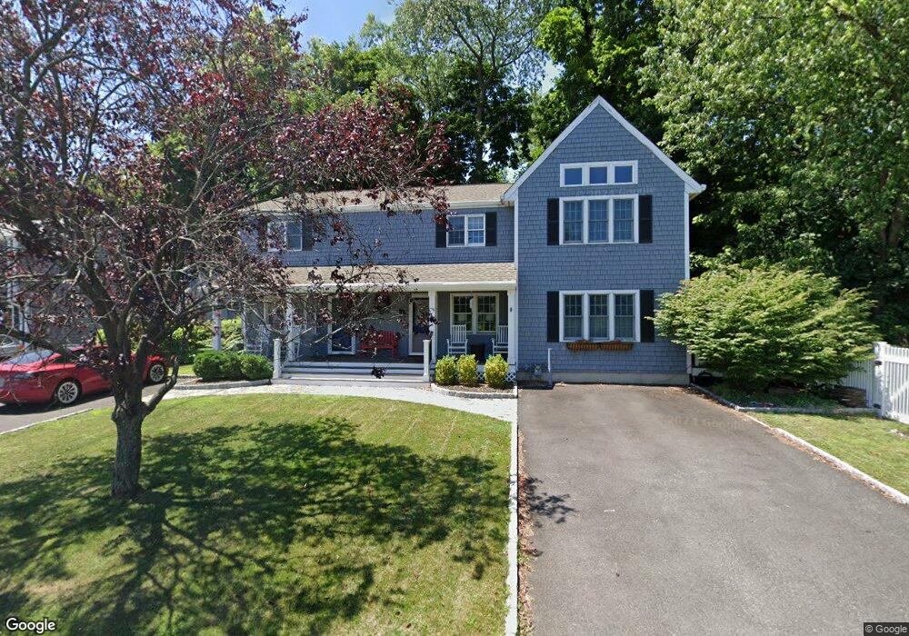
69 Strickland Rd Cos Cob, CT 06807
Estimated Value: $910,159 - $1,004,000
4
Beds
2
Baths
1,696
Sq Ft
$563/Sq Ft
Est. Value
About This Home
This home is located at 69 Strickland Rd, Cos Cob, CT 06807 and is currently estimated at $954,290, approximately $562 per square foot. 69 Strickland Rd is a home located in Fairfield County with nearby schools including Cos Cob School, Central Middle School, and Greenwich High School.
Ownership History
Date
Name
Owned For
Owner Type
Purchase Details
Closed on
Jun 10, 2010
Sold by
Wells Fargo Bk
Bought by
Dworski David
Current Estimated Value
Purchase Details
Closed on
Jul 17, 1998
Sold by
Kane David J and Kane Clare C
Bought by
Noble James D
Home Financials for this Owner
Home Financials are based on the most recent Mortgage that was taken out on this home.
Original Mortgage
$252,000
Interest Rate
6.98%
Mortgage Type
Purchase Money Mortgage
Create a Home Valuation Report for This Property
The Home Valuation Report is an in-depth analysis detailing your home's value as well as a comparison with similar homes in the area
Home Values in the Area
Average Home Value in this Area
Purchase History
| Date | Buyer | Sale Price | Title Company |
|---|---|---|---|
| Dworski David | -- | -- | |
| Noble James D | $335,000 | -- |
Source: Public Records
Mortgage History
| Date | Status | Borrower | Loan Amount |
|---|---|---|---|
| Previous Owner | Noble James D | $252,000 |
Source: Public Records
Tax History Compared to Growth
Tax History
| Year | Tax Paid | Tax Assessment Tax Assessment Total Assessment is a certain percentage of the fair market value that is determined by local assessors to be the total taxable value of land and additions on the property. | Land | Improvement |
|---|---|---|---|---|
| 2025 | $5,340 | $432,040 | $328,090 | $103,950 |
| 2024 | $5,157 | $432,040 | $328,090 | $103,950 |
| 2023 | $5,027 | $432,040 | $328,090 | $103,950 |
| 2022 | $4,981 | $432,040 | $328,090 | $103,950 |
| 2021 | $4,837 | $401,730 | $282,520 | $119,210 |
| 2020 | $4,829 | $401,730 | $282,520 | $119,210 |
| 2019 | $4,877 | $401,730 | $282,520 | $119,210 |
| 2018 | $4,769 | $401,730 | $282,520 | $119,210 |
| 2017 | $4,828 | $401,730 | $282,520 | $119,210 |
| 2016 | $4,752 | $401,730 | $282,520 | $119,210 |
| 2015 | $4,389 | $368,060 | $300,370 | $67,690 |
| 2014 | $4,279 | $368,060 | $300,370 | $67,690 |
Source: Public Records
Map
Nearby Homes
- 7 River Rd Unit Boat Slip A-2
- 7 River Rd Unit Boat Slip D-14
- 15 River Rd Unit 210
- 37 Miltiades Ave
- 4 Sound Shore Dr Unit 24
- 3 Relay Ct
- 7 Stanwich Rd
- 6 Gilliam Ln
- 24 Valley Rd
- 41 Valley Rd
- 47 Valley Rd Unit B3
- 32 Meyer Place
- 203 Riverside Ave
- 24 Harold St Unit E
- 48 Meyer Place
- 105 Woodside Dr
- 40 Bruce Park Dr
- 88 Valleywood Rd
- 52 Carriglea Dr
- 3 Finney Knoll Ln
- 65 Strickland Rd
- 73 Strickland Rd
- 87 Strickland Rd
- 75 Strickland Rd
- 75 Strickland Rd Unit D
- 75 Strickland Rd Unit B
- 75 Strickland Rd Unit A
- 75 Strickland Rd Unit F
- 75 Strickland Rd Unit E
- 77 Strickland Rd
- 77 Strickland Rd Unit A
- 77 Strickland Rd Unit B
- 79 Strickland Rd
- 79 Strickland Rd Unit B
- 81 Strickland Rd
- 33 Maplewood Dr
- 36 Maplewood Dr
- 38 Maplewood Dr
- 83 Strickland Rd Unit 2
- 83 Strickland Rd Unit 1