
Seller's Agent in 2017
Rebecca Donnelly
PureWest Real Estate - Missoula
(406) 541-4000
128 Total Sales


Estimated Value: $308,703
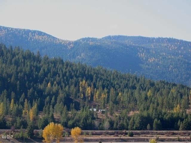
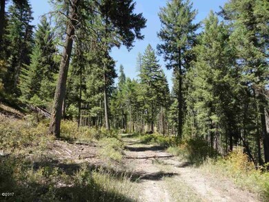
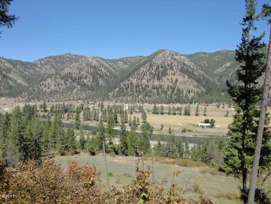
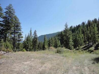
Remarks: Wonderful 140 acre property close to Superior with excellent views of the Clak Fork River. Backs to Lolo National Forest Service lands. Great building site with septic in. Excellent snowmobile and horse access to the back country.Many building sites. Septic tank in at building site with view of Clark Fork River and Superior. Phone about 50 yards from site. Power is close. Only a bit over a mile from downtown Superior. Ample game, Elk , Deer, Bear , Cougar, Turkey. 1/2 mile border with Lolo Nat. Forrest. Zoned for snow mobile. Has many logging roads allowing access to most of the property. Has a perpetually wet spot ,known as Lizard Lake by locals which is 10-15 feet south of an old cowboy/cattle trail from the east.
Last Agent to Sell the Property
PureWest Real Estate - Missoula License #RRE-BRO-LIC-14883 Listed on: 04/06/2017
Last Buyer's Agent
PureWest Real Estate - Missoula License #RRE-BRO-LIC-14883 Listed on: 04/06/2017
Property Type
Est. Annual Taxes
Lot Details
Property Views
Utilities
Listing and Financial Details
| Date | Event | Price | Change | Sq Ft Price |
|---|---|---|---|---|
| 06/12/2017 06/12/17 | Sold | -- | -- | -- |
| 05/22/2017 05/22/17 | Pending | -- | -- | -- |
| 04/06/2017 04/06/17 | For Sale | $199,900 | -- | -- |
| Year | Tax Paid | Tax Assessment Tax Assessment Total Assessment is a certain percentage of the fair market value that is determined by local assessors to be the total taxable value of land and additions on the property. | Land | Improvement |
|---|---|---|---|---|
| 2024 | $416 | $145,258 | $0 | $0 |
| 2023 | $429 | $134,559 | $0 | $0 |
| 2022 | $308 | $106,150 | $0 | $0 |
| 2021 | $226 | $95,452 | $0 | $0 |
| 2020 | $306 | $84,773 | $0 | $0 |
| 2019 | $309 | $84,773 | $0 | $0 |
| 2018 | $304 | $84,733 | $0 | $0 |
| 2017 | $290 | $84,733 | $0 | $0 |
| 2016 | $278 | $84,773 | $0 | $0 |
| 2015 | $197 | $84,773 | $0 | $0 |
| 2014 | $250 | $137,762 | $0 | $0 |
Seller's Agent in 2017
Rebecca Donnelly
PureWest Real Estate - Missoula
(406) 541-4000
128 Total Sales
Seller Co-Listing Agent in 2017
Cole Bergquist
PureWest Real Estate - Missoula
(406) 544-9817
87 Total Sales
Source: Montana Regional MLS
MLS Number: 21703155
APN: 54-2631-29-4-01-01-0000
Disclaimer: Certain information contained herein is derived from information provided by parties other than Homes.com. All information provided is deemed reliable, but is not guaranteed to be accurate and should be independently verified.
![]() IDX information is provided exclusively for personal, non-commercial use, and may not be used for any purpose other than to identify prospective properties consumers may be interested in purchasing. Information is deemed reliable but not guaranteed.
IDX information is provided exclusively for personal, non-commercial use, and may not be used for any purpose other than to identify prospective properties consumers may be interested in purchasing. Information is deemed reliable but not guaranteed.