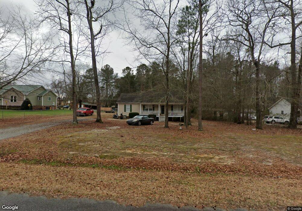
69 Walton Cir Benson, NC 27504
Pleasant Grove NeighborhoodEstimated Value: $262,000 - $300,000
3
Beds
2
Baths
1,316
Sq Ft
$218/Sq Ft
Est. Value
About This Home
This home is located at 69 Walton Cir, Benson, NC 27504 and is currently estimated at $286,496, approximately $217 per square foot. 69 Walton Cir is a home located in Johnston County with nearby schools including Benson Elementary School, Benson Middle School, and West Johnston High School.
Ownership History
Date
Name
Owned For
Owner Type
Purchase Details
Closed on
May 13, 2021
Sold by
Carroll Harold Glenn and Carroll Bridget
Bought by
C Breeze Properties Llc
Current Estimated Value
Purchase Details
Closed on
Feb 16, 2007
Sold by
C Breeze Properties Llc
Bought by
Carroll Harold G and Carroll Bridget J
Home Financials for this Owner
Home Financials are based on the most recent Mortgage that was taken out on this home.
Original Mortgage
$20,000
Interest Rate
6.08%
Mortgage Type
Construction
Purchase Details
Closed on
Jan 5, 2007
Sold by
South Park Development Co Inc
Bought by
C Breeze Properties Llc
Home Financials for this Owner
Home Financials are based on the most recent Mortgage that was taken out on this home.
Original Mortgage
$20,000
Interest Rate
6.08%
Mortgage Type
Construction
Create a Home Valuation Report for This Property
The Home Valuation Report is an in-depth analysis detailing your home's value as well as a comparison with similar homes in the area
Home Values in the Area
Average Home Value in this Area
Purchase History
We collect this data history from publicly available records. To have your information removed, we recommend requesting removal directly through your county’s website.
| Date | Buyer | Sale Price | Title Company |
|---|---|---|---|
| C Breeze Properties Llc | -- | None Available | |
| Carroll Harold G | -- | None Available | |
| C Breeze Properties Llc | $140,000 | None Available |
Source: Public Records
Mortgage History
We collect this data history from publicly available records. To have your information removed, we recommend requesting removal directly through your county’s website.
| Date | Status | Borrower | Loan Amount |
|---|---|---|---|
| Previous Owner | C Breeze Properties Llc | $20,000 |
Source: Public Records
Tax History
| Year | Tax Paid | Tax Assessment Tax Assessment Total Assessment is a certain percentage of the fair market value that is determined by local assessors to be the total taxable value of land and additions on the property. | Land | Improvement |
|---|---|---|---|---|
| 2025 | $1,730 | $272,460 | $80,000 | $192,460 |
| 2024 | $1,196 | $147,600 | $38,000 | $109,600 |
| 2023 | $1,151 | $147,600 | $38,000 | $109,600 |
| 2022 | $1,210 | $147,600 | $38,000 | $109,600 |
| 2021 | $1,181 | $147,600 | $38,000 | $109,600 |
| 2020 | $1,225 | $147,600 | $38,000 | $109,600 |
| 2019 | $1,225 | $147,600 | $38,000 | $109,600 |
| 2018 | $945 | $111,210 | $23,000 | $88,210 |
| 2017 | $945 | $111,210 | $23,000 | $88,210 |
| 2016 | $945 | $111,210 | $23,000 | $88,210 |
| 2015 | $945 | $111,210 | $23,000 | $88,210 |
| 2014 | $945 | $111,210 | $23,000 | $88,210 |
Source: Public Records
Map
Nearby Homes
- 100 Trail Ridge Dr
- 113 Clayton Rd
- 113 Happy Trails Dr
- 244 Black Forest Pointe Trail Unit 46
- 285 Trail
- 18 Cedar Run Ct Unit 11
- 188 Black Forest Pointe Trail Unit 48
- 81 Pinon Dr
- 1651 Live Oak Rd
- 26 Alice Trace Place Unit 34
- 65 Alice Trace Place Unit 2
- 50 Alice Trace Place Unit 33
- 95 Alice Trace Place Unit 3
- 117 Alice Trace Place Unit 4
- 70 Alice Trace Place Unit 32
- 102 Alice Trace Place Unit 31
- 133 Alice Trace Place Unit 5
- 18 Two Belles Ct
- 151 Alice Trace Place Unit 6
- 461 Johnston County Rd
- 91 Walton Cir
- 47 Walton Cir
- 131 Trail Ridge Dr
- 121 Walton Cir
- 99 Trail Ridge Dr
- 173 Trail Ridge Dr
- 70 Walton Cir
- 86 Walton Cir
- 77 Trail Ridge Dr
- 108 Walton Cir
- 195 Trail Ridge Dr
- 130 Walton Cir
- 140 Trail Ridge Dr
- 55 Trail Ridge Dr
- 145 Walton Cir
- 146 Walton Cir
- 215 Trail Ridge Dr
- 180 Trail Ridge Dr
- 33 Trail Ridge Dr
- 161 Walton Cir
Your Personal Tour Guide
Ask me questions while you tour the home.