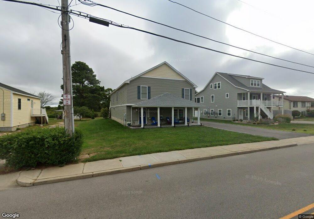
69 Winnapaug Rd Westerly, RI 02891
Estimated Value: $1,001,229 - $1,440,000
3
Beds
2
Baths
1,414
Sq Ft
$802/Sq Ft
Est. Value
About This Home
This home is located at 69 Winnapaug Rd, Westerly, RI 02891 and is currently estimated at $1,134,557, approximately $802 per square foot. 69 Winnapaug Rd is a home located in Washington County with nearby schools including Westerly High School and St. Michael School.
Ownership History
Date
Name
Owned For
Owner Type
Purchase Details
Closed on
Dec 12, 2018
Sold by
Mccarthy William and Mccarthy Laurena
Bought by
Williama & L A Mccarthy Ret and Mccarthy
Current Estimated Value
Purchase Details
Closed on
Aug 29, 2014
Sold by
Jensen Arlean M and Jensen Gertrude C
Bought by
Mccarthy William P and Mccarthy Laurene
Purchase Details
Closed on
May 15, 1997
Sold by
Mccarthy William F and Mccarthy Joyce
Bought by
St Angelo Ann M
Home Financials for this Owner
Home Financials are based on the most recent Mortgage that was taken out on this home.
Original Mortgage
$116,250
Interest Rate
8.12%
Mortgage Type
Purchase Money Mortgage
Create a Home Valuation Report for This Property
The Home Valuation Report is an in-depth analysis detailing your home's value as well as a comparison with similar homes in the area
Home Values in the Area
Average Home Value in this Area
Purchase History
| Date | Buyer | Sale Price | Title Company |
|---|---|---|---|
| Williama & L A Mccarthy Ret | -- | -- | |
| Williama & L A Mccarthy Ret | -- | -- | |
| Mccarthy William P | $150,000 | -- | |
| Mccarthy William P | $150,000 | -- | |
| St Angelo Ann M | $155,000 | -- | |
| St Angelo Ann M | $155,000 | -- |
Source: Public Records
Mortgage History
| Date | Status | Borrower | Loan Amount |
|---|---|---|---|
| Previous Owner | St Angelo Ann M | $116,250 | |
| Closed | Mccarthy William P | $0 |
Source: Public Records
Map
Nearby Homes
- 7 Fishermans Ave
- 27 Benson Ave
- 9 Compass Way Unit 201
- 9 Compass Way Unit 202
- 9 Compass Way Unit 101
- 9 Compass Way Unit 102
- 9 Compass Way Unit 103
- 9 Compass Way Unit 203
- 10 Tristam St
- 4 Shore Rd
- 4 Quail Run
- 19 Wicklow Rd
- 432 Atlantic Ave
- 446 Atlantic Ave
- 18 Timothy Dr
- 470 Atlantic Ave
- 417 River Rd
- 20 Browning Rd
- 60 Avondale Rd
- 9 Champlin Dr
Your Personal Tour Guide
Ask me questions while you tour the home.