Estimated Value: $425,224 - $739,000
Studio
--
Bath
1,428
Sq Ft
$384/Sq Ft
Est. Value
About This Home
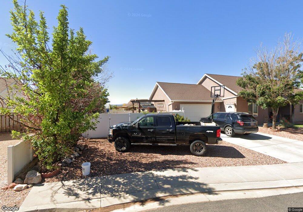
This home is located at 690 E Cedar Cir, Kanab, UT 84741 and is currently estimated at $548,741, approximately $384 per square foot. 690 E Cedar Cir is a home located in Kane County with nearby schools including Valley Elementary School and Valley High School.
Ownership History
Date
Name
Owned For
Owner Type
Purchase Details
Closed on
Mar 21, 2025
Sold by
Cervantes Chantal Galvan
Bought by
Shevlin John F and Shevlin Tracy A
Current Estimated Value
Purchase Details
Closed on
Aug 5, 2022
Sold by
Roberts Mitchell
Bought by
Cervantes Chantal Galvan
Purchase Details
Closed on
Nov 22, 2016
Sold by
Hawes Rory D and Hawes Pamela
Bought by
Roberts Mitchell and Roberts Candace
Purchase Details
Closed on
Jul 15, 2013
Sold by
Hawes Rory D
Bought by
Hawes Rory D and Hawes Pamela
Create a Home Valuation Report for This Property
The Home Valuation Report is an in-depth analysis detailing your home's value as well as a comparison with similar homes in the area
Home Values in the Area
Average Home Value in this Area
Purchase History
| Date | Buyer | Sale Price | Title Company |
|---|---|---|---|
| Shevlin John F | -- | -- | |
| Cervantes Chantal Galvan | -- | -- | |
| Roberts Mitchell | -- | -- | |
| Hawes Rory D | -- | -- |
Source: Public Records
Tax History
| Year | Tax Paid | Tax Assessment Tax Assessment Total Assessment is a certain percentage of the fair market value that is determined by local assessors to be the total taxable value of land and additions on the property. | Land | Improvement |
|---|---|---|---|---|
| 2025 | $2,917 | $423,976 | $136,810 | $287,166 |
| 2024 | $2,916 | $231,077 | $69,672 | $161,405 |
| 2023 | $2,670 | $224,743 | $63,338 | $161,405 |
| 2022 | $2,994 | $223,014 | $62,090 | $160,924 |
| 2021 | $2,498 | $279,450 | $62,717 | $216,733 |
| 2020 | $2,280 | $246,193 | $57,015 | $189,178 |
| 2019 | $2,181 | $228,996 | $57,015 | $171,981 |
| 2018 | $1,985 | $206,538 | $57,015 | $149,523 |
| 2017 | $1,649 | $164,258 | $50,960 | $113,298 |
| 2016 | $1,695 | $164,258 | $50,960 | $113,298 |
| 2015 | $1,555 | $164,258 | $50,960 | $113,298 |
| 2014 | $1,555 | $150,362 | $50,960 | $99,402 |
| 2013 | -- | $137,176 | $0 | $0 |
Source: Public Records
Map
Nearby Homes
- 745 Forest
- 790 E Cedar Mountain Dr
- 590 Forest Dr
- 690 Whispering Pines Dr
- 840 Whispering Pines Dr
- 880 E Ridge Dr
- 4290 Cedar Mountain
- 4310 N Cedar Mountain Dr
- 4290 N Cedar Mountain Dr
- 870 Appaloosa Dr
- 450 E Quaking Aspen Dr
- 670 Church Dr
- 485 E Rim Rd
- 4285 N Meadow Ranch Dr
- 4370 N Meadow Ranch Dr
- 4350 N Meadow Ranch Dr
- 4010 Porcupine Dr
- 295 Porcupine Dr
- 270 Whispering Pines Dr
- 390 Quaking Aspen Dr
- 690 E Cedar Mtn Dr Mvh F-341
- 710 E Cedar Cir
- 670 E Cedar Mountain Dr Unit E
- 670 E Cedar Cir
- 705 E Forest Service Rd
- 695 E Forest Service Rd
- 695 E Cedar Cir
- 720 E Cedar Cir
- 675 E Forest Service Rd
- 725 E Cedar Cir
- 745 E Forest Service Rd
- 655 E Forest Service Rd
- 745 E Cedar Cir
- 655 E Cedar Cir
- 755 Forest Dr
- 760 E Cedar Cir
- 730 E Kenner Dr
- 710 E Kenner Dr
- 635 E Forest Service Rd
- 670 E E Meadow Ranch Dr
Your Personal Tour Guide
Ask me questions while you tour the home.