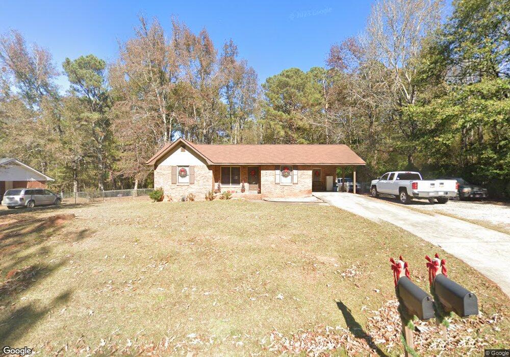
690 Mills Dr Unit 4 Covington, GA 30016
Estimated Value: $209,000 - $231,000
Studio
1
Bath
1,178
Sq Ft
$185/Sq Ft
Est. Value
About This Home
This home is located at 690 Mills Dr Unit 4, Covington, GA 30016 and is currently estimated at $217,932, approximately $185 per square foot. 690 Mills Dr Unit 4 is a home located in Newton County with nearby schools including South Salem Elementary School, Liberty Middle School, and Alcovy High School.
Ownership History
Date
Name
Owned For
Owner Type
Purchase Details
Closed on
Aug 22, 1997
Sold by
Stegall Susan L
Bought by
Harris Latonia J and Harris Norman Freeman
Current Estimated Value
Home Financials for this Owner
Home Financials are based on the most recent Mortgage that was taken out on this home.
Original Mortgage
$71,421
Outstanding Balance
$9,738
Interest Rate
7.43%
Mortgage Type
FHA
Estimated Equity
$208,194
Create a Home Valuation Report for This Property
The Home Valuation Report is an in-depth analysis detailing your home's value as well as a comparison with similar homes in the area
Home Values in the Area
Average Home Value in this Area
Purchase History
| Date | Buyer | Sale Price | Title Company |
|---|---|---|---|
| Harris Latonia J | $72,000 | -- |
Source: Public Records
Mortgage History
| Date | Status | Borrower | Loan Amount |
|---|---|---|---|
| Open | Harris Latonia J | $71,421 |
Source: Public Records
Tax History
| Year | Tax Paid | Tax Assessment Tax Assessment Total Assessment is a certain percentage of the fair market value that is determined by local assessors to be the total taxable value of land and additions on the property. | Land | Improvement |
|---|---|---|---|---|
| 2025 | $2,211 | $88,840 | $12,800 | $76,040 |
| 2024 | $2,141 | $84,520 | $12,800 | $71,720 |
| 2023 | $2,016 | $74,280 | $6,000 | $68,280 |
| 2022 | $1,689 | $62,240 | $6,000 | $56,240 |
| 2021 | $1,197 | $39,480 | $4,200 | $35,280 |
| 2020 | $869 | $25,880 | $4,200 | $21,680 |
| 2019 | $888 | $26,040 | $4,200 | $21,840 |
| 2018 | $864 | $25,160 | $4,200 | $20,960 |
| 2017 | $862 | $25,120 | $4,200 | $20,920 |
| 2016 | $819 | $23,840 | $3,800 | $20,040 |
| 2015 | $664 | $23,240 | $3,600 | $19,640 |
| 2014 | $393 | $15,320 | $0 | $0 |
Source: Public Records
Map
Nearby Homes
- 750 Mills Dr
- 800 Mills Dr
- 25 Woodcrest Dr
- 123 Cowan Rd
- 70 Countryside Ln
- 465 St Annes Place
- 113 St Annes Place
- 330 St Annes Place
- 120 Woodcrest Dr
- 45 Geranium Ln
- 161 Geranium Ln
- 270 St Annes Place
- 75 Tulip Dr
- 4681 Salem Rd
- 300 Brickstone Pkwy
- 231 Saint Anne's Place
- 80 Barge Ln
- 231 St Annes Place
- 165 Tulip Dr
- 440 E Country Woods Dr
Your Personal Tour Guide
Ask me questions while you tour the home.