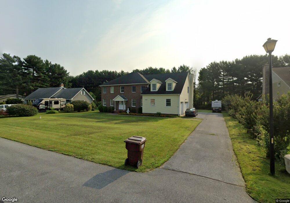
6900 Atlanta Cir Seaford, DE 19973
Estimated Value: $263,000 - $310,000
4
Beds
--
Bath
2,400
Sq Ft
$121/Sq Ft
Est. Value
About This Home
This home is located at 6900 Atlanta Cir, Seaford, DE 19973 and is currently estimated at $291,194, approximately $121 per square foot. 6900 Atlanta Cir is a home located in Sussex County with nearby schools including Seaford Central Elementary School, Frederick Douglass Elementary School, and Seaford Middle School.
Ownership History
Date
Name
Owned For
Owner Type
Purchase Details
Closed on
Nov 21, 2018
Sold by
Bruce W & S L Pollak Ret
Bought by
Stafford Brian E and Stafford Chanel R
Current Estimated Value
Home Financials for this Owner
Home Financials are based on the most recent Mortgage that was taken out on this home.
Original Mortgage
$114,375
Outstanding Balance
$99,667
Interest Rate
4.8%
Mortgage Type
Undefined Multiple Amounts
Estimated Equity
$191,527
Purchase Details
Closed on
Mar 13, 2018
Sold by
Pollak Bruce W
Bought by
Bruce W & S L Pollack Ret
Create a Home Valuation Report for This Property
The Home Valuation Report is an in-depth analysis detailing your home's value as well as a comparison with similar homes in the area
Home Values in the Area
Average Home Value in this Area
Purchase History
| Date | Buyer | Sale Price | Title Company |
|---|---|---|---|
| Stafford Brian E | $152,500 | -- | |
| Bruce W & S L Pollack Ret | -- | -- |
Source: Public Records
Mortgage History
| Date | Status | Borrower | Loan Amount |
|---|---|---|---|
| Open | Stafford Brian E | $114,375 |
Source: Public Records
Tax History Compared to Growth
Tax History
| Year | Tax Paid | Tax Assessment Tax Assessment Total Assessment is a certain percentage of the fair market value that is determined by local assessors to be the total taxable value of land and additions on the property. | Land | Improvement |
|---|---|---|---|---|
| 2025 | $1,023 | $10,050 | $1,950 | $8,100 |
| 2024 | $503 | $10,050 | $1,950 | $8,100 |
| 2023 | $502 | $10,050 | $1,950 | $8,100 |
| 2022 | $490 | $10,050 | $1,950 | $8,100 |
| 2021 | $492 | $10,050 | $1,950 | $8,100 |
| 2020 | $533 | $10,050 | $1,950 | $8,100 |
| 2019 | $467 | $10,050 | $1,950 | $8,100 |
| 2018 | $455 | $10,050 | $0 | $0 |
| 2017 | $432 | $10,050 | $0 | $0 |
| 2016 | $416 | $10,050 | $0 | $0 |
| 2015 | $415 | $10,050 | $0 | $0 |
| 2014 | $394 | $10,050 | $0 | $0 |
Source: Public Records
Map
Nearby Homes
- 6998 Atlanta Cir
- 6873 Robin Dr
- 1403 Tomlinson Dr
- 1102 Wythe Ln
- 23075 Atlanta Rd
- 413 Plantation Dr
- 312 Plantation Dr
- Fairfield Slab Plan at Belle Ayre
- Pembroke Slab Plan at Belle Ayre
- Princeton Slab Plan at Belle Ayre
- Charleston Slab Plan at Belle Ayre
- Hanover Slab Plan at Belle Ayre
- 1123 Magnolia Dr
- 131 Belle Ayre Dr
- 501 Chatham Dr
- 0 Helens Ln
- 23849 Ross Station Rd
- 22502 Atlanta Rd
- 732A Hurley Park Dr
- 175 Pond View Ln
- 6900 Atlanta Cir
- 6900 Atlanta Cir
- 6900 Atlanta Cir
- 6900 Atlanta Cir
- 6922 Atlanta Cir
- 6906 Atlanta Cir
- 6942 Atlanta Cir
- 6879 Atlanta Cir
- 6894 Atlanta Cir
- 6942 Robin Dr
- 6880 Atlanta Cir
- 6863 Atlanta Cir
- 6863 Atlanta Cir
- 6863 Atlanta Cir
- 6958 Atlanta Cir
- 6858 Atlanta Cir
- 6920 Robin Dr
- 6943 Atlanta Cir
- 6851 Atlanta Cir
- 6968 Atlanta Cir