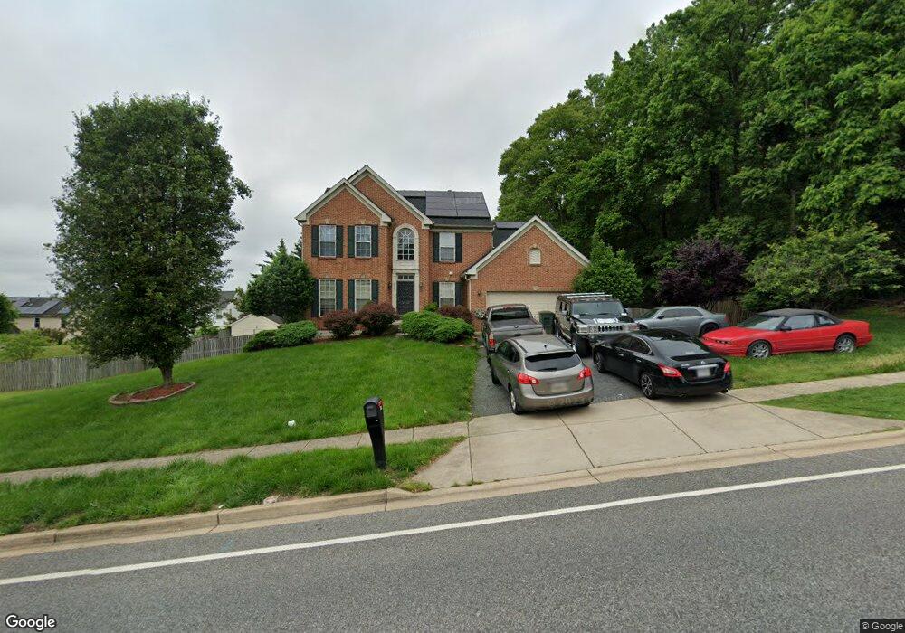
6901 Bock Rd Fort Washington, MD 20744
Estimated Value: $506,000 - $656,000
--
Bed
4
Baths
2,490
Sq Ft
$232/Sq Ft
Est. Value
About This Home
This home is located at 6901 Bock Rd, Fort Washington, MD 20744 and is currently estimated at $578,350, approximately $232 per square foot. 6901 Bock Rd is a home located in Prince George's County with nearby schools including Apple Grove Elementary School, Oxon Hill High School, and National Christian Academy.
Ownership History
Date
Name
Owned For
Owner Type
Purchase Details
Closed on
Jun 6, 2011
Sold by
Jeter Perry O
Bought by
Jeter Peter
Current Estimated Value
Purchase Details
Closed on
Jun 1, 2011
Sold by
Jeter Perry O
Bought by
Jeter Peter
Purchase Details
Closed on
Sep 23, 1999
Sold by
Nvr Inc
Bought by
Jeter Perry O and Harla Patricia A
Purchase Details
Closed on
Jun 1, 1999
Sold by
Trustees Nat Ch God At Ft Wash M
Bought by
Nvr Inc and Suite B
Create a Home Valuation Report for This Property
The Home Valuation Report is an in-depth analysis detailing your home's value as well as a comparison with similar homes in the area
Home Values in the Area
Average Home Value in this Area
Purchase History
| Date | Buyer | Sale Price | Title Company |
|---|---|---|---|
| Jeter Peter | -- | -- | |
| Jeter Peter | -- | -- | |
| Jeter Perry O | $228,690 | -- | |
| Nvr Inc | $50,000 | -- |
Source: Public Records
Tax History Compared to Growth
Tax History
| Year | Tax Paid | Tax Assessment Tax Assessment Total Assessment is a certain percentage of the fair market value that is determined by local assessors to be the total taxable value of land and additions on the property. | Land | Improvement |
|---|---|---|---|---|
| 2025 | $6,128 | $547,300 | -- | -- |
| 2024 | $6,128 | $510,900 | $103,200 | $407,700 |
| 2023 | $5,811 | $464,000 | $0 | $0 |
| 2022 | $4,638 | $417,100 | $0 | $0 |
| 2021 | $5,124 | $370,200 | $76,600 | $293,600 |
| 2020 | $4,838 | $349,867 | $0 | $0 |
| 2019 | $4,719 | $329,533 | $0 | $0 |
| 2018 | $4,599 | $309,200 | $76,600 | $232,600 |
| 2017 | $4,538 | $295,400 | $0 | $0 |
| 2016 | -- | $281,600 | $0 | $0 |
| 2015 | $4,837 | $267,800 | $0 | $0 |
| 2014 | $4,837 | $267,800 | $0 | $0 |
Source: Public Records
Map
Nearby Homes
- 6903 Bock Rd
- 1910 Belfast Dr
- 7009 Shagbark Ct
- 6900 Stirling St
- 2206 Wolf St
- 6415 Whitwell Ct
- 6510 Trowbridge Place
- 0 Bock Rd
- 6211 Caryhurst Dr
- 2107 High Timber Rd
- 6225 Dimrill Ct
- 1125 Devonshire Dr
- 6120 Brandyhall Ct
- 2516 Bellefield Ct
- 0 Livingston Rd
- 7100 Southlawn Dr
- 6113 Brandyhall Ct
- 7407 Bellefield Ave
- 7504 Grange Hall Dr
- 0 Saint Barnabas Rd
- 6904 Bitternut Ct
- 6902 Bitternut Ct
- 6906 Bitternut Ct
- 6813 Bock Rd
- 6900 Bock Rd
- 6902 Bock Rd
- 6908 Bitternut Ct
- 6905 Bock Rd
- 6814 Bock Rd
- 6910 Bitternut Ct
- 6903 Bitternut Ct
- 6905 Bitternut Ct
- 6906 Bock Rd
- 1905 Border Dr
- 2004 Browns Ln
- 6907 Bitternut Ct
- 6812 Bock Rd
- 6912 Bitternut Ct
- 2003 Browns Ln
- 6807 Bock Rd