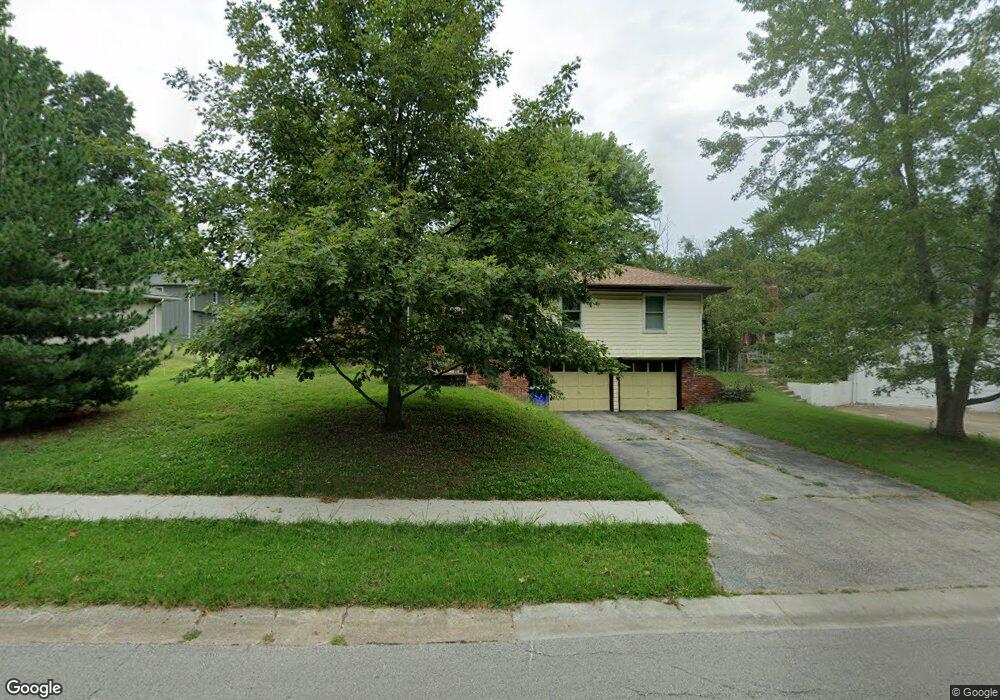
6904 E 129th St Grandview, MO 64030
Estimated Value: $237,000 - $270,000
3
Beds
3
Baths
1,438
Sq Ft
$173/Sq Ft
Est. Value
About This Home
This home is located at 6904 E 129th St, Grandview, MO 64030 and is currently estimated at $248,451, approximately $172 per square foot. 6904 E 129th St is a home located in Jackson County with nearby schools including Conn-West Elementary School, Grandview Middle, and Grandview High School.
Ownership History
Date
Name
Owned For
Owner Type
Purchase Details
Closed on
Nov 19, 2004
Sold by
Fitzpatrick Virginia M
Bought by
Rehel Maurice J and Rehel Barbara C
Current Estimated Value
Home Financials for this Owner
Home Financials are based on the most recent Mortgage that was taken out on this home.
Original Mortgage
$110,000
Outstanding Balance
$54,674
Interest Rate
5.72%
Mortgage Type
Purchase Money Mortgage
Estimated Equity
$193,777
Create a Home Valuation Report for This Property
The Home Valuation Report is an in-depth analysis detailing your home's value as well as a comparison with similar homes in the area
Home Values in the Area
Average Home Value in this Area
Purchase History
| Date | Buyer | Sale Price | Title Company |
|---|---|---|---|
| Rehel Maurice J | -- | Old Republic Title Company |
Source: Public Records
Mortgage History
| Date | Status | Borrower | Loan Amount |
|---|---|---|---|
| Open | Rehel Maurice J | $110,000 |
Source: Public Records
Tax History
| Year | Tax Paid | Tax Assessment Tax Assessment Total Assessment is a certain percentage of the fair market value that is determined by local assessors to be the total taxable value of land and additions on the property. | Land | Improvement |
|---|---|---|---|---|
| 2025 | $2,466 | $29,650 | $5,326 | $24,324 |
| 2024 | $2,423 | $30,320 | $6,004 | $24,316 |
| 2023 | $2,423 | $30,321 | $6,637 | $23,684 |
| 2022 | $1,925 | $22,420 | $3,732 | $18,688 |
| 2021 | $1,923 | $22,420 | $3,732 | $18,688 |
| 2020 | $1,722 | $21,266 | $3,732 | $17,534 |
| 2019 | $1,661 | $21,266 | $3,732 | $17,534 |
| 2018 | $1,554 | $18,508 | $3,248 | $15,260 |
| 2016 | $1,546 | $18,044 | $3,352 | $14,692 |
Source: Public Records
Map
Nearby Homes
- 6905 E 129th St
- 12825 Winchester Ave
- 6614 E 128th St
- 12200 Craig Dr
- 12217 Bennington Ave
- 12901 Byars Rd
- 6705 E 126th St
- 12608 Craig Ave
- 12709 Applewood Dr
- 12525 Craig Ave
- 12506 Winchester Ave
- 12701 Applewood Dr
- 7505 E 130th St
- 6411 E 127th St
- 7509 E 127 St
- 7601 High Grove Rd
- 6042 E 129th St
- 6008 E 129th St
- 13213 Winchester Ave
- 13218 Craig Ave
- 6900 E 129th St
- 6908 E 129th St
- 12824 Winchester Ave
- 12819 Cambridge Ave
- 6909 E 129th St
- 6913 E 129th St
- 12820 Winchester Ave
- 6901 E 129th St
- 12815 Cambridge Ave
- 6808 E 129th St
- 12901 Winchester Ave
- 12818 Cambridge Ave
- 12905 Winchester Ave
- 6813 E 129th St
- 12816 Winchester Ave
- 12811 Cambridge Ave
- 12814 Cambridge Ave
- 12821 Winchester Ave
- 6804 E 129th St
- 6809 E 129th St
Your Personal Tour Guide
Ask me questions while you tour the home.