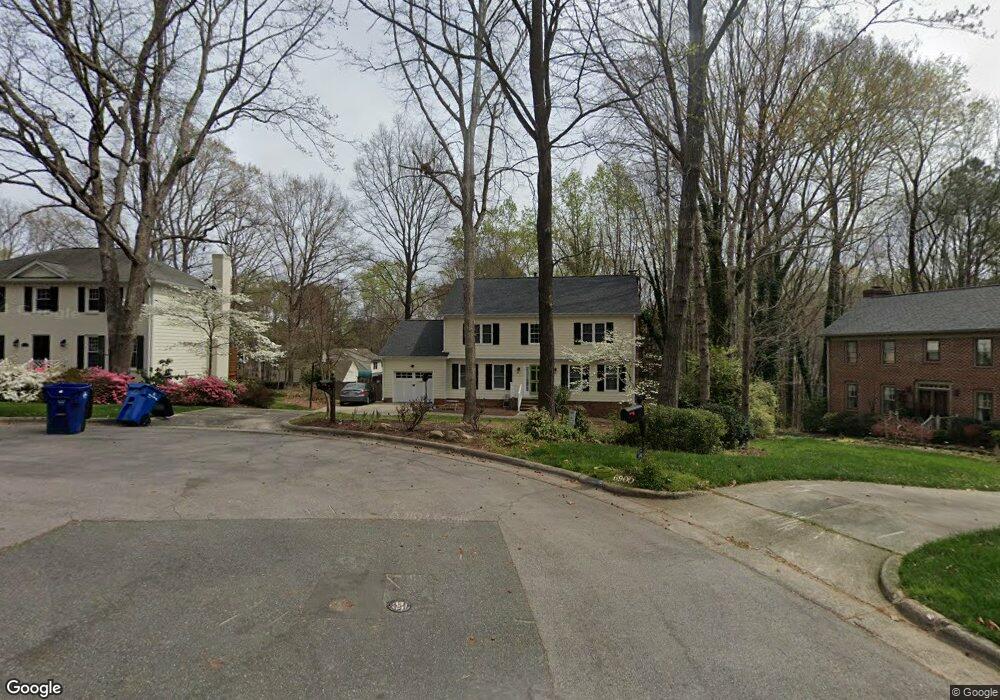
6904 Windtree Cir Raleigh, NC 27612
Estimated Value: $704,000 - $819,000
4
Beds
3
Baths
2,200
Sq Ft
$343/Sq Ft
Est. Value
About This Home
This home is located at 6904 Windtree Cir, Raleigh, NC 27612 and is currently estimated at $754,659, approximately $343 per square foot. 6904 Windtree Cir is a home located in Wake County with nearby schools including Lynn Road Elementary School, Carroll Middle, and Sanderson High School.
Ownership History
Date
Name
Owned For
Owner Type
Purchase Details
Closed on
Aug 18, 2011
Sold by
Parker David L and Parker Lanijo
Bought by
Monk David G and Oconnor Petts Justine S
Current Estimated Value
Home Financials for this Owner
Home Financials are based on the most recent Mortgage that was taken out on this home.
Original Mortgage
$246,600
Outstanding Balance
$171,140
Interest Rate
4.62%
Mortgage Type
New Conventional
Estimated Equity
$583,519
Create a Home Valuation Report for This Property
The Home Valuation Report is an in-depth analysis detailing your home's value as well as a comparison with similar homes in the area
Home Values in the Area
Average Home Value in this Area
Purchase History
| Date | Buyer | Sale Price | Title Company |
|---|---|---|---|
| Monk David G | $274,000 | None Available |
Source: Public Records
Mortgage History
| Date | Status | Borrower | Loan Amount |
|---|---|---|---|
| Open | Monk David G | $246,600 |
Source: Public Records
Tax History Compared to Growth
Tax History
| Year | Tax Paid | Tax Assessment Tax Assessment Total Assessment is a certain percentage of the fair market value that is determined by local assessors to be the total taxable value of land and additions on the property. | Land | Improvement |
|---|---|---|---|---|
| 2025 | $5,493 | $627,571 | $250,000 | $377,571 |
| 2024 | $5,470 | $627,571 | $250,000 | $377,571 |
| 2023 | $4,441 | $405,640 | $130,000 | $275,640 |
| 2022 | $4,127 | $405,640 | $130,000 | $275,640 |
| 2021 | $3,967 | $405,640 | $130,000 | $275,640 |
| 2020 | $3,634 | $378,344 | $130,000 | $248,344 |
| 2019 | $3,604 | $309,222 | $100,000 | $209,222 |
| 2018 | $3,399 | $309,222 | $100,000 | $209,222 |
| 2017 | $3,237 | $309,222 | $100,000 | $209,222 |
| 2016 | $3,170 | $309,222 | $100,000 | $209,222 |
| 2015 | $3,126 | $299,954 | $88,000 | $211,954 |
| 2014 | -- | $295,677 | $88,000 | $207,677 |
Source: Public Records
Map
Nearby Homes
- 2428 Havershire Dr
- 7216 Bluffside Ct
- 6801 Valley Lake Dr
- 6505 Burnette Flower Way
- 6502 Brecken Pines Ct
- 6501 Burnette Flower Way
- 1701 Burnette Garden Path
- 8920 Taymouth Ct
- 1705 Burnette Garden Path
- 7340 Doverton Ct
- 8913 Taymouth Ct
- 7922 Footman Way
- 6821 Middleboro Dr
- 6825 Middleboro Dr
- 2508 Village Grove Rd
- 6851 Middleboro Dr
- 6901 Middleboro Dr
- 6733 Middleboro Dr
- 7820 Harbor Dr
- 2609 Cobworth Ct
- 6900 Windtree Cir
- 6908 Windtree Cir
- 7205 Valley Lake Dr
- 7201 Valley Lake Dr
- 7207 Valley Lake Dr
- 6901 Windtree Cir
- 6909 Windtree Cir
- 7109 Valley Lake Dr
- 6905 Windtree Cir
- 7308 Valley Lake Dr
- 7304 Valley Lake Dr
- 1790 Lookout Point Ct
- 7312 Valley Lake Dr
- 7313 Valley Lake Dr
- 7208 Valley Lake Dr
- 2102 Oakcrest Ct
- 7204 Valley Lake Dr
- 2100 Oakcrest Ct
- 7316 Valley Lake Dr
- 1716 Lookout Point Ct