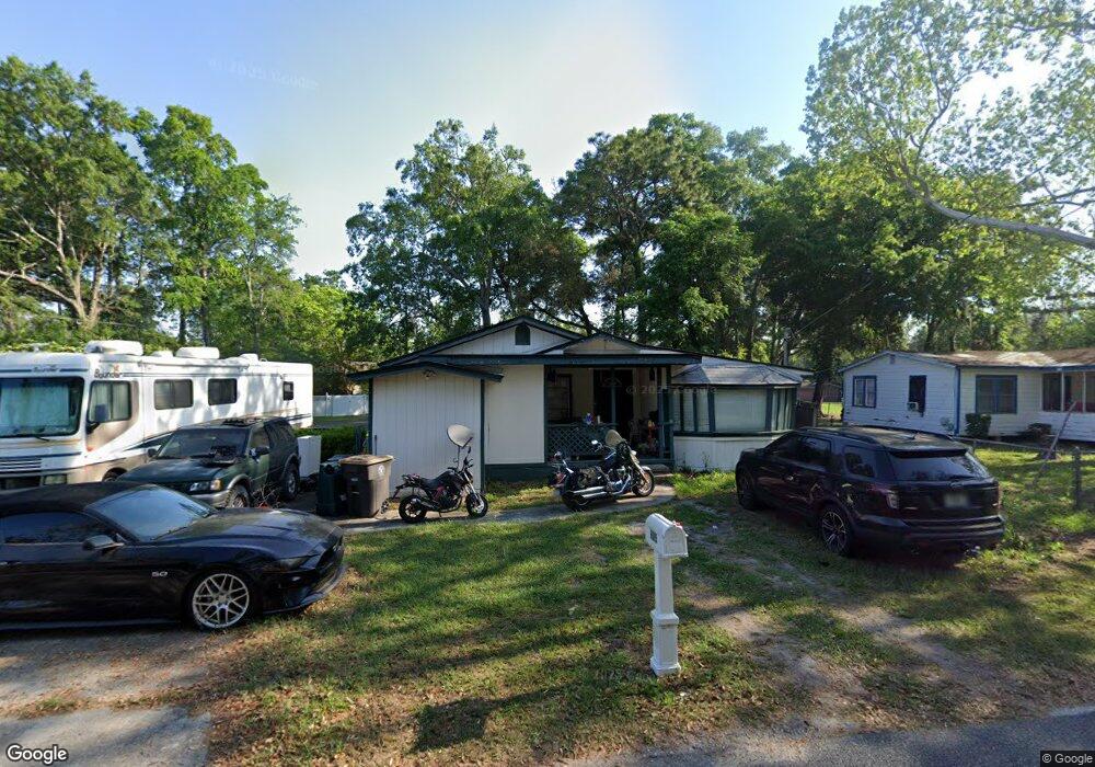
6905 Sallie Ave Jacksonville, FL 32210
Hyde Park NeighborhoodEstimated Value: $144,000 - $178,000
3
Beds
1
Bath
1,164
Sq Ft
$138/Sq Ft
Est. Value
About This Home
This home is located at 6905 Sallie Ave, Jacksonville, FL 32210 and is currently estimated at $160,541, approximately $137 per square foot. 6905 Sallie Ave is a home located in Duval County with nearby schools including Andros Karperos, Hyde Park Elementary School, and Lake Shore Middle School.
Ownership History
Date
Name
Owned For
Owner Type
Purchase Details
Closed on
Feb 12, 2024
Sold by
Gross Ronald E
Bought by
Gross Mark
Current Estimated Value
Purchase Details
Closed on
Nov 20, 2013
Sold by
Beliveau Sylvia
Bought by
Gross Ronald E
Home Financials for this Owner
Home Financials are based on the most recent Mortgage that was taken out on this home.
Original Mortgage
$21,000
Interest Rate
4.16%
Mortgage Type
New Conventional
Purchase Details
Closed on
Nov 28, 2000
Sold by
Wood Melinda J and Wood Tom
Bought by
Cox Elayne H
Create a Home Valuation Report for This Property
The Home Valuation Report is an in-depth analysis detailing your home's value as well as a comparison with similar homes in the area
Home Values in the Area
Average Home Value in this Area
Purchase History
| Date | Buyer | Sale Price | Title Company |
|---|---|---|---|
| Gross Mark | $100 | None Listed On Document | |
| Gross Ronald E | $30,000 | Vystar Title Agency | |
| Cox Elayne H | $41,000 | -- |
Source: Public Records
Mortgage History
| Date | Status | Borrower | Loan Amount |
|---|---|---|---|
| Previous Owner | Gross Ronald E | $21,000 |
Source: Public Records
Tax History Compared to Growth
Tax History
| Year | Tax Paid | Tax Assessment Tax Assessment Total Assessment is a certain percentage of the fair market value that is determined by local assessors to be the total taxable value of land and additions on the property. | Land | Improvement |
|---|---|---|---|---|
| 2025 | $270 | $100,638 | $41,984 | $58,654 |
| 2024 | $262 | $43,834 | -- | -- |
| 2023 | $262 | $42,558 | $0 | $0 |
| 2022 | $274 | $41,319 | $0 | $0 |
| 2021 | $270 | $40,116 | $20,992 | $19,124 |
| 2020 | $315 | $47,252 | $0 | $0 |
| 2019 | $313 | $46,190 | $11,808 | $34,382 |
| 2018 | $312 | $45,667 | $11,808 | $33,859 |
| 2017 | $311 | $45,134 | $11,808 | $33,326 |
| 2016 | $360 | $51,391 | $0 | $0 |
| 2015 | $349 | $48,898 | $0 | $0 |
| 2014 | $350 | $48,510 | $0 | $0 |
Source: Public Records
Map
Nearby Homes
- 1465 Winnebago Ave
- 6914 Alachua Ave
- 1454 Winnebago Ave
- 1438 Ron Rd
- 1465 Manotak Point Dr Unit 104
- 1341 Ottawa Ave
- 6938 Hanson Dr N
- 1627 Westminister Ave
- 7132 Hanson Dr N
- 1728 Londonderry Rd
- 6717 Bakersfield Dr
- 6711 Bakersfield Dr
- 6803 Golfview St
- 1704 Memory Ln
- 1832 Navaho Ave
- 6039 Hyde Park Cir
- 1449 Delmar St
- 6755 Calvados Ave
- 6151 Delmar Place
- 6145 Delmar Place
- 6889 Sallie Ave
- 6927 Sallie Ave
- 6914 Sallie Ave
- 6908 Sallie Ave
- 6879 Sallie Ave
- 1485 Ron Rd
- 1473 Winnebago Ave
- 6878 Sallie Ave
- 6941 Sallie Ave
- 1410 Navaho Ave
- 1404 Ottawa Ave
- 1417 Winnebago Ave
- 1463 Winnebago Ave
- 1398 Ottawa Ave
- 1418 Navaho Ave
- 1475 Ron Rd
- 1482 Winnebago Ave
- 1470 Winnebago Ave
- 0000 Winnebago Ave
- 1392 Ottawa Ave