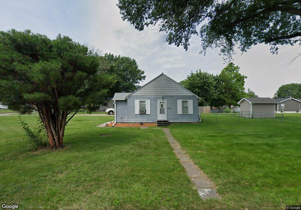
6908 SW 10th St Des Moines, IA 50315
Watrous South NeighborhoodEstimated Value: $154,664 - $206,000
2
Beds
1
Bath
840
Sq Ft
$202/Sq Ft
Est. Value
About This Home
This home is located at 6908 SW 10th St, Des Moines, IA 50315 and is currently estimated at $169,666, approximately $201 per square foot. 6908 SW 10th St is a home located in Polk County with nearby schools including Morris Elementary School, Mccombs Middle School, and Lincoln High School.
Ownership History
Date
Name
Owned For
Owner Type
Purchase Details
Closed on
Apr 3, 2003
Sold by
J & L Classic Homes Lc
Bought by
Strang Shawn Michael
Current Estimated Value
Home Financials for this Owner
Home Financials are based on the most recent Mortgage that was taken out on this home.
Original Mortgage
$81,619
Outstanding Balance
$35,242
Interest Rate
5.94%
Mortgage Type
FHA
Estimated Equity
$134,424
Purchase Details
Closed on
Aug 2, 1999
Sold by
Wenger Thelma I and Wenger Thelma Irene
Bought by
Harris Betty A
Home Financials for this Owner
Home Financials are based on the most recent Mortgage that was taken out on this home.
Original Mortgage
$61,370
Interest Rate
7.68%
Mortgage Type
FHA
Create a Home Valuation Report for This Property
The Home Valuation Report is an in-depth analysis detailing your home's value as well as a comparison with similar homes in the area
Home Values in the Area
Average Home Value in this Area
Purchase History
| Date | Buyer | Sale Price | Title Company |
|---|---|---|---|
| Strang Shawn Michael | $82,500 | -- | |
| Harris Betty A | $61,500 | -- |
Source: Public Records
Mortgage History
| Date | Status | Borrower | Loan Amount |
|---|---|---|---|
| Open | Strang Shawn Michael | $81,619 | |
| Previous Owner | Harris Betty A | $61,370 |
Source: Public Records
Tax History Compared to Growth
Tax History
| Year | Tax Paid | Tax Assessment Tax Assessment Total Assessment is a certain percentage of the fair market value that is determined by local assessors to be the total taxable value of land and additions on the property. | Land | Improvement |
|---|---|---|---|---|
| 2025 | $2,076 | $120,800 | $34,000 | $86,800 |
| 2024 | $2,076 | $105,500 | $29,700 | $75,800 |
| 2023 | $1,978 | $105,500 | $29,700 | $75,800 |
| 2022 | $1,962 | $83,900 | $24,300 | $59,600 |
| 2021 | $1,786 | $83,900 | $24,300 | $59,600 |
| 2020 | $1,856 | $71,600 | $20,900 | $50,700 |
| 2019 | $1,858 | $71,600 | $20,900 | $50,700 |
| 2018 | $1,838 | $69,100 | $18,600 | $50,500 |
| 2017 | $1,822 | $69,100 | $18,600 | $50,500 |
| 2016 | $1,776 | $67,400 | $17,600 | $49,800 |
| 2015 | $1,776 | $67,400 | $17,600 | $49,800 |
| 2014 | $1,746 | $68,200 | $17,400 | $50,800 |
Source: Public Records
Map
Nearby Homes
- 1115 Wade St
- 1115 Rittenhouse St
- 1010 Amos Ave
- 1029 Bundy St
- 1161 Bundy St
- 1313 Burnham Ave
- 1334 Wade St
- 1225 West St
- 7460 Southview Dr
- 1306 Amos Ave
- 7500 SW 12th St
- 6205 SW 12th St
- 1214 Leland Ave
- 6204 SW 5th St
- 1310 Leland Ave
- 214 Leland Ave
- 7306 SW 16th St
- 6107 SW 14th St
- 1010 Frederick Ave
- 1500 Leland Ave
- 1005 Johnson St
- 6920 SW 9th St
- 1006 Rittenhouse St
- 1006 Johnson St
- 906 Rittenhouse St
- 1008 Rittenhouse St
- 1010 Rittenhouse St
- 7005 SW 10th St
- 1023 Johnson St
- 1014 Johnson St
- 1004 Rittenhouse St
- 1002 Rittenhouse St
- 902 Rittenhouse St
- 1020 Johnson St
- 7000 SW 9th St
- 7006 SW 10th St
- 1025 Johnson St
- 1020 Rittenhouse St
- 6820 SW 10th St
- 1024 Johnson St