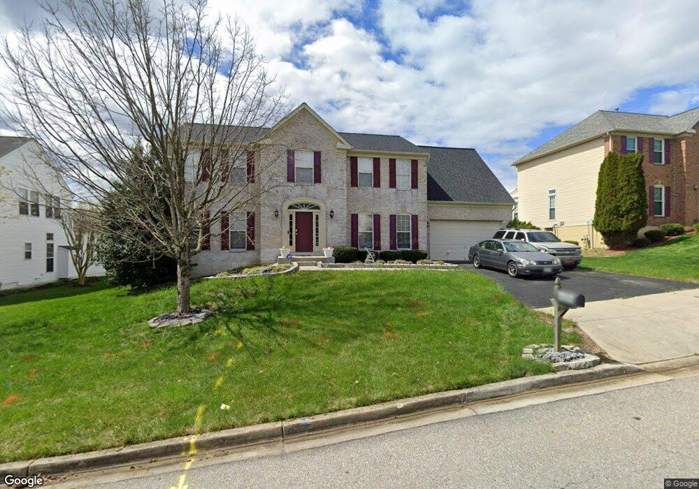
6909 Bitternut Ct Fort Washington, MD 20744
Estimated Value: $534,000 - $704,000
--
Bed
3
Baths
3,092
Sq Ft
$194/Sq Ft
Est. Value
About This Home
This home is located at 6909 Bitternut Ct, Fort Washington, MD 20744 and is currently estimated at $600,478, approximately $194 per square foot. 6909 Bitternut Ct is a home located in Prince George's County with nearby schools including Apple Grove Elementary School, Oxon Hill Middle School, and Oxon Hill High School.
Ownership History
Date
Name
Owned For
Owner Type
Purchase Details
Closed on
Jun 5, 2019
Sold by
Powell Charles A and Powell Janice F
Bought by
Powell Cassandra and Randolph Jimmie L
Current Estimated Value
Purchase Details
Closed on
May 23, 2007
Sold by
Powell Charles A and Powell Janice F
Bought by
Randolph Jimmie R Etal and Randolph Powell,Casssandra
Home Financials for this Owner
Home Financials are based on the most recent Mortgage that was taken out on this home.
Original Mortgage
$122,000
Interest Rate
6.21%
Mortgage Type
Stand Alone Second
Purchase Details
Closed on
Apr 30, 2007
Sold by
Powell Charles A and Powell Janice F
Bought by
Randolph Jimmie R Etal and Randolph Powell,Casssandra
Home Financials for this Owner
Home Financials are based on the most recent Mortgage that was taken out on this home.
Original Mortgage
$122,000
Interest Rate
6.21%
Mortgage Type
Stand Alone Second
Purchase Details
Closed on
May 12, 1999
Sold by
Nvr Inc
Bought by
Powell Charles A and Powell Janice F
Create a Home Valuation Report for This Property
The Home Valuation Report is an in-depth analysis detailing your home's value as well as a comparison with similar homes in the area
Home Values in the Area
Average Home Value in this Area
Purchase History
| Date | Buyer | Sale Price | Title Company |
|---|---|---|---|
| Powell Cassandra | $610,000 | None Available | |
| Randolph Jimmie R Etal | $610,000 | -- | |
| Randolph Jimmie R Etal | $610,000 | -- | |
| Powell Charles A | $227,990 | -- |
Source: Public Records
Mortgage History
| Date | Status | Borrower | Loan Amount |
|---|---|---|---|
| Previous Owner | Randolph Jimmie R Etal | $122,000 | |
| Previous Owner | Randolph Jimmie R Etal | $488,000 | |
| Previous Owner | Randolph Jimmie R Etal | $488,000 |
Source: Public Records
Tax History Compared to Growth
Tax History
| Year | Tax Paid | Tax Assessment Tax Assessment Total Assessment is a certain percentage of the fair market value that is determined by local assessors to be the total taxable value of land and additions on the property. | Land | Improvement |
|---|---|---|---|---|
| 2025 | $6,350 | $565,600 | -- | -- |
| 2024 | $6,350 | $529,600 | $101,200 | $428,400 |
| 2023 | $6,022 | $480,300 | $0 | $0 |
| 2022 | $5,654 | $431,000 | $0 | $0 |
| 2021 | $5,892 | $381,700 | $75,600 | $306,100 |
| 2020 | $5,772 | $363,233 | $0 | $0 |
| 2019 | $4,937 | $344,767 | $0 | $0 |
| 2018 | $5,381 | $326,300 | $75,600 | $250,700 |
| 2017 | $5,211 | $310,733 | $0 | $0 |
| 2016 | -- | $295,167 | $0 | $0 |
| 2015 | $6,381 | $279,600 | $0 | $0 |
| 2014 | $6,381 | $279,600 | $0 | $0 |
Source: Public Records
Map
Nearby Homes
- 6903 Bock Rd
- 7009 Shagbark Ct
- 1910 Belfast Dr
- 6900 Stirling St
- 2206 Wolf St
- 0 Bock Rd
- 6415 Whitwell Ct
- 6510 Trowbridge Place
- 6211 Caryhurst Dr
- 1125 Devonshire Dr
- 2107 High Timber Rd
- 2516 Bellefield Ct
- 7100 Southlawn Dr
- 6225 Dimrill Ct
- 0 Livingston Rd
- 7407 Bellefield Ave
- 6120 Brandyhall Ct
- 7504 Grange Hall Dr
- 6113 Brandyhall Ct
- 0 Saint Barnabas Rd
- 6907 Bitternut Ct
- 6911 Bitternut Ct
- 6916 Sourwood Ln
- 6914 Sourwood Ln
- 6918 Sourwood Ln
- 6905 Bitternut Ct
- 6913 Bitternut Ct
- 6910 Bitternut Ct
- 6908 Bitternut Ct
- 6912 Bitternut Ct
- 6912 Sourwood Ln
- 7000 Sourwood Ln
- 6906 Bitternut Ct
- 6914 Bitternut Ct
- 6915 Sourwood Ln
- 6903 Bitternut Ct
- 6910 Sourwood Ln
- 6913 Sourwood Ln
- 6904 Bitternut Ct
- 6905 Bock Rd