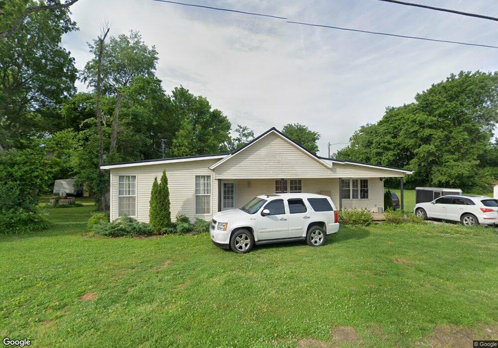
691 Richpond Rd Bowling Green, KY 42104
Greystone NeighborhoodEstimated Value: $156,000 - $214,000
3
Beds
2
Baths
1,371
Sq Ft
$139/Sq Ft
Est. Value
About This Home
This home is located at 691 Richpond Rd, Bowling Green, KY 42104 and is currently estimated at $191,033, approximately $139 per square foot. 691 Richpond Rd is a home located in Warren County with nearby schools including Rich Pond Elementary School, South Warren Middle School, and South Warren High School.
Ownership History
Date
Name
Owned For
Owner Type
Purchase Details
Closed on
Jun 9, 2023
Sold by
Kean Anthony J
Bought by
Cherith Farms Properties Llc
Current Estimated Value
Purchase Details
Closed on
Jun 7, 2023
Sold by
Studio Apartments Llc
Bought by
Service 1 Federal Credit Union
Purchase Details
Closed on
Nov 10, 2022
Sold by
Fuqua Family Holdings Llc
Bought by
Commonwealth Of Kentucky
Purchase Details
Closed on
May 16, 2014
Sold by
Estate Of Minnie M Arnold
Bought by
Fuqua Family Holdings Llc
Create a Home Valuation Report for This Property
The Home Valuation Report is an in-depth analysis detailing your home's value as well as a comparison with similar homes in the area
Home Values in the Area
Average Home Value in this Area
Purchase History
| Date | Buyer | Sale Price | Title Company |
|---|---|---|---|
| Cherith Farms Properties Llc | $244,000 | None Listed On Document | |
| Service 1 Federal Credit Union | $370,000 | None Listed On Document | |
| Commonwealth Of Kentucky | $35,000 | -- | |
| Fuqua Family Holdings Llc | $46,500 | None Available |
Source: Public Records
Tax History Compared to Growth
Tax History
| Year | Tax Paid | Tax Assessment Tax Assessment Total Assessment is a certain percentage of the fair market value that is determined by local assessors to be the total taxable value of land and additions on the property. | Land | Improvement |
|---|---|---|---|---|
| 2024 | $677 | $73,700 | $0 | $0 |
| 2023 | $693 | $75,000 | $0 | $0 |
| 2022 | $650 | $75,000 | $0 | $0 |
| 2021 | $648 | $75,000 | $0 | $0 |
| 2020 | $650 | $75,000 | $0 | $0 |
| 2019 | $529 | $60,000 | $0 | $0 |
| 2018 | $527 | $60,000 | $0 | $0 |
| 2017 | $523 | $60,000 | $0 | $0 |
| 2015 | $409 | $46,500 | $0 | $0 |
| 2014 | $583 | $70,000 | $0 | $0 |
Source: Public Records
Map
Nearby Homes
- 127 Skees Rd
- 114 Skees Rd
- 115 Cal Ave
- 9088 Bluestem Cir
- 9083 Bluestem Cir
- 9087 Bluestem Cir
- 9080 Bluestem Cir
- 9063 Bluestem Cir
- EDMON Plan at Hanover Run
- PENWELL Plan at Hanover Run
- BELFORT (EXPRESS) Plan at Hanover Run
- CALI Plan at Hanover Run
- ARIA Plan at Hanover Run
- 9047 Bluestem Cir
- 9035 Bluestem Cir
- 8444 Nashville Rd
- 8748 Merrill Cir
- 8702 Merrill Cir
- 3315 Fox Fire Ct
- 3228 S Oak St
- 723 Richpond Rd
- 698 Richpond Rd
- 678 & 698 Richpond Rd
- 655 Richpond Rd
- 658 Richpond Rd
- 714 Richpond Rd
- 741 Richpond Rd
- 641 Richpond Rd
- 640 Richpond Rd
- 140 Skees Rd
- 756 Richpond Rd
- 150 Halsell St
- 765 Richpond Rd
- 169 Halsell St
- 160 Skees Rd
- 606 Richpond Rd
- 172 Halsell St
- 781 Richpond Rd
- 590 Richpond Rd
- 193 Halsell St