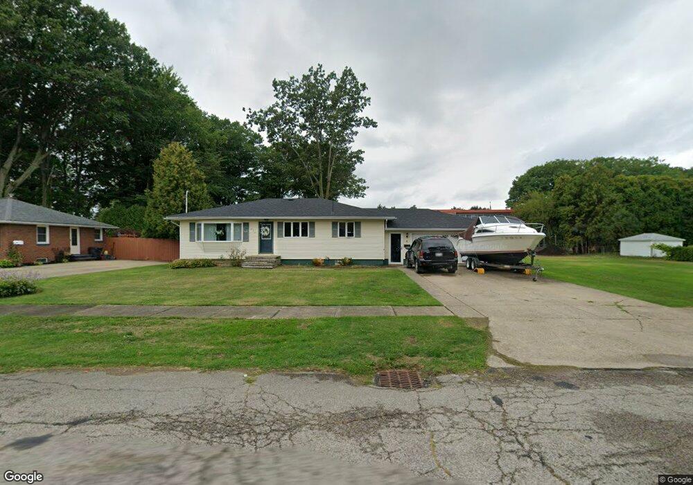
691 Sandusky St Conneaut, OH 44030
Estimated Value: $149,000 - $160,000
3
Beds
2
Baths
1,120
Sq Ft
$140/Sq Ft
Est. Value
About This Home
This home is located at 691 Sandusky St, Conneaut, OH 44030 and is currently estimated at $156,483, approximately $139 per square foot. 691 Sandusky St is a home located in Ashtabula County with nearby schools including Lakeshore Primary Elementary School, Gateway Elementary School, and Conneaut Middle School.
Ownership History
Date
Name
Owned For
Owner Type
Purchase Details
Closed on
May 20, 2024
Sold by
Thompson Eric L
Bought by
Thompson Michele R
Current Estimated Value
Home Financials for this Owner
Home Financials are based on the most recent Mortgage that was taken out on this home.
Original Mortgage
$46,000
Outstanding Balance
$41,531
Interest Rate
6.88%
Mortgage Type
Credit Line Revolving
Estimated Equity
$114,952
Purchase Details
Closed on
Jan 18, 2005
Sold by
Shean Renee M and Matwijko Donna R
Bought by
Thompson Eric L and Thompson Michele R
Home Financials for this Owner
Home Financials are based on the most recent Mortgage that was taken out on this home.
Original Mortgage
$104,500
Interest Rate
4.5%
Mortgage Type
Adjustable Rate Mortgage/ARM
Create a Home Valuation Report for This Property
The Home Valuation Report is an in-depth analysis detailing your home's value as well as a comparison with similar homes in the area
Home Values in the Area
Average Home Value in this Area
Purchase History
| Date | Buyer | Sale Price | Title Company |
|---|---|---|---|
| Thompson Michele R | -- | Title Professionals Group | |
| Thompson Michele R | -- | Title Professionals Group | |
| Thompson Eric L | $100,000 | Buckeye Title Corp |
Source: Public Records
Mortgage History
| Date | Status | Borrower | Loan Amount |
|---|---|---|---|
| Open | Thompson Michele R | $46,000 | |
| Closed | Thompson Michele R | $46,000 | |
| Previous Owner | Thompson Eric L | $104,500 |
Source: Public Records
Tax History
| Year | Tax Paid | Tax Assessment Tax Assessment Total Assessment is a certain percentage of the fair market value that is determined by local assessors to be the total taxable value of land and additions on the property. | Land | Improvement |
|---|---|---|---|---|
| 2024 | $2,553 | $34,900 | $5,640 | $29,260 |
| 2023 | $1,622 | $34,900 | $5,640 | $29,260 |
| 2022 | $1,374 | $26,010 | $4,340 | $21,670 |
| 2021 | $1,398 | $26,010 | $4,340 | $21,670 |
| 2020 | $1,397 | $26,010 | $4,340 | $21,670 |
| 2019 | $1,240 | $22,650 | $3,890 | $18,760 |
| 2018 | $1,182 | $22,650 | $3,890 | $18,760 |
| 2017 | $1,180 | $22,650 | $3,890 | $18,760 |
| 2016 | $1,045 | $21,880 | $3,750 | $18,130 |
| 2015 | $1,056 | $21,880 | $3,750 | $18,130 |
| 2014 | $930 | $21,880 | $3,750 | $18,130 |
| 2013 | $1,162 | $28,140 | $4,270 | $23,870 |
Source: Public Records
Map
Nearby Homes
Your Personal Tour Guide
Ask me questions while you tour the home.