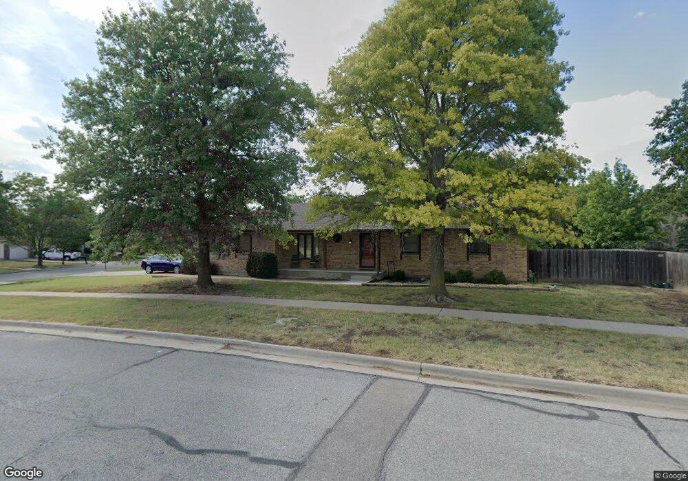
6910 E 25th St N Wichita, KS 67226
Northeast Wichita NeighborhoodEstimated Value: $302,431 - $336,000
3
Beds
3
Baths
1,548
Sq Ft
$206/Sq Ft
Est. Value
About This Home
This home is located at 6910 E 25th St N, Wichita, KS 67226 and is currently estimated at $319,216, approximately $206 per square foot. 6910 E 25th St N is a home located in Sedgwick County with nearby schools including Jackson Elementary School, Stucky Middle School, and Wichita Heights High School.
Ownership History
Date
Name
Owned For
Owner Type
Purchase Details
Closed on
Nov 30, 2007
Sold by
Vaught Paul R and Vaught Lila S
Bought by
Brosius Matthew J and Brosius Elizabetj L
Current Estimated Value
Home Financials for this Owner
Home Financials are based on the most recent Mortgage that was taken out on this home.
Original Mortgage
$148,950
Outstanding Balance
$94,133
Interest Rate
6.27%
Mortgage Type
New Conventional
Estimated Equity
$225,083
Create a Home Valuation Report for This Property
The Home Valuation Report is an in-depth analysis detailing your home's value as well as a comparison with similar homes in the area
Home Values in the Area
Average Home Value in this Area
Purchase History
| Date | Buyer | Sale Price | Title Company |
|---|---|---|---|
| Brosius Matthew J | -- | None Available |
Source: Public Records
Mortgage History
| Date | Status | Borrower | Loan Amount |
|---|---|---|---|
| Open | Brosius Matthew J | $148,950 |
Source: Public Records
Tax History Compared to Growth
Tax History
| Year | Tax Paid | Tax Assessment Tax Assessment Total Assessment is a certain percentage of the fair market value that is determined by local assessors to be the total taxable value of land and additions on the property. | Land | Improvement |
|---|---|---|---|---|
| 2025 | $3,368 | $32,672 | $7,475 | $25,197 |
| 2023 | $3,368 | $28,095 | $7,418 | $20,677 |
| 2022 | $2,681 | $24,012 | $6,992 | $17,020 |
| 2021 | $2,497 | $21,827 | $2,852 | $18,975 |
| 2020 | $2,386 | $20,792 | $2,852 | $17,940 |
| 2019 | $2,275 | $19,803 | $2,852 | $16,951 |
| 2018 | $2,214 | $19,229 | $2,910 | $16,319 |
| 2017 | $2,202 | $0 | $0 | $0 |
| 2016 | $2,199 | $0 | $0 | $0 |
| 2015 | $2,183 | $0 | $0 | $0 |
| 2014 | $2,139 | $0 | $0 | $0 |
Source: Public Records
Map
Nearby Homes
- 2624 N Cranberry St
- 3719 N Crest Cir
- 3710 N Crest Cir
- 7324 E 24th Ct N
- 2433 N Rutland Ct
- 6953 E Newbury Cir
- 7333 E 22nd St N
- 7720 E 24th Ct N
- 2705 N Winstead Cir
- 11507 E Winston St
- 2547 N Rock Road Ct
- 2431 N Hathway Cir
- 6510 E 29th St N
- 3027 N Governeour Cir
- 7519 E Leewood Cir
- 3109 N Rushwood St
- 2204 N Winstead Cir
- 8019 E Lakepoint Way
- 7405 E 30th Cir N
- 3153 N Cranberry St
- 2631 N Rushwood St
- 6822 E 25th Ct N
- 6820 E 25th Ct N
- 7003 E Mainsgate Rd
- 7007 E Mainsgate Rd
- 6821 E 25th St N
- 2633 N Rushwood St
- 6819 E 25th St N
- 6818 E 25th Ct N
- 2630 N Rushwood St
- 2637 N Rushwood St
- 6817 E 25th St N
- 6814 E 25th Ct N
- 2639 N Rushwood Ct
- 6816 E 25th Ct N
- 2632 N Rushwood St
- 7015 E Mainsgate Rd
- 6910 E Mainsgate Rd
- 7010 E 25th St N
- 2641 N Rushwood Ct