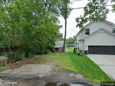
6912 Colony Dr West Bloomfield, MI 48323
West Bloomfield Township NeighborhoodEstimated Value: $241,000 - $308,641
2
Beds
1
Bath
916
Sq Ft
$298/Sq Ft
Est. Value
About This Home
This home is located at 6912 Colony Dr, West Bloomfield, MI 48323 and is currently estimated at $272,660, approximately $297 per square foot. 6912 Colony Dr is a home located in Oakland County with nearby schools including Clifford H. Smart Middle School, Walled Lake Northern High School, and Our Lady Of Refuge School.
Ownership History
Date
Name
Owned For
Owner Type
Purchase Details
Closed on
Jul 29, 2011
Sold by
Schaefer Jacqueline
Bought by
Kleismit Charles S
Current Estimated Value
Purchase Details
Closed on
Nov 6, 1998
Sold by
Deneweth Edward J
Bought by
Schaefer Jacqueline
Home Financials for this Owner
Home Financials are based on the most recent Mortgage that was taken out on this home.
Original Mortgage
$135,000
Interest Rate
6.93%
Purchase Details
Closed on
Aug 29, 1995
Sold by
Jennens Thomas E
Bought by
Deneweth Edward J
Home Financials for this Owner
Home Financials are based on the most recent Mortgage that was taken out on this home.
Original Mortgage
$107,200
Interest Rate
7.78%
Create a Home Valuation Report for This Property
The Home Valuation Report is an in-depth analysis detailing your home's value as well as a comparison with similar homes in the area
Home Values in the Area
Average Home Value in this Area
Purchase History
| Date | Buyer | Sale Price | Title Company |
|---|---|---|---|
| Kleismit Charles S | $60,000 | Fnt | |
| Schaefer Jacqueline | $150,000 | -- | |
| Deneweth Edward J | $134,000 | -- |
Source: Public Records
Mortgage History
| Date | Status | Borrower | Loan Amount |
|---|---|---|---|
| Previous Owner | Schaefer Jacqueline | $135,000 | |
| Previous Owner | Deneweth Edward J | $107,200 |
Source: Public Records
Tax History Compared to Growth
Tax History
| Year | Tax Paid | Tax Assessment Tax Assessment Total Assessment is a certain percentage of the fair market value that is determined by local assessors to be the total taxable value of land and additions on the property. | Land | Improvement |
|---|---|---|---|---|
| 2024 | $3,042 | $137,880 | $0 | $0 |
| 2022 | $2,880 | $124,360 | $93,770 | $30,590 |
| 2021 | $4,567 | $121,910 | $0 | $0 |
| 2020 | $2,628 | $120,470 | $93,770 | $26,700 |
| 2018 | $4,376 | $111,660 | $85,250 | $26,410 |
| 2015 | -- | $67,940 | $0 | $0 |
| 2014 | -- | $62,390 | $0 | $0 |
| 2011 | -- | $58,330 | $0 | $0 |
Source: Public Records
Map
Nearby Homes
- 6978 Colony Dr
- 3991 Fieldview Ave
- 3965 Carrick Ave
- 3960 Bradmore Ave
- 4120 Bunker Ave
- 7170 Crestmore St
- 4442 Borland St
- 6481 Wardell Ct
- 7335 Colony Dr
- 6980 Hambro St
- 0000 Kress Rd
- 7381 Crestmore St
- 4642 Azzo Ct
- 6830 Heron Point Unit 8
- 3641 Green Lake Rd
- 6685 Heron Point
- 6050 Upper Straits Blvd
- 7146 Arrowood Dr
- 4705 Halsted Rd
- 3418 Fieldview Ave
- 6912 Colony Dr
- 6918 Colony Dr
- 6906 Colony Dr
- 6922 Colony Dr
- 6896 Colony Dr
- 6930 Colony Dr
- 6894 Colony Dr
- 6938 Colony Dr
- 6888 Colony Dr
- 6942 Colony Dr
- 4121 Welland Dr
- 4116 Welland Dr
- 6950 Colony Dr
- 6870 Colony Dr Unit Bldg-Unit
- 6870 Colony Dr
- 6949 Colony Dr
- 6956 Colony Dr
- 0 Howarth Unit 29105282
- 0 Howarth Unit 4559565
- 0 Howarth Unit 4962866