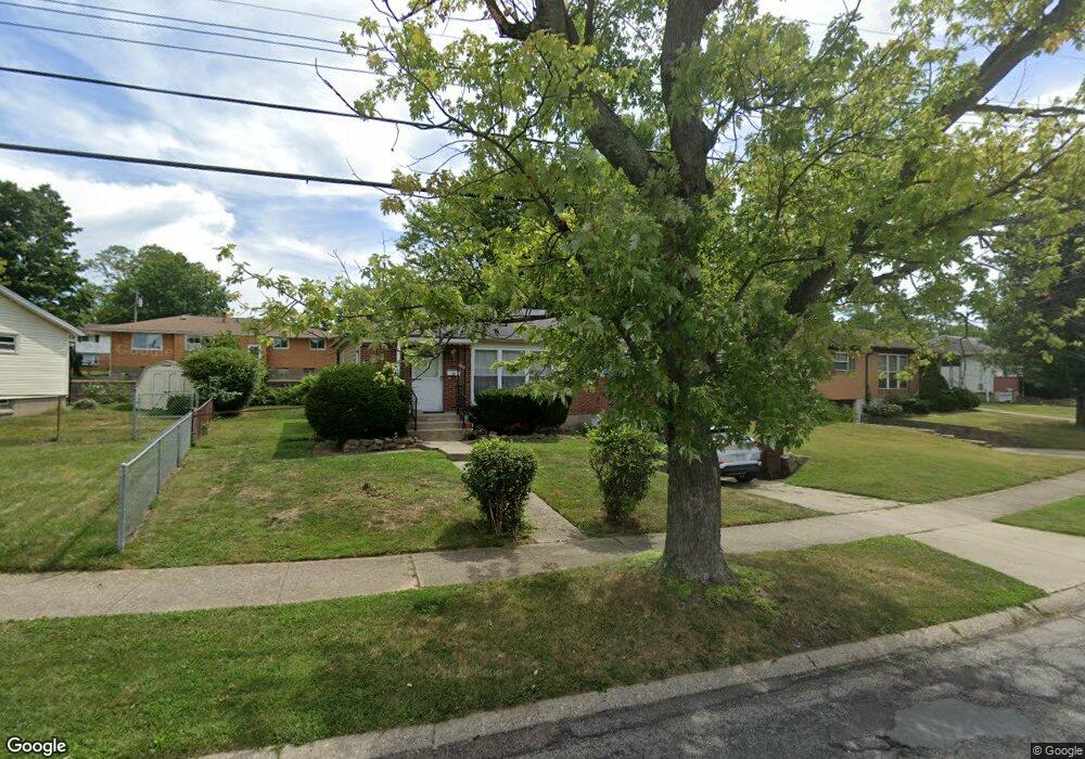
6912 Memory Ln Cincinnati, OH 45239
Estimated Value: $170,000 - $207,000
3
Beds
1
Bath
1,008
Sq Ft
$180/Sq Ft
Est. Value
About This Home
This home is located at 6912 Memory Ln, Cincinnati, OH 45239 and is currently estimated at $181,793, approximately $180 per square foot. 6912 Memory Ln is a home located in Hamilton County with nearby schools including White Oak Middle School, Colerain High School, and Cincinnati Achievement Academy.
Ownership History
Date
Name
Owned For
Owner Type
Purchase Details
Closed on
Aug 5, 2009
Sold by
Mahler Alvin Bernard
Bought by
Mahler Leslie L
Current Estimated Value
Purchase Details
Closed on
May 5, 1995
Sold by
Mahler Alvin Bernard
Bought by
Mahler Alvin Bernard and Mahler Leslie L
Create a Home Valuation Report for This Property
The Home Valuation Report is an in-depth analysis detailing your home's value as well as a comparison with similar homes in the area
Home Values in the Area
Average Home Value in this Area
Purchase History
| Date | Buyer | Sale Price | Title Company |
|---|---|---|---|
| Mahler Leslie L | -- | Attorney | |
| Mahler Alvin Bernard | -- | -- |
Source: Public Records
Tax History
| Year | Tax Paid | Tax Assessment Tax Assessment Total Assessment is a certain percentage of the fair market value that is determined by local assessors to be the total taxable value of land and additions on the property. | Land | Improvement |
|---|---|---|---|---|
| 2025 | $1,642 | $38,661 | $7,798 | $30,863 |
| 2023 | $2,077 | $38,661 | $7,798 | $30,863 |
| 2022 | $1,511 | $22,912 | $6,101 | $16,811 |
| 2021 | $1,498 | $22,912 | $6,101 | $16,811 |
| 2020 | $1,514 | $22,912 | $6,101 | $16,811 |
| 2019 | $1,375 | $19,415 | $5,170 | $14,245 |
| 2018 | $1,233 | $19,415 | $5,170 | $14,245 |
| 2017 | $1,168 | $19,415 | $5,170 | $14,245 |
| 2016 | $1,383 | $22,709 | $7,109 | $15,600 |
| 2015 | $1,396 | $22,709 | $7,109 | $15,600 |
| 2014 | $1,399 | $22,709 | $7,109 | $15,600 |
| 2013 | $1,447 | $24,686 | $7,728 | $16,958 |
Source: Public Records
Map
Nearby Homes
- 6751 Rutherford Ct
- 2427 Crosley Meadow
- 2405 Amelia Ct
- 2391 Deblin Dr
- 2424 Banning Rd
- 2757 Banning Rd
- 2730 Byrneside Dr
- 2528 Flanigan Ct
- 2820 Geraldine Dr
- 2806 Breezy Way
- 2503 Flanigan Ct
- 2836 Banning Rd
- 2801 Byrneside Dr
- 2342 Banning Rd
- 5970 Colerain Ave
- 2268 Deblin Dr
- 2564 Altura Dr
- 2603 Kipling Ave
- 2680 Royal Glen Dr
- 3140 Banning Rd
- 6884 Memory Ln
- 6942 Memory Ln
- 6917 Grange Ct
- 6891 Grange Ct
- 6854 Memory Ln
- 6943 Grange Ct
- 6913 Memory Ln
- 6863 Grange Ct
- 6931 Memory Ln
- 6885 Memory Ln
- 6970 Memory Ln
- 6951 Memory Ln
- 6855 Memory Ln
- 6826 Memory Ln
- 6837 Grange Ct
- 2595 Sandhurst Dr
- 2627 Sandhurst Dr
- 6916 Grange Ct
- 6827 Memory Ln
- 6910 Rutherford Ct
Your Personal Tour Guide
Ask me questions while you tour the home.