Estimated Value: $272,000 - $419,000
1
Bed
1
Bath
500
Sq Ft
$710/Sq Ft
Est. Value
About This Home
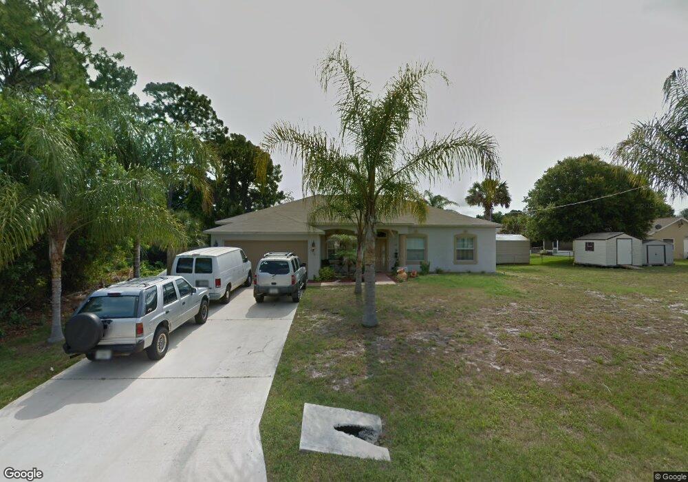
This home is located at 6915 Kaylor Ave, Cocoa, FL 32927 and is currently estimated at $355,076, approximately $710 per square foot. 6915 Kaylor Ave is a home located in Brevard County with nearby schools including Enterprise Elementary School, Space Coast Junior/Senior High School, and East Atlantic Prep of Brevard County.
Ownership History
Date
Name
Owned For
Owner Type
Purchase Details
Closed on
Oct 20, 2003
Sold by
Holiday Builders Inc
Bought by
Franco Jorge
Current Estimated Value
Home Financials for this Owner
Home Financials are based on the most recent Mortgage that was taken out on this home.
Original Mortgage
$122,517
Outstanding Balance
$56,978
Interest Rate
6.16%
Estimated Equity
$298,099
Purchase Details
Closed on
Feb 7, 2003
Sold by
Leavy Maurice
Bought by
Holiday Bldr Inc
Purchase Details
Closed on
Jul 28, 2002
Sold by
Velji Prabhu D and Velji Carmen J
Bought by
Leavy Maurice
Create a Home Valuation Report for This Property
The Home Valuation Report is an in-depth analysis detailing your home's value as well as a comparison with similar homes in the area
Home Values in the Area
Average Home Value in this Area
Purchase History
| Date | Buyer | Sale Price | Title Company |
|---|---|---|---|
| Franco Jorge | $136,200 | Hbi Title Company | |
| Holiday Bldr Inc | $18,000 | -- | |
| Leavy Maurice | $13,500 | -- |
Source: Public Records
Mortgage History
| Date | Status | Borrower | Loan Amount |
|---|---|---|---|
| Open | Franco Jorge | $122,517 |
Source: Public Records
Tax History
| Year | Tax Paid | Tax Assessment Tax Assessment Total Assessment is a certain percentage of the fair market value that is determined by local assessors to be the total taxable value of land and additions on the property. | Land | Improvement |
|---|---|---|---|---|
| 2025 | $1,764 | $125,990 | -- | -- |
| 2024 | $1,723 | $122,440 | -- | -- |
| 2023 | $1,723 | $118,880 | $0 | $0 |
| 2022 | $1,611 | $115,420 | $0 | $0 |
| 2021 | $1,617 | $112,060 | $0 | $0 |
| 2020 | $1,543 | $110,520 | $0 | $0 |
| 2019 | $1,480 | $108,040 | $0 | $0 |
| 2018 | $1,474 | $106,030 | $0 | $0 |
| 2017 | $1,470 | $103,850 | $0 | $0 |
| 2016 | $1,476 | $101,720 | $18,000 | $83,720 |
| 2015 | $1,498 | $101,020 | $15,000 | $86,020 |
| 2014 | $1,501 | $100,220 | $11,000 | $89,220 |
Source: Public Records
Map
Nearby Homes
- 6990 Bryant Rd
- 7065 Hundred Acre Dr
- 6815 Bryant Rd
- 5555 Brandon St
- 5155 Mayflower St
- 5165 Patricia St
- 6760 Cairo Rd
- 7230 Venus Ave
- 5080 Mayflower St
- 7200 Oakwood Ave
- 6615 Dock Ave
- 5200 Frisco St
- 7635 Fringe Place
- 5095 Hogan Place
- 7155 Export Ave
- 5150 Melody St
- 7545 Fringe Place
- 6581 Bancroft Ave
- 7275 Durban Ave
- 6620 Grissom Pkwy
- 5290 Devon St
- 5280 Devon St
- 6910 Bryant Rd
- 6920 Bryant Rd
- 6935 Kaylor Ave
- 5270 Devon St
- 6930 Bryant Rd
- 6920 Kaylor Ave
- 6910 Kaylor Ave
- 6930 Kaylor Ave
- 6895 Cedar Ave
- 6940 Bryant Rd
- 5275 Devon St
- 6917 Bryant Rd
- 6940 Kaylor Ave
- 6909 Bryant Rd
- 6925 Bryant Rd
- 6890 Cedar Ave
- 6885 Cedar Ave
- 6965 Kaylor Ave
Your Personal Tour Guide
Ask me questions while you tour the home.