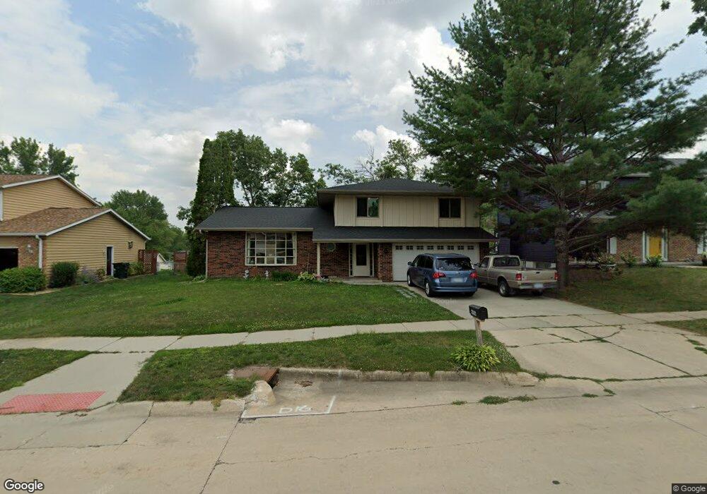
6916 Kent Dr NE Cedar Rapids, IA 52402
Estimated Value: $243,000 - $277,000
3
Beds
4
Baths
2,335
Sq Ft
$114/Sq Ft
Est. Value
About This Home
This home is located at 6916 Kent Dr NE, Cedar Rapids, IA 52402 and is currently estimated at $265,094, approximately $113 per square foot. 6916 Kent Dr NE is a home located in Linn County with nearby schools including Bowman Woods Elementary School, Oak Ridge School, and Linn-Mar High School.
Ownership History
Date
Name
Owned For
Owner Type
Purchase Details
Closed on
Sep 26, 2016
Sold by
Back Investments Llc
Bought by
Platten Bret A and Platten Katherine J
Current Estimated Value
Purchase Details
Closed on
Feb 9, 2011
Sold by
Maly Robert P and Verdeck Warren
Bought by
Back Investments Llc
Purchase Details
Closed on
Oct 27, 2006
Sold by
Maly Robert P and Verdeck Warren
Bought by
Maly Dr Robert P and Verdeck Dr Warren
Purchase Details
Closed on
Nov 20, 1999
Sold by
White Glenn E
Bought by
White Glenn E
Create a Home Valuation Report for This Property
The Home Valuation Report is an in-depth analysis detailing your home's value as well as a comparison with similar homes in the area
Home Values in the Area
Average Home Value in this Area
Purchase History
| Date | Buyer | Sale Price | Title Company |
|---|---|---|---|
| Platten Bret A | -- | None Available | |
| Back Investments Llc | $143,500 | None Available | |
| Maly Dr Robert P | -- | None Available | |
| White Glenn E | -- | -- |
Source: Public Records
Tax History Compared to Growth
Tax History
| Year | Tax Paid | Tax Assessment Tax Assessment Total Assessment is a certain percentage of the fair market value that is determined by local assessors to be the total taxable value of land and additions on the property. | Land | Improvement |
|---|---|---|---|---|
| 2025 | $4,456 | $253,500 | $56,000 | $197,500 |
| 2024 | $4,954 | $247,200 | $52,000 | $195,200 |
| 2023 | $4,954 | $227,400 | $52,000 | $175,400 |
| 2022 | $4,460 | $216,800 | $44,000 | $172,800 |
| 2021 | $4,416 | $201,500 | $44,000 | $157,500 |
| 2020 | $4,416 | $188,100 | $38,000 | $150,100 |
| 2019 | $4,258 | $183,300 | $38,000 | $145,300 |
| 2018 | $4,076 | $183,300 | $38,000 | $145,300 |
| 2017 | $4,026 | $175,700 | $38,000 | $137,700 |
| 2016 | $3,836 | $171,500 | $38,000 | $133,500 |
| 2015 | $3,854 | $172,084 | $38,000 | $134,084 |
| 2014 | $3,854 | $174,116 | $24,000 | $150,116 |
| 2013 | $3,770 | $174,116 | $24,000 | $150,116 |
Source: Public Records
Map
Nearby Homes
- 342 Cambridge Dr NE
- 6726 Bowman Ln NE
- 316 Sussex Dr NE
- 1151 Plumwood Ct NE
- 7320 Hampshire Dr NE
- 2140 Newcastle Rd
- 1000 Hampshire Cir
- 980 Hampshire Cir
- 960 Hampshire Cir
- 948 Hampshire Cir
- 932 Prescott Ln
- 916 Hampshire Cir
- 3310 Timber Ridge Ct
- 884 Hampshire Cir
- 862 Hampshire Cir
- 2010 Newcastle Rd
- 1150 Bedford Ct
- 819 Hampshire Cir
- 820 Hampshire Cir
- 750 Hampshire Dr
- 7004 Kent Dr NE
- 6912 Kent Dr NE Unit X
- 341 Carnaby Dr NE
- 7006 Kent Dr NE
- 6908 Kent Dr NE
- 351 Carnaby Dr NE
- 355 Essex Dr NE
- 331 Carnaby Dr NE
- 7010 Kent Dr NE
- 7005 Kent Dr NE
- 6904 Kent Dr NE
- 361 Carnaby Dr NE
- 7009 Kent Dr NE
- 6905 Bowman Ln NE
- 212 Kent Ct NE
- 357 Essex Dr NE
- 321 Carnaby Dr NE
- 7014 Kent Dr NE
- 6844 Kent Dr NE
- 358 Essex Dr NE