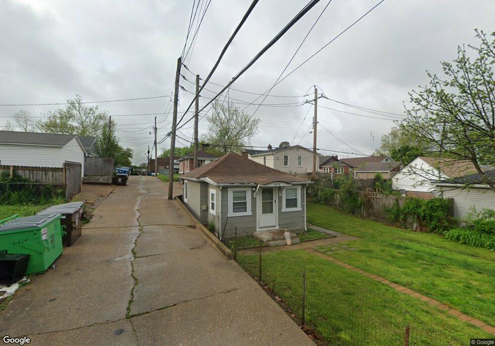
6916 Sutherland Ave Saint Louis, MO 63109
Lindenwood Park NeighborhoodEstimated Value: $130,000 - $161,000
--
Bed
1
Bath
914
Sq Ft
$163/Sq Ft
Est. Value
About This Home
This home is located at 6916 Sutherland Ave, Saint Louis, MO 63109 and is currently estimated at $149,333, approximately $163 per square foot. 6916 Sutherland Ave is a home located in St. Louis City with nearby schools including Mason Elementary School, Long International Middle School, and Roosevelt High School.
Ownership History
Date
Name
Owned For
Owner Type
Purchase Details
Closed on
Sep 16, 2014
Sold by
Keune Adam A
Bought by
Dizzy Irishman Properties Llc
Current Estimated Value
Purchase Details
Closed on
Jun 22, 2012
Sold by
Walker Kelly
Bought by
Keune Adam
Purchase Details
Closed on
Feb 14, 2012
Sold by
Wheeler Dorothy Elaine
Bought by
Walker Kelly
Purchase Details
Closed on
Mar 3, 2000
Sold by
Wheeler Norman E
Bought by
Wheeler Norman Earl and Wheeler Dorothy Elaine
Create a Home Valuation Report for This Property
The Home Valuation Report is an in-depth analysis detailing your home's value as well as a comparison with similar homes in the area
Home Values in the Area
Average Home Value in this Area
Purchase History
| Date | Buyer | Sale Price | Title Company |
|---|---|---|---|
| Dizzy Irishman Properties Llc | -- | None Available | |
| Keune Adam | -- | None Available | |
| Walker Kelly | -- | None Available | |
| Wheeler Norman Earl | -- | -- |
Source: Public Records
Tax History Compared to Growth
Tax History
| Year | Tax Paid | Tax Assessment Tax Assessment Total Assessment is a certain percentage of the fair market value that is determined by local assessors to be the total taxable value of land and additions on the property. | Land | Improvement |
|---|---|---|---|---|
| 2025 | $446 | $5,540 | $2,280 | $3,260 |
| 2024 | $425 | $4,990 | $2,280 | $2,710 |
| 2023 | $425 | $4,990 | $2,280 | $2,710 |
| 2022 | $421 | $4,750 | $2,280 | $2,470 |
| 2021 | $420 | $4,750 | $2,280 | $2,470 |
| 2020 | $397 | $4,500 | $2,280 | $2,220 |
| 2019 | $395 | $4,500 | $2,280 | $2,220 |
| 2018 | $388 | $4,280 | $2,090 | $2,190 |
| 2017 | $382 | $4,280 | $2,090 | $2,190 |
| 2016 | $393 | $4,350 | $2,090 | $2,260 |
| 2015 | $358 | $4,350 | $2,090 | $2,260 |
| 2014 | $358 | $4,350 | $2,090 | $2,260 |
| 2013 | -- | $4,350 | $2,090 | $2,260 |
Source: Public Records
Map
Nearby Homes
- 6927-6931 Sutherland Ave
- 6968 Lansdowne Ave
- 6709 Lansdowne Ave
- 6973 Winona Ave
- 7044 Lansdowne Ave
- 7048 Lansdowne Ave
- 7059 Lansdowne Ave
- 6637 Devonshire Ave Unit 2
- 4721 Jamieson Ave Unit 6
- 4719 Jamieson Ave Unit 4
- 7081 Bancroft Ave
- 3815 Mccausland Ave Unit 4
- 6600 Devonshire Ave Unit 5
- 7081 Winona Ave
- 6561 Bancroft Ave
- 7114 Bancroft Ave
- 7120 Bancroft Ave
- 6646 Mardel Ave
- 7127 Bancroft Ave
- 6659 Tholozan Ave
- 6920 Sutherland Ave
- 6922 Sutherland Ave
- 4405 Jamieson Ave
- 4409 Jamieson Ave
- 4401 Jamieson Ave
- 6912 Sutherland Ave
- 6926 Sutherland Ave
- 4413 Jamieson Ave
- 6915 Lansdowne Ave
- 4415 Jamieson Ave
- 6930 Sutherland Ave
- 6923 Lansdowne Ave
- 4325 Jamieson Ave
- 6934 Sutherland Ave
- 6915 Sutherland Ave
- 6919 Sutherland Ave
- 6931 Lansdowne Ave
- 6923 Sutherland Ave
- 4321 Jamieson Ave
- 6938 Sutherland Ave