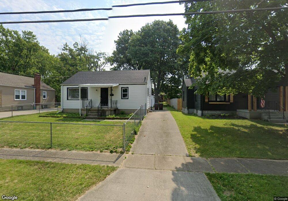
6918 Mar Bev Dr Cincinnati, OH 45239
Estimated Value: $128,000 - $175,000
2
Beds
1
Bath
810
Sq Ft
$187/Sq Ft
Est. Value
About This Home
This home is located at 6918 Mar Bev Dr, Cincinnati, OH 45239 and is currently estimated at $151,844, approximately $187 per square foot. 6918 Mar Bev Dr is a home located in Hamilton County with nearby schools including North College Hill Elementary School, North College Hill Middle School, and North College Hill High School.
Ownership History
Date
Name
Owned For
Owner Type
Purchase Details
Closed on
Aug 2, 2021
Sold by
Ccc Capital Partners Llc
Bought by
Sfr3 020 Llc
Current Estimated Value
Purchase Details
Closed on
Jun 23, 2017
Sold by
Estate Of Carl F Engler
Bought by
Morris Daniel
Purchase Details
Closed on
Jan 23, 1991
Sold by
Engler Homes Inc
Bought by
Engler Carl F
Create a Home Valuation Report for This Property
The Home Valuation Report is an in-depth analysis detailing your home's value as well as a comparison with similar homes in the area
Home Values in the Area
Average Home Value in this Area
Purchase History
| Date | Buyer | Sale Price | Title Company |
|---|---|---|---|
| Sfr3 020 Llc | $72,000 | None Available | |
| Sfr3-020 Llc | $72,000 | None Listed On Document | |
| Ccc Capital Partners Llc | $58,000 | None Available | |
| Ccc Capital Partners Llc | $58,000 | None Listed On Document | |
| Morris Daniel | -- | None Available | |
| Engler Carl F | $15,500 | -- |
Source: Public Records
Tax History Compared to Growth
Tax History
| Year | Tax Paid | Tax Assessment Tax Assessment Total Assessment is a certain percentage of the fair market value that is determined by local assessors to be the total taxable value of land and additions on the property. | Land | Improvement |
|---|---|---|---|---|
| 2024 | $2,368 | $44,521 | $6,759 | $37,762 |
| 2023 | $2,348 | $44,521 | $6,759 | $37,762 |
| 2022 | $1,731 | $23,492 | $5,530 | $17,962 |
| 2021 | $2,137 | $23,492 | $5,530 | $17,962 |
| 2020 | $1,486 | $23,492 | $5,530 | $17,962 |
| 2019 | $1,467 | $20,608 | $4,851 | $15,757 |
| 2018 | $1,466 | $20,608 | $4,851 | $15,757 |
| 2017 | $1,408 | $20,608 | $4,851 | $15,757 |
| 2016 | $1,426 | $23,118 | $7,004 | $16,114 |
| 2015 | $1,426 | $23,118 | $7,004 | $16,114 |
| 2014 | $1,424 | $23,118 | $7,004 | $16,114 |
| 2013 | $1,470 | $24,595 | $7,452 | $17,143 |
Source: Public Records
Map
Nearby Homes
- 6909 Lois Dr
- 6942 Gloria Dr
- 6941 Mulberry St
- 6943 Mulberry St
- 7004 Mulberry St
- 6912 Noble Ave
- 2943 Pin Oak Dr
- 2927 Pin Oak Dr
- 7068 Mulberry St
- 1944 Dallas Ave
- 2029 Sundale Ave
- 1850 Bising Ave
- 1841 Bising Ave
- 1842 Bising Ave
- 1917 Dallas Ave
- 1902 Knollridge Ln
- 6842 Grace Ave
- 1835 Dallas Ave
- 1818 Dallas Ave
- 2347 Golf Dr
- 6920 Mar Bev Dr
- 6916 Mar Bev Dr
- 6922 Mar Bev Dr
- 6914 Mar Bev Dr
- 6917 Gloria Dr
- 6912 Mar Bev Dr
- 6919 Gloria Dr
- 6924 Mar Bev Dr
- 6915 Gloria Dr
- 6921 Gloria Dr
- 6913 Gloria Dr
- 6923 Gloria Dr
- 6917 Mar Bev Dr
- 6915 Mar Bev Dr
- 6910 Mar Bev Dr
- 6926 Mar Bev Dr
- 6919 Mar Bev Dr
- 6911 Gloria Dr
- 6913 Mar Bev Dr
- 6925 Gloria Dr