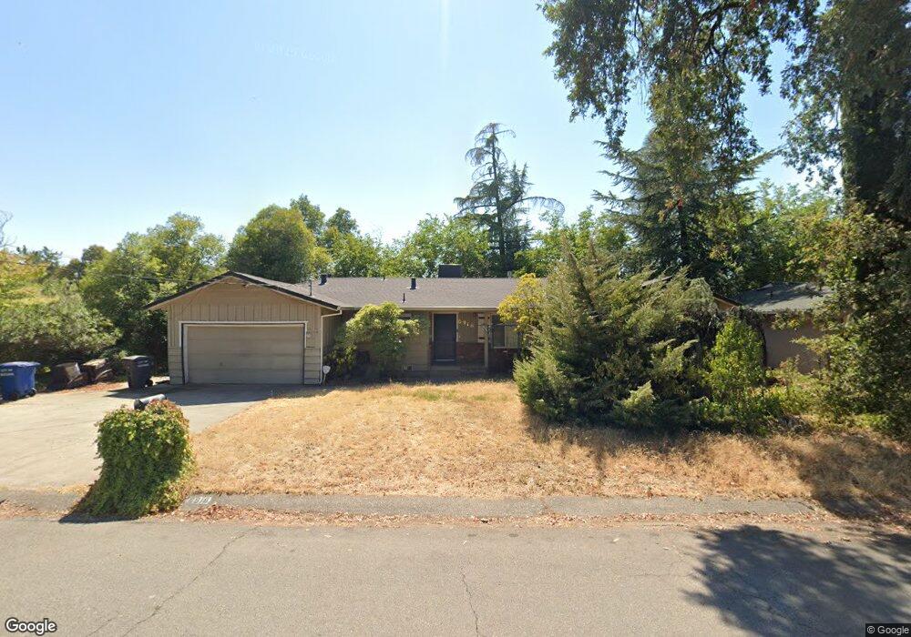
6918 Riverside Dr Redding, CA 96001
Girvan NeighborhoodEstimated Value: $302,916 - $343,000
About This Home
This home is located at 6918 Riverside Dr, Redding, CA 96001 and is currently estimated at $324,729, approximately $213 per square foot. 6918 Riverside Dr is a home located in Shasta County with nearby schools including Bonny View Elementary School, Sequoia Middle School, and Shasta High School.
Ownership History
We collect this data history from publicly available records. To have your information removed, we recommend requesting removal directly through your county’s website.
Purchase Details
Purchase Details
Purchase Details
Purchase Details
Home Financials for this Owner
Home Financials are based on the most recent Mortgage that was taken out on this home.Home Values in the Area
Average Home Value in this Area
Purchase History
We collect this data history from publicly available records. To have your information removed, we recommend requesting removal directly through your county’s website.
| Date | Buyer | Sale Price | Title Company |
|---|---|---|---|
| -- | None Listed On Document | ||
| -- | None Available | ||
| -- | None Listed On Document | ||
| -- | None Available | ||
| $150,000 | Placer Title Company | ||
| $100,000 | Fidelity National Title Co |
Mortgage History
We collect this data history from publicly available records. To have your information removed, we recommend requesting removal directly through your county’s website.
| Date | Status | Borrower | Loan Amount |
|---|---|---|---|
| Previous Owner | $80,000 |
Tax History
We collect this data history from publicly available records. To have your information removed, we recommend requesting removal directly through your county’s website.
| Year | Tax Paid | Tax Assessment Tax Assessment Total Assessment is a certain percentage of the fair market value that is determined by local assessors to be the total taxable value of land and additions on the property. | Land | Improvement |
|---|---|---|---|---|
| 2025 | $1,967 | $188,394 | $50,235 | $138,159 |
| 2024 | $1,937 | $184,700 | $49,250 | $135,450 |
| 2023 | $1,937 | $181,080 | $48,285 | $132,795 |
| 2022 | $1,904 | $177,531 | $47,339 | $130,192 |
| 2021 | $1,895 | $174,051 | $46,411 | $127,640 |
| 2020 | $1,919 | $172,268 | $45,936 | $126,332 |
| 2019 | $1,823 | $168,891 | $45,036 | $123,855 |
| 2018 | $1,839 | $165,580 | $44,153 | $121,427 |
| 2017 | $1,829 | $162,335 | $43,288 | $119,047 |
| 2016 | $1,771 | $159,153 | $42,440 | $116,713 |
| 2015 | $1,748 | $156,763 | $41,803 | $114,960 |
| 2014 | $1,737 | $153,694 | $40,985 | $112,709 |
Map
- 6913 Riverside Dr
- 7035 Riverside Dr
- 6681 Riverside Dr
- 6834 Irving Rd
- 6671 Creekside St
- 2810 Lakewood Dr
- 2879 Balaton Ave
- 19133 Smith Ln
- 2993 Sacramento Dr
- 2667 Ely Ln
- 2850 Balaton Ave
- 7253 Legacy
- 2652 Brooch Ct
- 2486 Neighborly Way
- 19233 W Niles Ln
- 7728 Pit Rd
- 2450 Neighborly Way
- 6478 Beretta Ln
- 19279 Green Acres Ln W
- 19278 Green Acres Ln W
- 6940 Riverside Dr
- 6912 Riverside Dr
- 6900 Riverside Dr
- 6921 Riverside Dr
- 6974 Riverside Dr
- 6880 Riverside Dr
- 6901 Riverside Dr
- 6961 Riverside Dr
- 6879 Riverside Dr
- 6990 Riverside Dr
- 6868 Riverside Dr
- 6973 Riverside Dr
- 6895 Sacramento Dr
- 3194 Island Dr
- 6842 Riverside Dr
- 6881 Sacramento Dr
- 6865 Riverside Dr Unit 1
- 6865 Riverside Dr
- 6909 Sacramento Dr
- 6909 Sacramento Dr
Ask me questions while you tour the home.