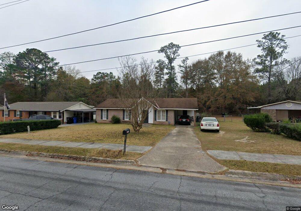
6919 Bradshaw Dr Columbus, GA 31907
Eastern Columbus NeighborhoodEstimated Value: $125,000 - $160,000
3
Beds
2
Baths
1,218
Sq Ft
$113/Sq Ft
Est. Value
About This Home
This home is located at 6919 Bradshaw Dr, Columbus, GA 31907 and is currently estimated at $137,783, approximately $113 per square foot. 6919 Bradshaw Dr is a home located in Muscogee County with nearby schools including Forrest Road Elementary School, Fort Middle School, and Kendrick High School.
Ownership History
Date
Name
Owned For
Owner Type
Purchase Details
Closed on
Dec 17, 2009
Sold by
Bibb Rentals Llc
Bought by
Upshaw Caesar
Current Estimated Value
Home Financials for this Owner
Home Financials are based on the most recent Mortgage that was taken out on this home.
Original Mortgage
$77,838
Outstanding Balance
$50,562
Interest Rate
4.82%
Mortgage Type
FHA
Estimated Equity
$87,221
Purchase Details
Closed on
Sep 30, 2008
Sold by
Clausell Pillot Jose A
Bought by
Rp Investment Group Llc
Purchase Details
Closed on
Jun 25, 2008
Sold by
Rp Investment Group Llc
Bought by
Bibb Rentals Llc
Home Financials for this Owner
Home Financials are based on the most recent Mortgage that was taken out on this home.
Original Mortgage
$79,000
Interest Rate
5.96%
Mortgage Type
Unknown
Create a Home Valuation Report for This Property
The Home Valuation Report is an in-depth analysis detailing your home's value as well as a comparison with similar homes in the area
Home Values in the Area
Average Home Value in this Area
Purchase History
| Date | Buyer | Sale Price | Title Company |
|---|---|---|---|
| Upshaw Caesar | $81,500 | None Available | |
| Rp Investment Group Llc | $49,400 | None Available | |
| Bibb Rentals Llc | $92,000 | None Available |
Source: Public Records
Mortgage History
| Date | Status | Borrower | Loan Amount |
|---|---|---|---|
| Open | Upshaw Caesar | $77,838 | |
| Previous Owner | Bibb Rentals Llc | $79,000 |
Source: Public Records
Tax History Compared to Growth
Tax History
| Year | Tax Paid | Tax Assessment Tax Assessment Total Assessment is a certain percentage of the fair market value that is determined by local assessors to be the total taxable value of land and additions on the property. | Land | Improvement |
|---|---|---|---|---|
| 2025 | $1,577 | $40,280 | $8,712 | $31,568 |
| 2024 | $1,577 | $40,280 | $8,712 | $31,568 |
| 2023 | $1,587 | $40,280 | $8,712 | $31,568 |
| 2022 | $1,199 | $29,372 | $8,712 | $20,660 |
| 2021 | $1,121 | $27,464 | $8,712 | $18,752 |
| 2020 | $1,122 | $27,464 | $8,712 | $18,752 |
| 2019 | $1,125 | $27,464 | $8,712 | $18,752 |
| 2018 | $1,125 | $27,464 | $8,712 | $18,752 |
| 2017 | $1,129 | $27,464 | $8,712 | $18,752 |
| 2016 | $1,386 | $33,605 | $2,604 | $31,001 |
| 2015 | $1,388 | $33,605 | $2,604 | $31,001 |
| 2014 | $1,390 | $33,605 | $2,604 | $31,001 |
| 2013 | -- | $33,605 | $2,604 | $31,001 |
Source: Public Records
Map
Nearby Homes
- 6916 Bradshaw Dr
- 2708 Courtland Ave
- 1754 Mazor Dr
- 1925 Woodhollow Dr
- 2672 Honeysuckle Dr
- 3041 Waddell Dr
- 1826 Woodhollow Dr
- 2942 Poppy Seed Loop
- 2216 Hunter Ct
- 5929 Gleneden Dr
- 2525 Corineth Dr
- 5920 Gleneden Dr
- 6213 Fitzgerald Dr
- 6059 Nassau Cir
- 1607 Mazor Dr
- 6028 Caribou Dr
- 5906 Forrest Rd
- 5833 Gleneden Dr
- 6000 Caribou Dr
- 6636 Foxboro Dr
- 6913 Bradshaw Dr
- 2513 Courtland Ave
- 6907 Bradshaw Dr
- 6924 Bradshaw Dr
- 2414 Burnside Dr
- 6855 Bradshaw Dr
- 2512 Courtland Ave
- 6404 Fairmount Rd
- 0 Courtland Ave
- 6849 Bradshaw Dr
- 2408 Burnside Dr
- 2415 Courtland Ave
- 2413 Burnside Dr
- 6412 Fairmount Rd
- 6323 Bradshaw Dr
- 2504 Courtland Ave
- 2407 Burnside Dr
- 2402 Burnside Dr
- 2409 Courtland Ave
- 6317 Bradshaw Dr