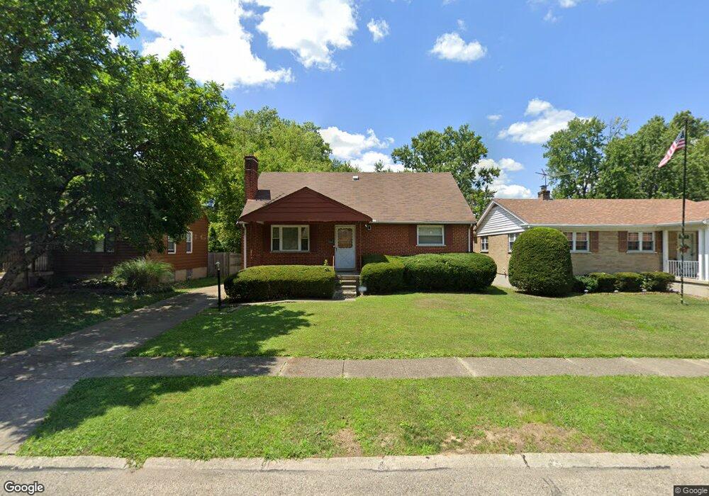
6919 Shamrock Ave Cincinnati, OH 45231
Estimated Value: $220,418 - $257,000
5
Beds
4
Baths
1,685
Sq Ft
$141/Sq Ft
Est. Value
About This Home
This home is located at 6919 Shamrock Ave, Cincinnati, OH 45231 and is currently estimated at $237,355, approximately $140 per square foot. 6919 Shamrock Ave is a home located in Hamilton County with nearby schools including North College Hill Elementary School, North College Hill Middle School, and North College Hill High School.
Ownership History
Date
Name
Owned For
Owner Type
Purchase Details
Closed on
Jun 1, 2000
Sold by
Holmes Richard S and Holmes Crystal A
Bought by
Berry Alfred
Current Estimated Value
Home Financials for this Owner
Home Financials are based on the most recent Mortgage that was taken out on this home.
Original Mortgage
$109,944
Outstanding Balance
$39,973
Interest Rate
8.66%
Mortgage Type
FHA
Estimated Equity
$197,382
Purchase Details
Closed on
Mar 28, 1996
Sold by
Freking Alice M and Gigandet Alice M
Bought by
Holmes Richard S
Home Financials for this Owner
Home Financials are based on the most recent Mortgage that was taken out on this home.
Original Mortgage
$90,780
Interest Rate
7%
Mortgage Type
VA
Create a Home Valuation Report for This Property
The Home Valuation Report is an in-depth analysis detailing your home's value as well as a comparison with similar homes in the area
Home Values in the Area
Average Home Value in this Area
Purchase History
| Date | Buyer | Sale Price | Title Company |
|---|---|---|---|
| Berry Alfred | $110,000 | -- | |
| Holmes Richard S | $89,000 | -- |
Source: Public Records
Mortgage History
| Date | Status | Borrower | Loan Amount |
|---|---|---|---|
| Open | Berry Alfred | $109,944 | |
| Previous Owner | Holmes Richard S | $90,780 |
Source: Public Records
Tax History Compared to Growth
Tax History
| Year | Tax Paid | Tax Assessment Tax Assessment Total Assessment is a certain percentage of the fair market value that is determined by local assessors to be the total taxable value of land and additions on the property. | Land | Improvement |
|---|---|---|---|---|
| 2024 | $2,867 | $56,561 | $8,943 | $47,618 |
| 2023 | $2,891 | $56,561 | $8,943 | $47,618 |
| 2022 | $2,722 | $38,011 | $7,536 | $30,475 |
| 2021 | $2,667 | $38,011 | $7,536 | $30,475 |
| 2020 | $2,337 | $38,011 | $7,536 | $30,475 |
| 2019 | $2,292 | $33,345 | $6,612 | $26,733 |
| 2018 | $2,293 | $33,345 | $6,612 | $26,733 |
| 2017 | $2,169 | $33,345 | $6,612 | $26,733 |
| 2016 | $2,244 | $36,604 | $8,663 | $27,941 |
| 2015 | $2,247 | $36,604 | $8,663 | $27,941 |
| 2014 | $2,244 | $36,604 | $8,663 | $27,941 |
| 2013 | $2,199 | $36,974 | $8,750 | $28,224 |
Source: Public Records
Map
Nearby Homes
- 7929 Cherrywood Ct
- 1280 Brushwood Ave
- 7923 Bobolink Dr
- 6832 Tarawa Dr
- 6765 Richard Ave
- 1544 W Galbraith Rd
- 6785 Marvin Ave
- 8681 Desoto Dr
- 1478 Foxwood Dr
- 8579 Daly Rd
- 8543 Foxcroft Dr
- 1575 W Galbraith Rd
- 1586 W Galbraith Rd
- 6596 S Oak Knoll Dr
- 6586 S Oak Knoll Dr
- 1523 Gardenwood Ct
- 1562 Oak Knoll Dr
- 8772 Balboa Dr
- 1541 Southridge Ln
- 1533 Corcoran Place
- 6921 Shamrock Ave
- 6917 Shamrock Ave
- 6923 Shamrock Ave
- 6915 Shamrock Ave
- 6946 Clovernook Ave
- 6925 Shamrock Ave
- 6934 Clovernook Ave
- 6913 Shamrock Ave
- 6936 Clovernook Ave
- 6950 Clovernook Ave
- 6928 Clovernook Ave
- 6911 Shamrock Ave
- 6924 Clovernook Ave
- 6920 Shamrock Ave
- 6922 Shamrock Ave
- 6918 Shamrock Ave
- 6924 Shamrock Ave
- 6916 Shamrock Ave
- 6918 Clovernook Ave
- 6926 Shamrock Ave