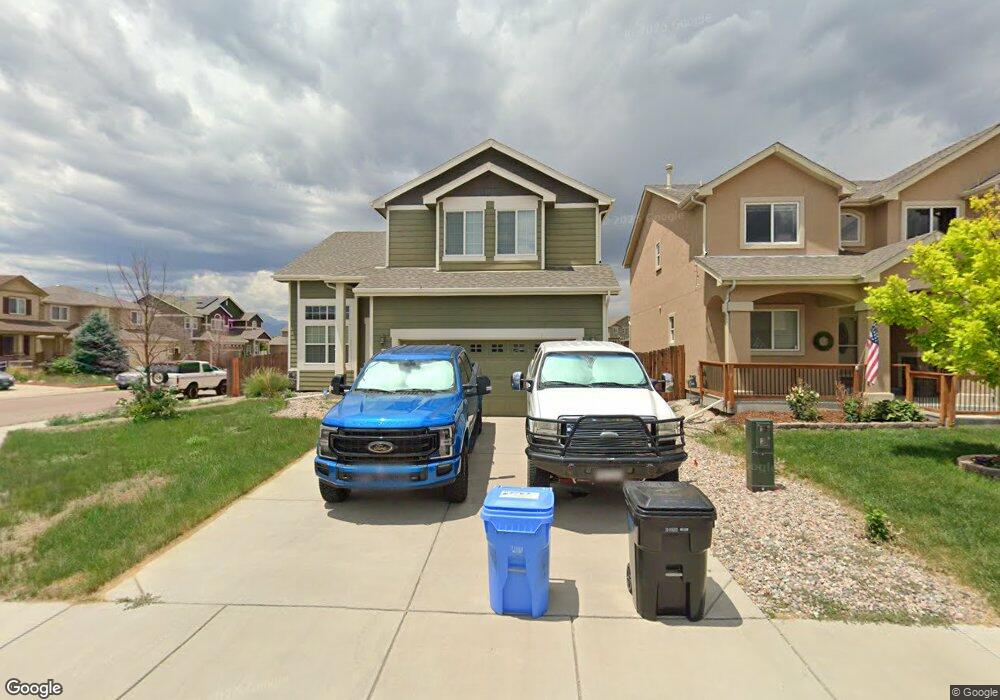
6926 Alliance Loop Colorado Springs, CO 80925
Widefield NeighborhoodEstimated Value: $440,808 - $488,000
3
Beds
3
Baths
3,497
Sq Ft
$132/Sq Ft
Est. Value
About This Home
This home is located at 6926 Alliance Loop, Colorado Springs, CO 80925 and is currently estimated at $463,202, approximately $132 per square foot. 6926 Alliance Loop is a home located in El Paso County with nearby schools including Grand Mountain School, Mesa Ridge High School, and Valley Christian Academy.
Ownership History
Date
Name
Owned For
Owner Type
Purchase Details
Closed on
Sep 8, 2020
Sold by
Dugger Joseph Franklin and Dugger Jolene Ida
Bought by
Stringer Johnathon Michael
Current Estimated Value
Home Financials for this Owner
Home Financials are based on the most recent Mortgage that was taken out on this home.
Original Mortgage
$388,000
Outstanding Balance
$344,324
Interest Rate
2.9%
Mortgage Type
New Conventional
Estimated Equity
$118,878
Purchase Details
Closed on
Aug 2, 2019
Sold by
Arzola Eloy and Arzola Lourdes
Bought by
Dugger Joseph Franklin and Dugger Jolene Ida
Home Financials for this Owner
Home Financials are based on the most recent Mortgage that was taken out on this home.
Original Mortgage
$314,000
Interest Rate
3.8%
Mortgage Type
VA
Purchase Details
Closed on
Apr 11, 2014
Sold by
Aspen View Homes Llc
Bought by
Arzola Eloy and Arzola Lourdes
Home Financials for this Owner
Home Financials are based on the most recent Mortgage that was taken out on this home.
Original Mortgage
$261,856
Interest Rate
4.41%
Mortgage Type
VA
Create a Home Valuation Report for This Property
The Home Valuation Report is an in-depth analysis detailing your home's value as well as a comparison with similar homes in the area
Home Values in the Area
Average Home Value in this Area
Purchase History
| Date | Buyer | Sale Price | Title Company |
|---|---|---|---|
| Stringer Johnathon Michael | $400,000 | Unified Title Co | |
| Dugger Joseph Franklin | $314,000 | Land Title Guarantee Co | |
| Arzola Eloy | $256,345 | None Available |
Source: Public Records
Mortgage History
| Date | Status | Borrower | Loan Amount |
|---|---|---|---|
| Open | Stringer Johnathon Michael | $388,000 | |
| Previous Owner | Dugger Joseph Franklin | $314,000 | |
| Previous Owner | Arzola Eloy | $261,856 |
Source: Public Records
Tax History Compared to Growth
Tax History
| Year | Tax Paid | Tax Assessment Tax Assessment Total Assessment is a certain percentage of the fair market value that is determined by local assessors to be the total taxable value of land and additions on the property. | Land | Improvement |
|---|---|---|---|---|
| 2025 | $4,325 | $31,370 | -- | -- |
| 2024 | $4,279 | $32,450 | $6,040 | $26,410 |
| 2022 | $3,151 | $22,760 | $4,810 | $17,950 |
| 2021 | $3,280 | $23,410 | $4,950 | $18,460 |
| 2020 | $3,142 | $22,190 | $4,330 | $17,860 |
| 2019 | $3,132 | $22,190 | $4,330 | $17,860 |
| 2018 | $2,722 | $18,990 | $4,360 | $14,630 |
| 2017 | $2,779 | $18,990 | $4,360 | $14,630 |
| 2016 | $2,494 | $19,270 | $4,380 | $14,890 |
| 2015 | $2,627 | $19,270 | $4,380 | $14,890 |
| 2014 | $2,614 | $19,260 | $4,290 | $14,970 |
Source: Public Records
Map
Nearby Homes
- 10179 Seawolf Dr
- 10202 Abrams Dr
- 6572 Justice Way
- 10208 Abrams Dr
- 10250 Intrepid Way
- 6868 Alsea Dr
- 10405 Abrams Dr
- 10670 Abrams Dr
- 10868 Deer Meadow Cir
- 10394 Abrams Dr
- 10568 Kalama Dr
- 10732 Deer Meadow Cir
- 10634 Abrams Dr
- 10442 Abrams Dr
- 10604 Deer Meadow Cir
- 6961 Maidford Dr
- 6672 Kearsarge Dr
- 6562 Phantom Way
- 10525 Abrams Dr
- 6225 Laurel Grass Range Trail
- 6918 Alliance Loop
- 6910 Alliance Loop
- 10315 Declaration Dr
- 6526 Alliance Loop
- 6518 Alliance Loop
- 6534 Alliance Loop
- 6902 Alliance Loop
- 6510 Alliance Loop
- 6917 Alliance Loop
- 10317 Declaration Dr
- 6542 Alliance Loop
- 6909 Alliance Loop
- 6502 Alliance Loop
- 6550 Alliance Loop
- 6894 Alliance Loop
- 10253 Old Glory Dr
- 6901 Alliance Loop
- 6557 Alliance Loop
- 10323 Declaration Dr
- 10201 Abrams Dr