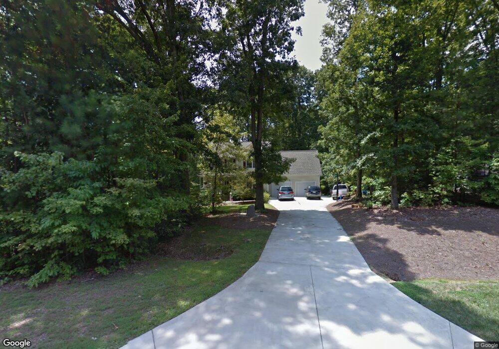
6929 Calais Dr Durham, NC 27712
North Durham NeighborhoodEstimated Value: $479,000 - $502,789
3
Beds
3
Baths
2,105
Sq Ft
$233/Sq Ft
Est. Value
About This Home
This home is located at 6929 Calais Dr, Durham, NC 27712 and is currently estimated at $490,947, approximately $233 per square foot. 6929 Calais Dr is a home located in Durham County with nearby schools including Eno Valley Elementary, George L Carrington Middle, and Northern High School.
Ownership History
Date
Name
Owned For
Owner Type
Purchase Details
Closed on
Dec 3, 2002
Sold by
Db Walker Construction Company
Bought by
Holland Peter W and Holland Kelly A
Current Estimated Value
Home Financials for this Owner
Home Financials are based on the most recent Mortgage that was taken out on this home.
Original Mortgage
$167,300
Outstanding Balance
$72,173
Interest Rate
6.3%
Estimated Equity
$418,774
Create a Home Valuation Report for This Property
The Home Valuation Report is an in-depth analysis detailing your home's value as well as a comparison with similar homes in the area
Home Values in the Area
Average Home Value in this Area
Purchase History
| Date | Buyer | Sale Price | Title Company |
|---|---|---|---|
| Holland Peter W | $186,000 | -- |
Source: Public Records
Mortgage History
| Date | Status | Borrower | Loan Amount |
|---|---|---|---|
| Open | Holland Peter W | $167,300 |
Source: Public Records
Tax History
| Year | Tax Paid | Tax Assessment Tax Assessment Total Assessment is a certain percentage of the fair market value that is determined by local assessors to be the total taxable value of land and additions on the property. | Land | Improvement |
|---|---|---|---|---|
| 2025 | $3,196 | $451,857 | $127,832 | $324,025 |
| 2024 | $2,678 | $262,823 | $53,235 | $209,588 |
| 2023 | $2,539 | $262,823 | $53,235 | $209,588 |
| 2022 | $2,440 | $262,823 | $53,235 | $209,588 |
| 2021 | $2,153 | $254,159 | $53,235 | $200,924 |
| 2020 | $2,109 | $254,159 | $53,235 | $200,924 |
| 2019 | $2,109 | $254,159 | $53,235 | $200,924 |
| 2018 | $1,952 | $218,426 | $50,840 | $167,586 |
| 2017 | $1,930 | $218,426 | $50,840 | $167,586 |
| 2016 | $1,848 | $218,426 | $50,840 | $167,586 |
| 2015 | $2,283 | $238,323 | $53,858 | $184,465 |
| 2014 | $2,283 | $238,323 | $53,858 | $184,465 |
Source: Public Records
Map
Nearby Homes
- 6782 Calais Dr
- 2916 Bivins Rd
- 3621 Bivins Rd
- 6900, 6918 Russell Rd
- 127 Misty Ridge Rd
- 200 Prescott Dr
- 1680 Terry Rd
- 2004 Upland Dr
- 2004 Upland Ln
- 1108 Prominence Dr
- 1112 Prominence Dr
- 1109 Prominence Dr
- 1109 Prominence Dr Unit 17
- 5857 Genesee Dr
- 116 Cavendish Ct
- 6036 Scalybark Rd
- 1409 Cotherstone Dr
- 6026 Scalybark Rd
- 5820 Genesee Dr
- 1417 Barliff Place
- 6933 Calais Dr
- 6928 Calais Dr
- 7004 Calais Dr
- 7003 Calais Dr
- 6920 Calais Dr
- 6921 Calais Dr
- 7020 Calais Dr
- 6916 Calais Dr
- 6906 Calais Dr
- 7024 Calais Dr
- 6912 Calais Dr
- 7019 Calais Dr
- 6908 Calais Dr
- lot 6 Calais Dr
- lot 7 Calais Dr
- LOT #8 Calais Dr
- LOT 10 Calais Dr
- 0 Calais Dr
- 7040 Calais Dr
- 7023 Calais Dr
Your Personal Tour Guide
Ask me questions while you tour the home.