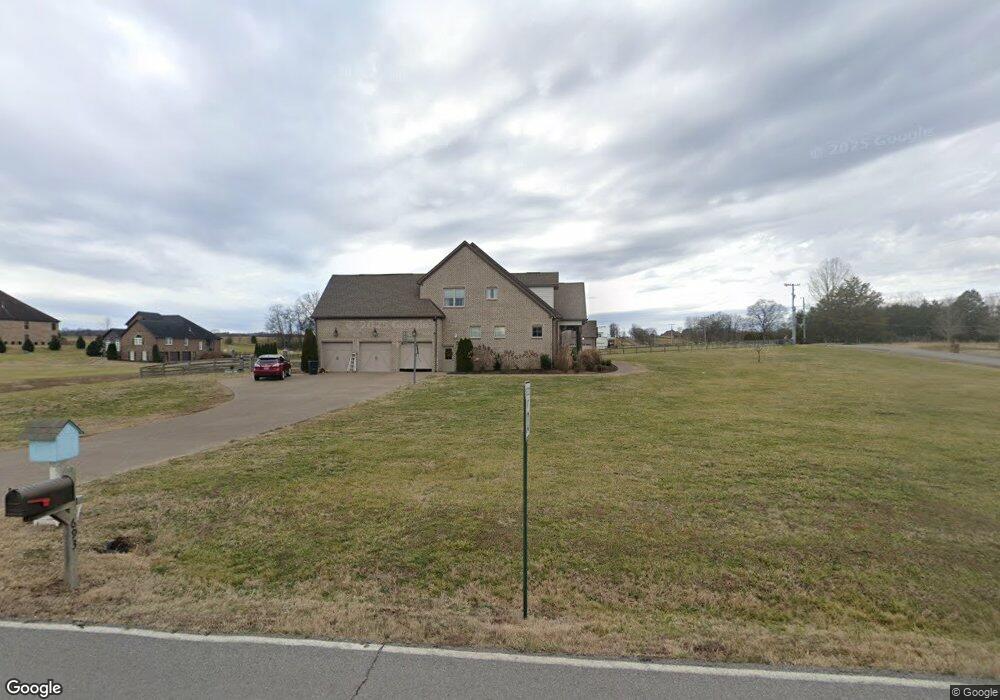
693 Neals Ln Gallatin, TN 37066
Estimated Value: $976,000 - $1,143,000
4
Beds
4
Baths
3,493
Sq Ft
$305/Sq Ft
Est. Value
About This Home
This home is located at 693 Neals Ln, Gallatin, TN 37066 and is currently estimated at $1,067,009, approximately $305 per square foot. 693 Neals Ln is a home with nearby schools including Station Camp High School.
Ownership History
Date
Name
Owned For
Owner Type
Purchase Details
Closed on
Jul 25, 2016
Sold by
Brown Tray D and Brown Amy S
Bought by
Finn Dustin and Finn Morgan
Current Estimated Value
Home Financials for this Owner
Home Financials are based on the most recent Mortgage that was taken out on this home.
Original Mortgage
$92,893
Outstanding Balance
$74,261
Interest Rate
3.54%
Mortgage Type
Commercial
Estimated Equity
$992,748
Purchase Details
Closed on
Mar 23, 2015
Sold by
Dorris Patricia Janan
Bought by
Brown Tray D and Brown Amy S
Create a Home Valuation Report for This Property
The Home Valuation Report is an in-depth analysis detailing your home's value as well as a comparison with similar homes in the area
Home Values in the Area
Average Home Value in this Area
Purchase History
| Date | Buyer | Sale Price | Title Company |
|---|---|---|---|
| Finn Dustin | $92,000 | Warranty Title Insurance Co | |
| Brown Tray D | $67,500 | Highland Title |
Source: Public Records
Mortgage History
| Date | Status | Borrower | Loan Amount |
|---|---|---|---|
| Open | Finn Dustin | $92,893 |
Source: Public Records
Tax History Compared to Growth
Tax History
| Year | Tax Paid | Tax Assessment Tax Assessment Total Assessment is a certain percentage of the fair market value that is determined by local assessors to be the total taxable value of land and additions on the property. | Land | Improvement |
|---|---|---|---|---|
| 2024 | $3,292 | $231,650 | $28,300 | $203,350 |
| 2023 | $4,044 | $179,575 | $19,675 | $159,900 |
| 2022 | $4,062 | $179,575 | $19,675 | $159,900 |
| 2021 | $3,955 | $174,850 | $19,675 | $155,175 |
| 2020 | $3,955 | $174,850 | $19,675 | $155,175 |
| 2019 | $3,955 | $0 | $0 | $0 |
| 2018 | $2,716 | $0 | $0 | $0 |
| 2017 | $256 | $0 | $0 | $0 |
| 2016 | $256 | $0 | $0 | $0 |
| 2015 | -- | $0 | $0 | $0 |
Source: Public Records
Map
Nearby Homes
- 662 Neals Ln
- 2045 Liberty Ln
- 650 Neals Ln
- 1176 Liberty Ln
- 315 Cummings Ln
- 1017 Wickshire Dr
- 1869 Tennessee 25
- 1328 Wentworth Dr
- 1036 Middleton Ln
- 305 Remington Ave
- 540 Bradford Dr
- 300 Remington Ave
- 1273 Wentworth Dr
- 172 Cavalcade Loop
- 249 Cavalcade Loop
- 1245 Amherst Ct
- 608 Bradford Dr
- 360 Turfway Park
- The Ridgeport Plan at Carellton
- 1239 Wentworth Dr