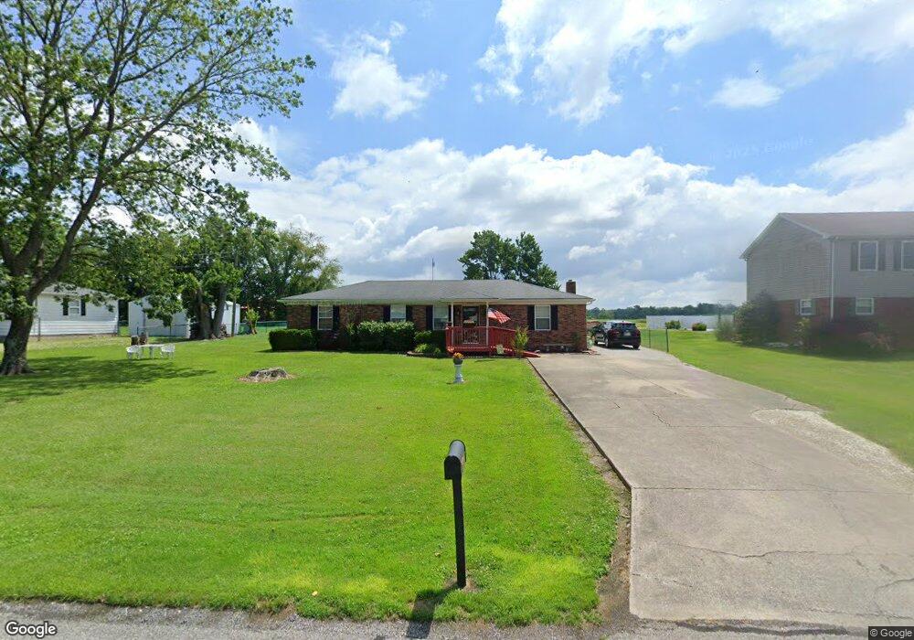
6930 N Bogardus Rd Austin, IN 47102
Estimated Value: $185,000 - $257,000
3
Beds
1
Bath
1,296
Sq Ft
$166/Sq Ft
Est. Value
About This Home
This home is located at 6930 N Bogardus Rd, Austin, IN 47102 and is currently estimated at $215,348, approximately $166 per square foot. 6930 N Bogardus Rd is a home located in Scott County with nearby schools including Austin Elementary School, Austin Middle School, and Austin High School.
Ownership History
Date
Name
Owned For
Owner Type
Purchase Details
Closed on
Sep 24, 2010
Sold by
Hollan Gary D and Hollan Brenda K
Bought by
Potts Chester R and Potts Doris A
Current Estimated Value
Home Financials for this Owner
Home Financials are based on the most recent Mortgage that was taken out on this home.
Original Mortgage
$88,804
Outstanding Balance
$57,663
Interest Rate
4.5%
Mortgage Type
FHA
Estimated Equity
$157,685
Create a Home Valuation Report for This Property
The Home Valuation Report is an in-depth analysis detailing your home's value as well as a comparison with similar homes in the area
Purchase History
| Date | Buyer | Sale Price | Title Company |
|---|---|---|---|
| Potts Chester R | -- | None Available |
Source: Public Records
Mortgage History
| Date | Status | Borrower | Loan Amount |
|---|---|---|---|
| Open | Potts Chester R | $88,804 |
Source: Public Records
Tax History
| Year | Tax Paid | Tax Assessment Tax Assessment Total Assessment is a certain percentage of the fair market value that is determined by local assessors to be the total taxable value of land and additions on the property. | Land | Improvement |
|---|---|---|---|---|
| 2025 | $694 | $131,600 | $12,200 | $119,400 |
| 2024 | $694 | $116,800 | $12,200 | $104,600 |
| 2023 | $659 | $115,300 | $12,200 | $103,100 |
| 2022 | $636 | $117,600 | $12,200 | $105,400 |
| 2021 | $525 | $108,700 | $12,200 | $96,500 |
| 2020 | $872 | $110,200 | $12,200 | $98,000 |
| 2019 | $768 | $105,800 | $12,200 | $93,600 |
| 2018 | $672 | $99,800 | $9,900 | $89,900 |
| 2017 | $610 | $97,700 | $9,900 | $87,800 |
| 2016 | $620 | $96,900 | $9,900 | $87,000 |
| 2014 | $587 | $91,800 | $9,900 | $81,900 |
| 2013 | $587 | $91,800 | $9,900 | $81,900 |
Source: Public Records
Map
Nearby Homes
- TBD E Oard Spring Rd
- 0 E Oard Spring Rd
- 5672 N Terry Rd
- 92 Stonybrook Dr
- 5187 N Jack Morgan Rd
- 4604 N Bogardus Rd
- 0 S County Road 910 W
- 5745 W County Road 1040 S
- 137 Bowles Cir
- 880 Mann Ave
- 274 Audrey Ln
- 284 Audrey Ln
- 294 Audrey Ln
- 815 Linden Dr
- 1020 N Church St
- 354 Audrey Ln
- 344 Audrey Ln
- 265 Rice St
- 324 Audrey Ln
- 314 Audrey Ln
- 6950 N Bogardus Rd
- 6910 N Bogardus Rd
- 6970 N Bogardus Rd
- 6890 N Bogardus Rd
- 6931 N Bogardus Rd
- 1048 E Oard Spring Rd
- 6990 N Bogardus Rd
- 6870 N Bogardus Rd
- 6891 N Bogardus Rd
- 6840 N Bogardus Rd
- 6820 N Bogardus Rd
- 949 E Oard Spring Rd
- 6810 N Bogardus Rd
- 1138 E Oard Spring Rd
- 902 E Oard Spring Rd
- 6790 N Bogardus Rd
- 6760 N Bogardus Rd
- 1151 E Oard Spring Rd
- 1214 E Oard Spring Rd
- 851 E Oard Spring Rd
Your Personal Tour Guide
Ask me questions while you tour the home.