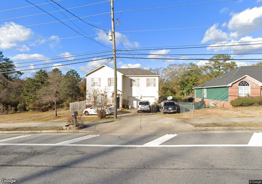
6931 Forrest Rd Columbus, GA 31907
Eastern Columbus NeighborhoodEstimated Value: $180,000 - $214,273
3
Beds
3
Baths
1,764
Sq Ft
$113/Sq Ft
Est. Value
About This Home
This home is located at 6931 Forrest Rd, Columbus, GA 31907 and is currently estimated at $199,568, approximately $113 per square foot. 6931 Forrest Rd is a home located in Muscogee County with nearby schools including Forrest Road Elementary School, Fort Middle School, and Kendrick High School.
Ownership History
Date
Name
Owned For
Owner Type
Purchase Details
Closed on
Jul 29, 2013
Sold by
Ingram Benjie T
Bought by
Ingram Benjie T and Ingram Tonya L
Current Estimated Value
Home Financials for this Owner
Home Financials are based on the most recent Mortgage that was taken out on this home.
Original Mortgage
$90,333
Outstanding Balance
$67,204
Interest Rate
4.4%
Mortgage Type
FHA
Estimated Equity
$132,364
Purchase Details
Closed on
Feb 5, 2013
Sold by
Bigg Home Builders Inc
Bought by
F & M Bank & Trust Co
Create a Home Valuation Report for This Property
The Home Valuation Report is an in-depth analysis detailing your home's value as well as a comparison with similar homes in the area
Home Values in the Area
Average Home Value in this Area
Purchase History
| Date | Buyer | Sale Price | Title Company |
|---|---|---|---|
| Ingram Benjie T | $92,000 | -- | |
| Ingram Benjie T | $92,000 | -- | |
| F & M Bank & Trust Co | $130,000 | -- |
Source: Public Records
Mortgage History
| Date | Status | Borrower | Loan Amount |
|---|---|---|---|
| Open | Ingram Benjie T | $90,333 | |
| Closed | Ingram Benjie T | $90,333 |
Source: Public Records
Tax History Compared to Growth
Tax History
| Year | Tax Paid | Tax Assessment Tax Assessment Total Assessment is a certain percentage of the fair market value that is determined by local assessors to be the total taxable value of land and additions on the property. | Land | Improvement |
|---|---|---|---|---|
| 2025 | $3,374 | $86,184 | $8,404 | $77,780 |
| 2024 | $3,374 | $86,184 | $8,404 | $77,780 |
| 2023 | $3,395 | $86,184 | $8,404 | $77,780 |
| 2022 | $963 | $67,508 | $8,404 | $59,104 |
| 2021 | $956 | $53,032 | $8,404 | $44,628 |
| 2020 | $956 | $53,032 | $8,404 | $44,628 |
| 2019 | $961 | $53,032 | $8,404 | $44,628 |
| 2018 | $961 | $53,032 | $8,404 | $44,628 |
| 2017 | $966 | $53,032 | $8,404 | $44,628 |
| 2016 | $971 | $36,800 | $9,600 | $27,200 |
| 2015 | $972 | $36,800 | $9,600 | $27,200 |
| 2014 | $974 | $36,800 | $9,600 | $27,200 |
| 2013 | -- | $44,989 | $9,600 | $35,389 |
Source: Public Records
Map
Nearby Homes
- 6915 Forrest Rd
- 2735 Schatulga Rd
- 2737 Schatulga Rd
- 2216 Hunter Ct
- 5644 Peggy Dr
- 6636 Foxboro Dr
- 5642 Boby Dr
- 3041 Waddell Dr
- 2942 Poppy Seed Loop
- 2708 Courtland Ave
- 6916 Bradshaw Dr
- 1754 Mazor Dr
- 1925 Woodhollow Dr
- 2672 Honeysuckle Dr
- 1826 Woodhollow Dr
- 6620 Cove Cir
- 6028 Caribou Dr
- 1607 Mazor Dr
- 6059 Nassau Cir
- 6000 Caribou Dr
- 6939 Forrest Rd
- 6927 Forrest Rd
- 6927 Forest Rd
- 6923 Forrest Rd
- 6923 Forest Rd
- 6970 Forrest Rd
- 6960 Forrest Rd
- 2947 Schatulga Rd
- 6980 Forrest Rd
- 6918 Forrest Rd
- 2965 Schatulga Rd
- 6851 Forrest Rd
- 6910 Forrest Rd
- 2971 Schatulga Rd
- 2981 Schatulga Rd
- 2729 Schatulga Rd
- 6845 Forrest Rd
- 6844 Forrest Rd
- 3001 Schatulga Rd
- 6840 Forrest Rd