Estimated Value: $301,450 - $342,000
3
Beds
2
Baths
1,476
Sq Ft
$219/Sq Ft
Est. Value
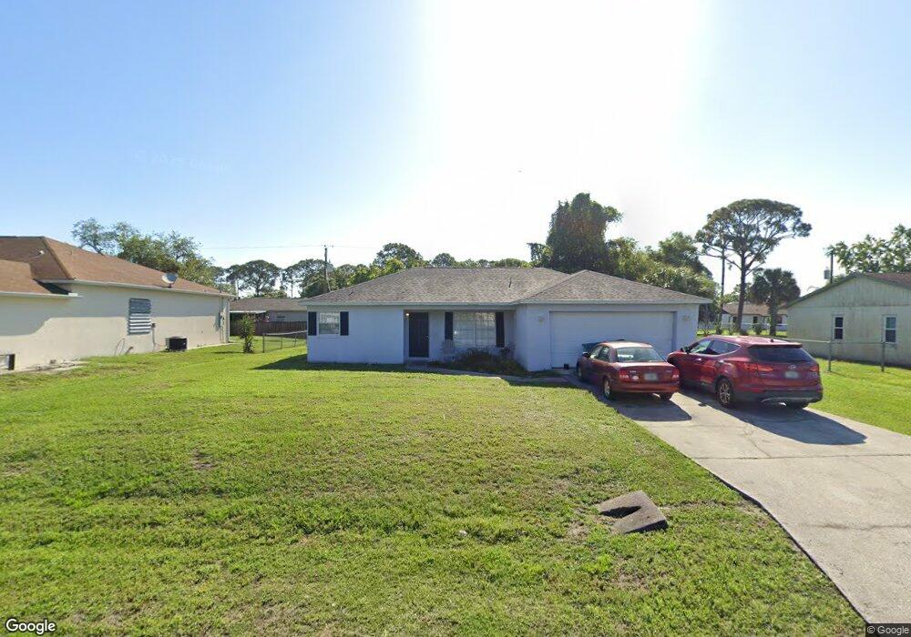
About This Home
This home is located at 6933 Bryant Rd, Cocoa, FL 32927 and is currently estimated at $323,863, approximately $219 per square foot. 6933 Bryant Rd is a home located in Brevard County with nearby schools including Enterprise Elementary School, Space Coast Junior/Senior High School, and Sculptor Charter School.
Ownership History
Date
Name
Owned For
Owner Type
Purchase Details
Closed on
Jan 24, 1997
Sold by
Mark D Derman Bldg Cont Inc
Bought by
Davis Dale M and Davis Vivianne E
Current Estimated Value
Home Financials for this Owner
Home Financials are based on the most recent Mortgage that was taken out on this home.
Original Mortgage
$78,425
Outstanding Balance
$9,034
Interest Rate
7.77%
Estimated Equity
$314,829
Purchase Details
Closed on
Sep 27, 1996
Sold by
Pancho Domingo A and Pancho Reveria V
Bought by
Mark D Derman Bldg Cont Inc
Create a Home Valuation Report for This Property
The Home Valuation Report is an in-depth analysis detailing your home's value as well as a comparison with similar homes in the area
Home Values in the Area
Average Home Value in this Area
Purchase History
| Date | Buyer | Sale Price | Title Company |
|---|---|---|---|
| Davis Dale M | $78,800 | -- | |
| Mark D Derman Bldg Cont Inc | $11,000 | -- |
Source: Public Records
Mortgage History
| Date | Status | Borrower | Loan Amount |
|---|---|---|---|
| Open | Davis Dale M | $78,425 |
Source: Public Records
Tax History
| Year | Tax Paid | Tax Assessment Tax Assessment Total Assessment is a certain percentage of the fair market value that is determined by local assessors to be the total taxable value of land and additions on the property. | Land | Improvement |
|---|---|---|---|---|
| 2025 | $1,241 | $88,730 | -- | -- |
| 2024 | $1,204 | $86,230 | -- | -- |
| 2023 | $1,204 | $83,720 | $0 | $0 |
| 2022 | $1,121 | $81,290 | $0 | $0 |
| 2021 | $1,109 | $78,930 | $0 | $0 |
| 2020 | $1,044 | $77,850 | $0 | $0 |
| 2019 | $977 | $76,100 | $0 | $0 |
| 2018 | $969 | $74,690 | $0 | $0 |
| 2017 | $970 | $73,160 | $0 | $0 |
| 2016 | $979 | $71,660 | $18,000 | $53,660 |
| 2015 | $989 | $71,170 | $15,000 | $56,170 |
| 2014 | $993 | $70,610 | $11,000 | $59,610 |
Source: Public Records
Map
Nearby Homes
- 6990 Bryant Rd
- 7065 Hundred Acre Dr
- 5155 Mayflower St
- 5165 Patricia St
- 6815 Bryant Rd
- 5555 Brandon St
- 6760 Cairo Rd
- 5080 Mayflower St
- 7230 Venus Ave
- 5200 Frisco St
- 7200 Oakwood Ave
- 6615 Dock Ave
- 7155 Export Ave
- 5095 Hogan Place
- 7635 Fringe Place
- 5150 Melody St
- 7545 Fringe Place
- 7275 Durban Ave
- 6620 Grissom Pkwy
- 6581 Bancroft Ave
Your Personal Tour Guide
Ask me questions while you tour the home.