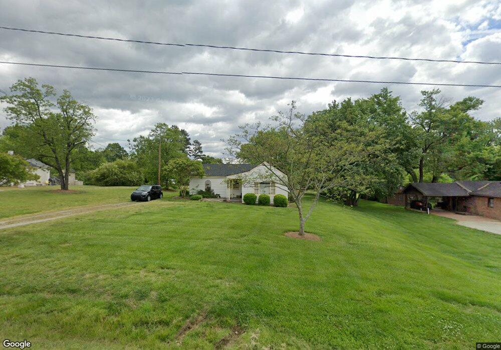
6933 Cecil Farm Rd High Point, NC 27263
Greater High Point NeighborhoodEstimated Value: $179,967 - $201,000
3
Beds
1
Bath
1,206
Sq Ft
$157/Sq Ft
Est. Value
About This Home
This home is located at 6933 Cecil Farm Rd, High Point, NC 27263 and is currently estimated at $188,992, approximately $156 per square foot. 6933 Cecil Farm Rd is a home located in Guilford County with nearby schools including Allen Jay Elementary School, Southern Guilford Middle, and Southern Guilford High School.
Ownership History
Date
Name
Owned For
Owner Type
Purchase Details
Closed on
Jul 9, 2009
Sold by
High Point Bank & Trust Company
Bought by
Foster Bobby G and Foster Brenda G
Current Estimated Value
Purchase Details
Closed on
Apr 8, 2009
Sold by
Kingston Investments Llc
Bought by
High Point Bank & Trust Company
Purchase Details
Closed on
Sep 27, 2005
Sold by
Branch Banking & Trust Co
Bought by
Kingston Investments Llc
Home Financials for this Owner
Home Financials are based on the most recent Mortgage that was taken out on this home.
Original Mortgage
$56,400
Interest Rate
5.77%
Mortgage Type
Construction
Purchase Details
Closed on
Apr 12, 2005
Sold by
Carroll Richard Lee and Carroll Vanessa G
Bought by
Branch Banking & Trust Co
Create a Home Valuation Report for This Property
The Home Valuation Report is an in-depth analysis detailing your home's value as well as a comparison with similar homes in the area
Home Values in the Area
Average Home Value in this Area
Purchase History
| Date | Buyer | Sale Price | Title Company |
|---|---|---|---|
| Foster Bobby G | $15,000 | None Available | |
| High Point Bank & Trust Company | $30,400 | None Available | |
| Kingston Investments Llc | $29,000 | None Available | |
| Branch Banking & Trust Co | $40,150 | -- |
Source: Public Records
Mortgage History
| Date | Status | Borrower | Loan Amount |
|---|---|---|---|
| Previous Owner | Kingston Investments Llc | $56,400 |
Source: Public Records
Tax History Compared to Growth
Tax History
| Year | Tax Paid | Tax Assessment Tax Assessment Total Assessment is a certain percentage of the fair market value that is determined by local assessors to be the total taxable value of land and additions on the property. | Land | Improvement |
|---|---|---|---|---|
| 2025 | $617 | $70,300 | $25,000 | $45,300 |
| 2024 | $617 | $70,300 | $25,000 | $45,300 |
| 2023 | $617 | $70,300 | $25,000 | $45,300 |
| 2022 | $617 | $70,300 | $25,000 | $45,300 |
| 2021 | $489 | $55,700 | $22,000 | $33,700 |
| 2020 | $489 | $55,700 | $22,000 | $33,700 |
| 2019 | $489 | $55,700 | $0 | $0 |
| 2018 | $486 | $55,700 | $0 | $0 |
| 2017 | $471 | $55,700 | $0 | $0 |
| 2016 | $466 | $53,200 | $0 | $0 |
| 2015 | $468 | $53,200 | $0 | $0 |
| 2014 | $473 | $53,200 | $0 | $0 |
Source: Public Records
Map
Nearby Homes
- 1640 Kersey Valley Rd
- 6019 Checker Rd
- 6007 Checker Rd
- 6108 Appletree Ct
- 103 Hanner Ct
- 105 Willow Terrace
- 1846 Sechrest Cir
- 1815 Sechrest Cir
- 510 Aldridge Rd
- 424 Aldridge Rd
- 3617 Southpark Dr
- 2616 Ingram Rd
- 104 Autumn Hill Ct
- 204 Aldridge Ln
- 1206 Byron Ln
- 1120 E Springfield Rd
- 630 Liberty Rd
- 108 Sprucewood Ct
- 0 Sprucewood Ct
- 1702 Baker Rd
- 6933 Cecil Farm Rd
- 6935 Cecil Farm Rd
- 6929 Cecil Farm Rd
- 6923 Cecil Farm Rd
- 6950 Cecil Farm Rd
- 7010 Windcreek Ct
- 7008 Windcreek Ct
- 7009 Windcreek Ct
- 7004 Windcreek Ct
- 7007 Windcreek Ct
- 0 US HWY 311 U S Highway 311
- 0000 U S Highway 311
- 1635 Kersey Valley Rd
- 7000 Windcreek Ct
- 6200 Modlin Grove Rd
- 6204 Modlin Grove Rd
- 1625 Kersey Valley Rd
- 6204 Modlin Grove Rd
- 6201 Modlin Grove Rd
- 6208 Modlin Grove Rd