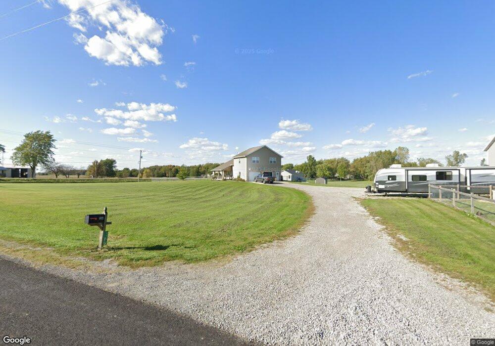
6935 Auglaize Rd Waynesfield, OH 45896
Estimated Value: $298,000 - $581,000
3
Beds
2
Baths
2,340
Sq Ft
$191/Sq Ft
Est. Value
About This Home
This home is located at 6935 Auglaize Rd, Waynesfield, OH 45896 and is currently estimated at $446,361, approximately $190 per square foot. 6935 Auglaize Rd is a home located in Allen County with nearby schools including Allen East Elementary School, Allen East Middle School, and Allen East High School.
Ownership History
Date
Name
Owned For
Owner Type
Purchase Details
Closed on
Jan 11, 2024
Sold by
Wireman Fielden E
Bought by
Wireman Laurel
Current Estimated Value
Home Financials for this Owner
Home Financials are based on the most recent Mortgage that was taken out on this home.
Original Mortgage
$132,275
Outstanding Balance
$129,960
Interest Rate
6.95%
Mortgage Type
FHA
Estimated Equity
$316,401
Purchase Details
Closed on
Aug 24, 1999
Sold by
Skinner John
Bought by
Wireman Fielden
Create a Home Valuation Report for This Property
The Home Valuation Report is an in-depth analysis detailing your home's value as well as a comparison with similar homes in the area
Purchase History
| Date | Buyer | Sale Price | Title Company |
|---|---|---|---|
| Wireman Laurel | -- | None Listed On Document | |
| Wireman Fielden | $15,500 | -- |
Source: Public Records
Mortgage History
| Date | Status | Borrower | Loan Amount |
|---|---|---|---|
| Open | Wireman Laurel | $132,275 |
Source: Public Records
Tax History
| Year | Tax Paid | Tax Assessment Tax Assessment Total Assessment is a certain percentage of the fair market value that is determined by local assessors to be the total taxable value of land and additions on the property. | Land | Improvement |
|---|---|---|---|---|
| 2024 | $3,955 | $113,970 | $10,260 | $103,710 |
| 2023 | $3,504 | $89,750 | $8,090 | $81,660 |
| 2022 | $3,452 | $89,750 | $8,090 | $81,660 |
| 2021 | $3,456 | $89,750 | $8,090 | $81,660 |
| 2020 | $3,003 | $76,270 | $7,140 | $69,130 |
| 2019 | $3,003 | $76,270 | $7,140 | $69,130 |
| 2018 | $2,468 | $62,160 | $7,140 | $55,020 |
| 2017 | $2,474 | $52,990 | $7,140 | $45,850 |
| 2016 | $2,452 | $52,990 | $7,140 | $45,850 |
| 2015 | $2,553 | $52,990 | $7,140 | $45,850 |
| 2014 | $2,553 | $54,080 | $6,720 | $47,360 |
| 2013 | $2,404 | $51,770 | $6,720 | $45,050 |
Source: Public Records
Map
Nearby Homes
- 25353 Buckland Holden Rd
- 8150 Amherst Rd
- 18544 Santa Fe Line Rd
- 4850 Bowdle Rd
- 101 Sunrise Dr
- 533 N Westminster St
- 404 N Westminster St
- 105 Guthrie St
- 211 E Wapakoneta St
- 25702 Ohio 67
- 7165 Faulkner Rd
- 3300 Johnston Rd
- 6381 McPheron Rd
- 5600 E Hanthorn Rd
- 5490 E Hanthorn Rd
- 21320 Fairmount Rd
- 4160 E Hanthorn Rd
- 9373 Harrod Rd
- 20630 State Route 67
- 3700 Greely Chapel Rd
- 19990 State Route 196
- 6597 Waynesfield Rd
- 6885 Auglaize County Line Rd
- 6570 State Route 196
- 6565 State Route 196
- 6565 Waynesfield Rd
- 6535 State Route 196
- 25212 Allen Union Wayne Rd
- 6464 State Route 196
- 7141 Auglaize Rd
- 25254 Allen Union Wayne Rd
- 6450 State Route 196
- 25288 Allen Union Wayne Rd
- 19823 State Route 196
- 6396 State Route 196
- 6396 Waynesfield Rd
- 6440 State Route 196
Your Personal Tour Guide
Ask me questions while you tour the home.